USFSOkanogan-Wenatchee National Forest · Washington
American Forks Campground
Overview American Forks Campground is located about 40 miles west of Naches, Washington, near the American River and Bumping River in the East Cascade mountains.
Sites12first-come
Elev.2,789ft
Comf.May-Oct6 months
Max rig45 ft
Electricnonesites
From Yakima1h06real road time
The honest read
Synthesized from RIDB · Open-Meteo OSM · OSRM Updated 2026-05-27
At 2,789 ft, American Forks Campground has a 6-month comfortable window (May-Oct). Winter nights average around 27°F, so the shoulder seasons turn cold fast. All 12 sites are first-come, first-served. No reservations, so arrive early. Within about 4 miles: 2 named hiking routes, 1 peak, lake or river access.
The campground at a glance
01 · CHARACTER
Reads strongest on shade and cool nights. Softest on reservability.
Six axes, each scored relative to every other federal campground in the region: quiet (miles to a major road), cool (elevation), roomy (average site spacing), shade, RV-fit (longest rig), and how reservable it is. All six come from data, nothing hand-tuned.
When to go
02 · CLIMATE
avg highavg lowfrost-freedriest · Jul
May-Oct
Comfortable window: nights stay above 35°F, days below 90°F.
92%
Of summer weekend-days are dry.
May 14
Last spring frost; first fall frost Oct 17.
52°F
Average July low. Bring a fleece.
Getting there
03 · ACCESS
01
Yakima
47 mi
1h06
02
Seattle
106 mi
2h42
03
Spokane
247 mi
4h42
By drive time
Routed road time (OSRM). Nearest major highway 0.1 mi away.
AMERICAN FORKS CAMPGROUND · prime location · shaded.
To neighbor
110 ft
Location
Prime
Max rig
30 ft
Type
Standard
What's within four miles
05 · TRAILS · PEAKS · WATER
Trails & Peaks
Named hiking routes
2
Trail segments
18
Peaks
1
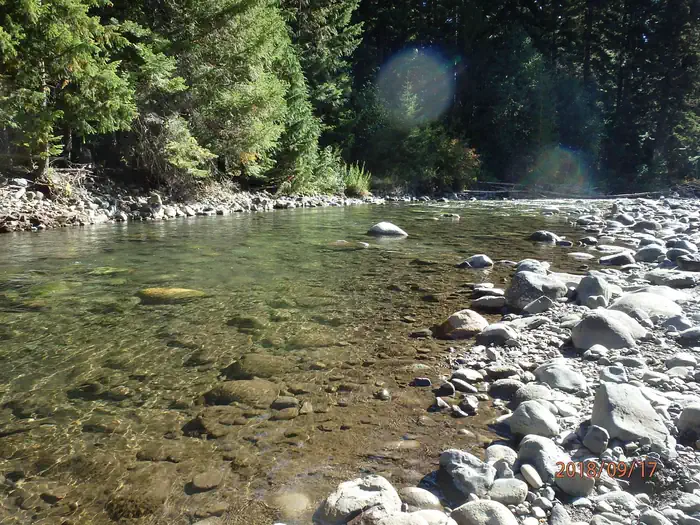
Water & Access
Lake / river access
yes
To nearest major road
0.1 mi
Method
We synthesize public data layers: RIDB and Recreation.gov facility and site records, Open-Meteo climate normals, OpenStreetMap roads, trails, and water, OSRM drive times, and USGS elevation. We take no bookings, no ads, and no paid placements. Independence is the entire point.