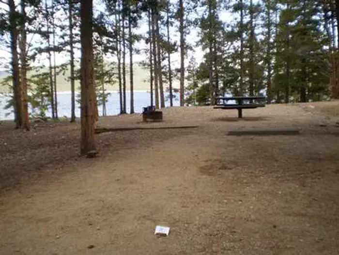
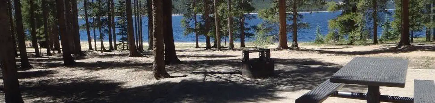
Overview Baby Doe Campground is situated on the eastern shore of Turquoise Lake in the shade of a lodgepole pine and subalpine fir forest.
Sites5148 reservable
Elev.9,938ft
Comf.Jul-Sep3 months
Max rig45 ft
Electricnonesites
From Denver2h16real road time
The honest read
Synthesized from RIDB · Open-Meteo OSM · OSRM Updated 2026-05-27
At 9,938 ft, Baby Doe has a 3-month comfortable window (Jul-Sep). Winter nights average around 7°F, so the shoulder seasons turn cold fast. 51 sites total: 48 reservable and 3 first-come, first-served. Within about 4 miles: 1 named hiking route, 2 peaks, lake or river access.
What campers say
SYNTHESIZED · MODERATE SIGNAL
Water
01 / 05
No potable water on site for the 2026 season, pack in everything.
The Forest Service and recent visitors confirm water is not available at Baby Doe in 2026. Bring enough to drink, cook, wash, and fully drown your campfire, because there are no spigots and the nearest fill is back toward Leadville.
Facilities
02 / 05
Vault toilets run cleaner than most campers expect.
Repeat visitors single out the restrooms as well kept, and the loops stay tidy when an attentive host is on rotation. Trash service and a firewood vendor on site round out the basics, but there are no hookups and the nearby dump stations at Printer Boy and White Star are closed this season.
Vibe
03 / 05
Host quality swings hard between rotations and shapes the whole stay.
One group will describe the hosts as friendly with maps and tips, the next will describe bike patrols enforcing quiet hours, awning lights, and group size at the fire ring. Families and larger parties report the strictest treatment, so the experience depends heavily on which hosts are working your week.
Sites
04 / 05
Spacious pine-shaded sites, but several pads sit unlevel.
Sites have real separation and a soft duff floor, which campers like for tents and hammocks. Rigs over about 25 feet report tight turns and noticeable slope on a handful of pads, so checking site photos before booking pays off.
Booking
05 / 05
Summer weekends lock up roughly six months ahead on Recreation.gov.
Visitors repeatedly note that prime July and August dates disappear the moment the rolling window opens. Midweek and shoulder dates in June and September are the realistic targets if you are planning inside ninety days.
Synthesized from public trip reports and forum discussion, summarized in our words and never quoted. This is durable sentiment, not a live feed.
The campground at a glance
01 · CHARACTER
Reads strongest on reservability and shade. Softest on roomy sites.
Six axes, each scored relative to every other federal campground in the region: quiet (miles to a major road), cool (elevation), roomy (average site spacing), shade, RV-fit (longest rig), and how reservable it is. All six come from data, nothing hand-tuned.
When to go
02 · CLIMATE
avg highavg lowfrost-freedriest · Jun
Jul-Sep
Comfortable window: nights stay above 35°F, days below 90°F.
82%
Of summer weekend-days are dry.
Jun 21
Last spring frost; first fall frost Sep 13.
41°F
Average July low. Bring a fleece.
Getting there
03 · ACCESS
01
Denver
104 mi
2h16
02
Colorado Springs
130 mi
2h51
03
Grand Junction
175 mi
3h20
04
Fort Collins
164 mi
3h21
By drive time
Routed road time (OSRM). Nearest major highway 1.6 mi away.
We synthesize public data layers: RIDB and Recreation.gov facility and site records, Open-Meteo climate normals, OpenStreetMap roads, trails, and water, OSRM drive times, and USGS elevation. We take no bookings, no ads, and no paid placements. Independence is the entire point.