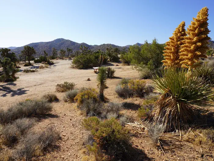
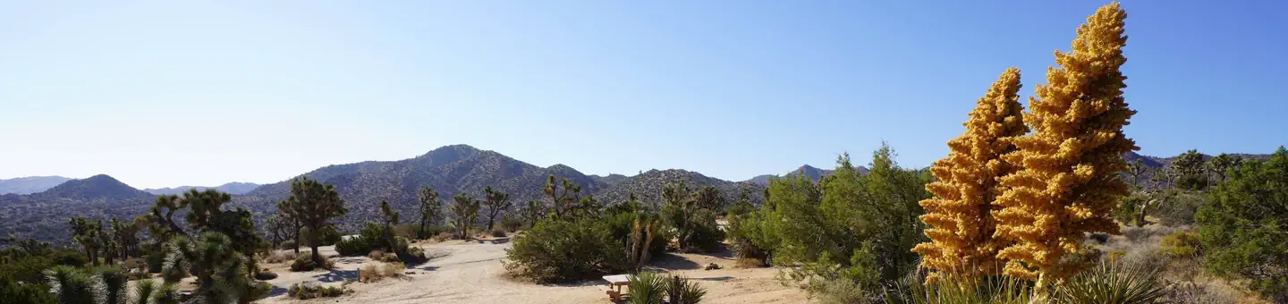
Overview Download the NPS app prior to visiting the park – trail maps and more! Black Rock Campground lies among one of the thickest Joshua tree forests in Joshua Tree National Park.
Sites9994 reservable
Elev.4,029ft
Comf.Jan-Dec11 months
Max rig35 ft14 pull-thru
Electricnonesites
From San Diego3h00real road time
The honest read
Synthesized from RIDB · Open-Meteo OSM · OSRM Updated 2026-05-27
At 4,029 ft, Black Rock Campground has a 11-month comfortable window (Jan-Dec). Winter nights average around 39°F, so the shoulder seasons turn cold fast. 99 sites total: 94 reservable and 5 first-come, first-served. Of the sites, 14 pull-through, and the longest takes a 35-ft rig. Within about 4 miles: 9 peaks.
What campers say
SYNTHESIZED · RICH SIGNAL
Access
01 / 06
Separate northwest entrance, no road link to the main park interior.
Black Rock has its own gate out of Yucca Valley and does not connect to Park Boulevard, so reaching Hidden Valley, Keys View, or Cholla Garden means driving out and re-entering through the West or North entrance, roughly 30 to 45 minutes each way.
Facilities
02 / 06
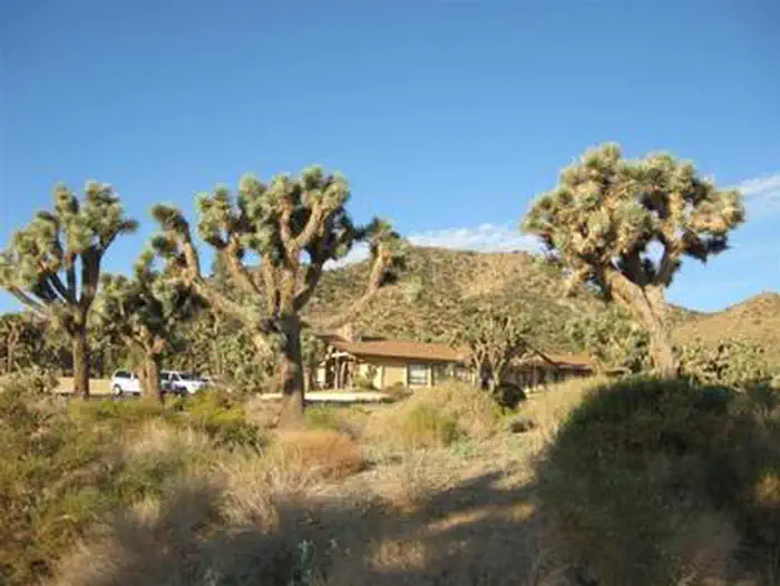
Flush toilets, potable water, and a dump station set it apart from most JT campgrounds.
Campers repeatedly note this is one of the only campgrounds in the park with running water and a dump station, which makes it the default pick for RVs and anyone who does not want to haul water in. No hookups or showers.
Weather
03 / 06
Wind and cold nights at 4,000 ft catch people off guard.
Reports of multi-hour windstorms, January lows in the 30s, and occasional rain or snow into April are common. Stake tents hard and bring more insulation than a sea-level desert trip would suggest.
Trails & access
04 / 06
Panorama Loop leaves straight from camp and stays quiet.
The 6 to 7 mile Panorama Loop and the California Riding and Hiking Trail both start at the campground, and campers consistently say this corner of the park sees a fraction of the foot traffic of Hidden Valley or Barker Dam.
Sites
05 / 06
Interior sites feel tight, outer-ring sites are the prize.
Several reviewers describe sites as packed close with thin brush between them, while outer loop and hilltop sites (81 is named more than once) get more space and better views. Interior roads are unpaved and washed out in spots, awkward for trailers over 30 ft despite the 35 ft posted limit.
Vibe
06 / 06
Yucca Valley is five miles away, which is convenient and a tradeoff.
Easy resupply, gas, and cell signal across all carriers, but campers also note town glow on the northern horizon that dims the stargazing compared to Jumbo Rocks or Cottonwood, plus occasional generator and party noise on busy weekends.
Synthesized from public trip reports and forum discussion, summarized in our words and never quoted. This is durable sentiment, not a live feed.
The campground at a glance
01 · CHARACTER
Reads strongest on reservability and cool nights. Softest on roomy sites.
Six axes, each scored relative to every other federal campground in the region: quiet (miles to a major road), cool (elevation), roomy (average site spacing), shade, RV-fit (longest rig), and how reservable it is. All six come from data, nothing hand-tuned.
When to go
02 · CLIMATE
avg highavg lowfrost-freedriest · May
Jan-Dec
Comfortable window: nights stay above 35°F, days below 90°F.
93%
Of summer weekend-days are dry.
Mar 16
Last spring frost; first fall frost Nov 30.
74°F
Average July low. Bring a fleece.
Getting there
03 · ACCESS
01
San Diego
135 mi
3h00
02
Los Angeles
138 mi
3h04
03
Fresno
345 mi
7h40
04
Sacramento
548 mi
12h11
05
San Francisco
550 mi
12h13
By drive time
Routed road time (OSRM). Nearest major highway 3.8 mi away.
We synthesize public data layers: RIDB and Recreation.gov facility and site records, Open-Meteo climate normals, OpenStreetMap roads, trails, and water, OSRM drive times, and USGS elevation. We take no bookings, no ads, and no paid placements. Independence is the entire point.