USFSGeorge Washington & Jefferson National Forest · Virginia
Bolar Mountain Recreation Area
Overview Bolar Mountain Recreation Area is a great destination for visitors looking for a fun getaway on Lake Moomaw.
Sites12586 reservable
Elev.1,670ft
Comf.Mar-Nov9 months
Max rig50 ft
Electric3210×50-amp
From Roanoke2h38real road time
The honest read
Synthesized from RIDB · Open-Meteo OSM · OSRM Updated 2026-05-27
At 1,670 ft, Bolar Mountain Recreation Area has a 9-month comfortable window (Mar-Nov). Winter nights average around 27°F, so the shoulder seasons turn cold fast. 125 sites total: 86 reservable and 39 first-come, first-served. Of the sites, 6 walk-in, 10 with 50-amp, and the longest takes a 50-ft rig. Within about 4 miles: 2 named hiking routes, 2 peaks, lake or river access.
What campers say
SYNTHESIZED · MODERATE SIGNAL
Water
01 / 06
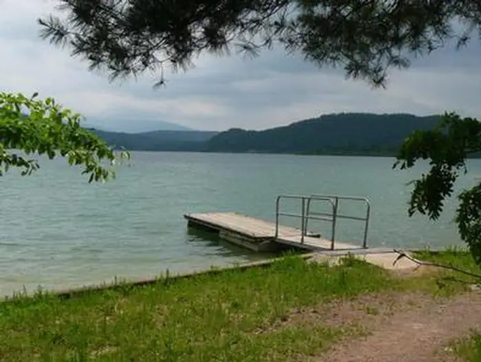
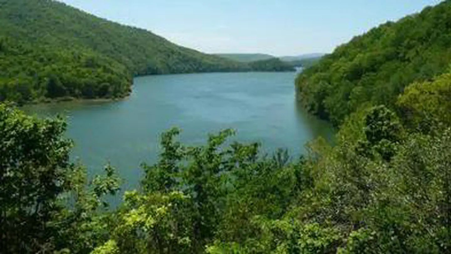
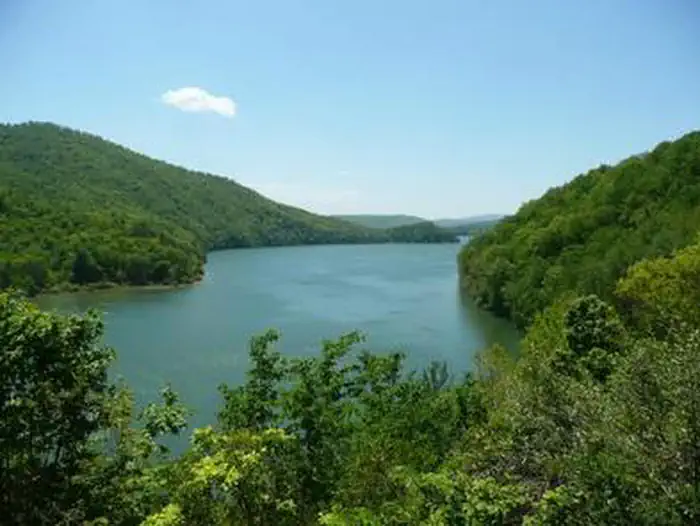
A big, clean reservoir, and a rare two-story fishery.
Lake Moomaw is a 2,530-acre Corps reservoir with about 43 miles of wooded shoreline, and people remember the clean, clear water and the mountain backdrop. It is a two-story fishery, with stocked trout down deep and bass, crappie, catfish, and panfish up top. Because the Corps manages the dam, levels rise and fall, so the shoreline does not always match the photos.
Sites
02 / 06
Four loops, each with a different feel, and lakefront goes fast.
Campground 1 gets praised for shade and spacing, Sugar Ridge is the spread-out quiet one, and Campgrounds 2 and 3 sit closer to the water but feel tight on busy weekends. The waterfront sites are the prize and book up first. One repeated tip is to check which side a site's electric box is on before you commit.
Booking
03 / 06
Reserve the lakefront and electric sites well ahead.
Electric sites are limited and cluster in Campgrounds 1 and 2, and the lakefront spots are the first to go. For a summer weekend, book early rather than gambling on a walk-up.
Facilities
04 / 06
Clean when staffed, but upkeep has been hit-or-miss.
Many campers find the bathhouses clean with hot showers, while others report worn or out-of-service fixtures and less frequent cleaning, which several tie to a change in who runs the place. There are two dump stations.
Vibe
05 / 06
Calm midweek, a busy motorboat lake on summer weekends.
Weekdays and the shoulder seasons are quiet and relaxing. Summer weekends bring crowds, motorboats and jet-skis, music, and generators, so anyone after calm should aim midweek. There is essentially no cell service, which most people treat as a plus.
Access
06 / 06
Genuinely remote. Bring everything you need.
Groceries and gas are about 30 minutes away around Hot Springs and Warm Springs, so stock up first. First-timers report confusing signage and unreliable GPS on arrival, so print directions and a map before you lose signal.
Synthesized from public trip reports and forum discussion, summarized in our words and never quoted. This is durable sentiment, not a live feed.
The campground at a glance
01 · CHARACTER
Reads strongest on shade and reservability. Softest on roomy sites.
Six axes, each scored relative to every other federal campground in the region: quiet (miles to a major road), cool (elevation), roomy (average site spacing), shade, RV-fit (longest rig), and how reservable it is. All six come from data, nothing hand-tuned.
When to go
02 · CLIMATE
avg highavg lowfrost-freedriest · Nov
Mar-Nov
Comfortable window: nights stay above 35°F, days below 90°F.
74%
Of summer weekend-days are dry.
Apr 22
Last spring frost; first fall frost Nov 6.
66°F
Average July low.
Getting there
03 · ACCESS
01
Roanoke
80 mi
2h38
02
Richmond
174 mi
4h03
03
Washington DC
223 mi
5h02
04
Norfolk
265 mi
5h51
By drive time
Routed road time (OSRM). Nearest major highway 5.7 mi away.
We synthesize public data layers: RIDB and Recreation.gov facility and site records, Open-Meteo climate normals, OpenStreetMap roads, trails, and water, OSRM drive times, and USGS elevation. We take no bookings, no ads, and no paid placements. Independence is the entire point.