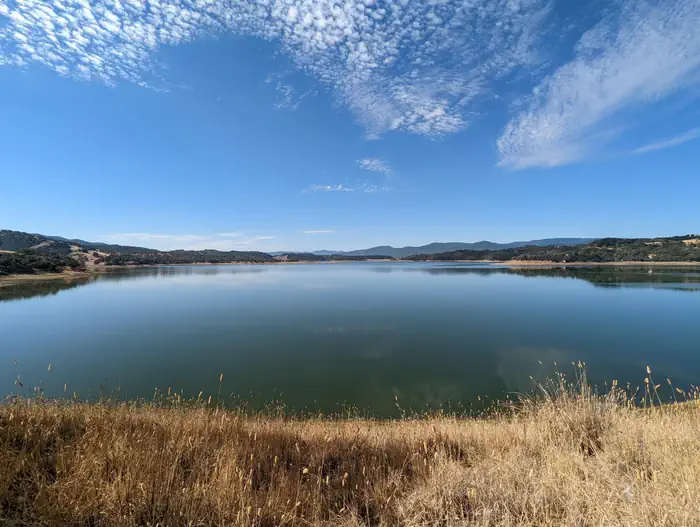
Overview Bushay Recreation Area is situated on Lake Mendocino in California's Mendocino Range, where redwood forests meet wine country.
Sites16743 reservable
Elev.735ft
Comf.Jan-Dec10 months
Max rig78 ft
Electric1sites
From Sacramento2h55real road time
The honest read
Synthesized from RIDB · Open-Meteo OSM · OSRM Updated 2026-05-27
At 735 ft, Bushay Recreation Area has a 10-month comfortable window (Jan-Dec). Winter nights average around 39°F, so the shoulder seasons turn cold fast. 167 sites total: 43 reservable and 124 first-come, first-served. Within about 4 miles: 12 peaks, lake or river access.
What campers say
SYNTHESIZED · MODERATE SIGNAL
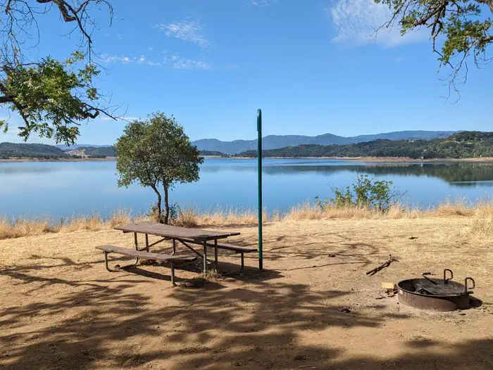
Sites
01 / 05
Spacious mix of sun and shade, but lake-view sites sit 60 feet above the water.
Most reports describe level pads with a usable mix of shaded and open sites, and grassy ground that beats packed dirt. Sites with a lake view perch on a steep bank with no direct path down, so the water you can see is not water you can step into from camp.
Wildlife & sky
02 / 05
Wild turkeys, deer, and bald eagles are routine sightings.
Multiple campers mention turkeys and deer wandering the loops and bald eagles overhead, consistent with the 700-acre wildlife area next door. Songbird activity is heavy in the oak canopy, especially at dawn.
Booking
03 / 05
Reservation-only and prone to seasonal and storm-related closures.
The access road floods when lake levels rise, so the campground typically runs May through November and has had extended closures after winter storm damage, with some loops still reopening in stages. All sites must be booked online in advance and the facility is cashless, with thin cell service at the kiosk.
Facilities
04 / 05
Flush toilets, free showers, and a playground, but almost no hookups.
Reviewers consistently note clean flush restrooms, free hot showers, a dump station, and a playground that families use heavily. Only one site has electric, there is no sewer, and the boat ramp is a drive away rather than walkable, so big-rig boaters often pick a different Lake Mendocino loop.
Weather
05 / 05
Inland heat in summer, with little relief at the exposed sites.
Campers report June and July afternoons running hot at the 830-foot elevation, and the sunnier sites bake without the oak cover. Shoulder season trips read as the more comfortable window, which lines up with the May to November operating pattern.
Synthesized from public trip reports and forum discussion, summarized in our words and never quoted. This is durable sentiment, not a live feed.
The campground at a glance
01 · CHARACTER
Reads strongest on shade and reservability. Softest on roomy sites.
Six axes, each scored relative to every other federal campground in the region: quiet (miles to a major road), cool (elevation), roomy (average site spacing), shade, RV-fit (longest rig), and how reservable it is. All six come from data, nothing hand-tuned.
When to go
02 · CLIMATE
avg highavg lowfrost-freedriest · Jul
Jan-Dec
Comfortable window: nights stay above 35°F, days below 90°F.
98%
Of summer weekend-days are dry.
Mar 23
Last spring frost; first fall frost Nov 29.
56°F
Average July low.
Getting there
03 · ACCESS
01
Sacramento
131 mi
2h55
02
San Francisco
141 mi
3h08
03
Fresno
328 mi
7h17
04
Los Angeles
585 mi
13h00
05
San Diego
730 mi
16h13
By drive time
Routed road time (OSRM). Nearest major highway 0.2 mi away.
We synthesize public data layers: RIDB and Recreation.gov facility and site records, Open-Meteo climate normals, OpenStreetMap roads, trails, and water, OSRM drive times, and USGS elevation. We take no bookings, no ads, and no paid placements. Independence is the entire point.