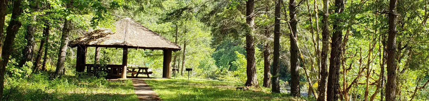
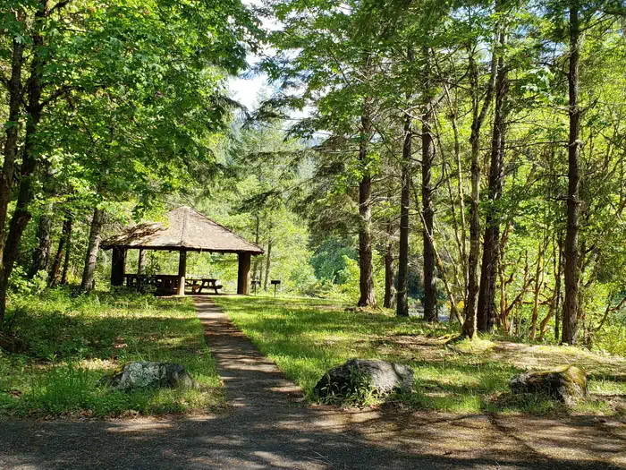
Overview Canton Creek Campground is a quaint little campground that sits along the banks of Steamboat Creek near the confluence with the Wild and Scenic North Umpqua River.
Sites5all reservable
Elev.1,302ft
Comf.Apr-Nov8 months
Max rig24 ft
Electricnonesites
From Eugene2h12real road time
The honest read
Synthesized from RIDB · Open-Meteo OSM · OSRM Updated 2026-05-27
At 1,302 ft, Canton Creek Campground has a 8-month comfortable window (Apr-Nov). Winter nights average around 34°F, so the shoulder seasons turn cold fast. All 5 sites are reservable in advance, so plan ahead. Popular weekends book out. Within about 4 miles: 3 peaks, lake or river access.
The campground at a glance
01 · CHARACTER
Reads strongest on shade and reservability. Softest on big-rig fit.
Six axes, each scored relative to every other federal campground in the region: quiet (miles to a major road), cool (elevation), roomy (average site spacing), shade, RV-fit (longest rig), and how reservable it is. All six come from data, nothing hand-tuned.
When to go
02 · CLIMATE
avg highavg lowfrost-freedriest · Jul
Apr-Nov
Comfortable window: nights stay above 35°F, days below 90°F.
90%
Of summer weekend-days are dry.
Apr 26
Last spring frost; first fall frost Oct 22.
56°F
Average July low.
Getting there
03 · ACCESS
01
Eugene
70 mi
2h12
02
Medford
136 mi
2h54
03
Bend
137 mi
3h07
04
Portland
175 mi
4h16
By drive time
Routed road time (OSRM). Nearest major highway 0.3 mi away.
Picking your site
04 · 5 SITES
0
Pull-thru
0
Walk-in
0
50-amp
0
Accessible
3
Prime
5
Sites
★ The standout
Site 03
CANTON CREEK CAMPGROUND · prime location · shaded.
Location
Prime
Max rig
24 ft
Type
Standard
What's within four miles
05 · TRAILS · PEAKS · WATER
Trails & Peaks
Trail segments
4
Peaks
3
Water & Access
Lake / river access
yes
To nearest major road
0.3 mi
Method
We synthesize public data layers: RIDB and Recreation.gov facility and site records, Open-Meteo climate normals, OpenStreetMap roads, trails, and water, OSRM drive times, and USGS elevation. We take no bookings, no ads, and no paid placements. Independence is the entire point.