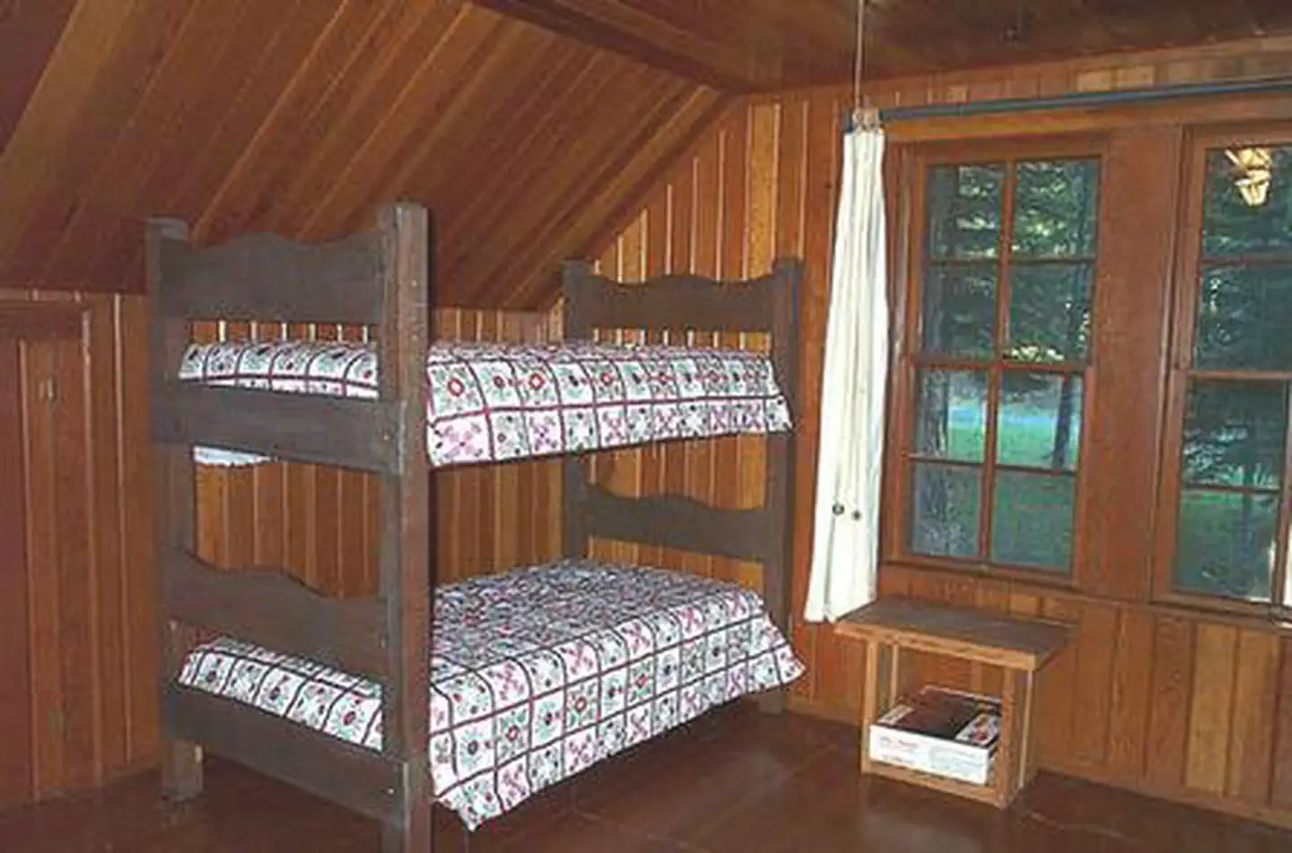
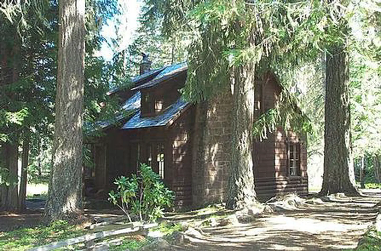
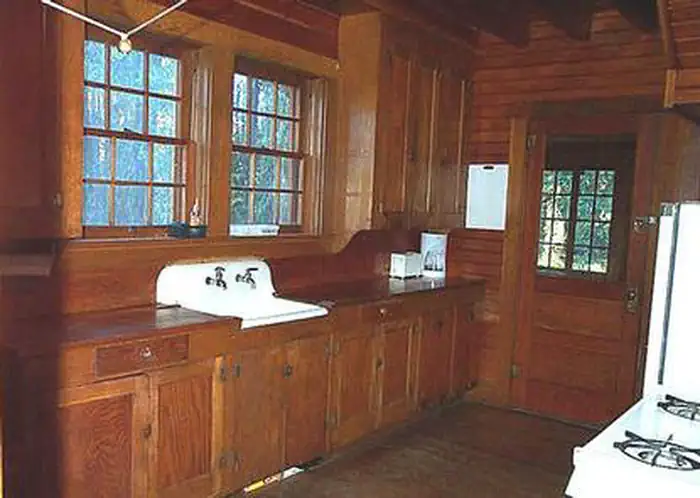
Overview Clackamas Lake Historic Cabin gives campers an old-fashioned cabin experience with its well-preserved features, including a massive rock chimney, knot-free interior paneling and hand-wrought
Sites1all reservable
Elev.3,402ft
Comf.May-Oct6 months
Max rigtents
Electricnonesites
From Portland2h02real road time
The honest read
Synthesized from RIDB · Open-Meteo OSM · OSRM Updated 2026-05-27
At 3,402 ft, Clackamas Lake Historic Cabin has a 6-month comfortable window (May-Oct). Winter nights average around 28°F, so the shoulder seasons turn cold fast. All 1 sites are reservable in advance, so plan ahead. Popular weekends book out. Within about 4 miles: 1 named hiking route, 2 peaks, lake or river access.
The campground at a glance
01 · CHARACTER
Reads strongest on shade and reservability. Softest on cool nights.
Six axes, each scored relative to every other federal campground in the region: quiet (miles to a major road), cool (elevation), roomy (average site spacing), shade, RV-fit (longest rig), and how reservable it is. All six come from data, nothing hand-tuned.
When to go
02 · CLIMATE
avg highavg lowfrost-freedriest · Jul
May-Oct
Comfortable window: nights stay above 35°F, days below 90°F.
91%
Of summer weekend-days are dry.
May 9
Last spring frost; first fall frost Oct 12.
50°F
Average July low. Bring a fleece.
Getting there
03 · ACCESS
01
Portland
77 mi
2h02
02
Bend
100 mi
2h33
03
Eugene
174 mi
3h57
04
Medford
272 mi
6h28
By drive time
Routed road time (OSRM). Nearest major highway 5.9 mi away.
Picking your site
04 · 1 SITES
0
Pull-thru
0
Walk-in
0
50-amp
0
Accessible
0
Prime
1
Sites
What's within four miles
05 · TRAILS · PEAKS · WATER
Trails & Peaks
Named hiking routes
1
Trail segments
38
Peaks
2
Viewpoints
2
Water & Access
Lake / river access
yes
To nearest major road
5.9 mi
Method
We synthesize public data layers: RIDB and Recreation.gov facility and site records, Open-Meteo climate normals, OpenStreetMap roads, trails, and water, OSRM drive times, and USGS elevation. We take no bookings, no ads, and no paid placements. Independence is the entire point.