Overview Cougar Rock Campground, on the southwest side of Mt.
Sites184130 reservable
Elev.3,199ft
Comf.May-Oct6 months
Max rig35 ft59 pull-thru
Electricnonesites
From Yakima2h27real road time
The honest read
Synthesized from RIDB · Open-Meteo OSM · OSRM Updated 2026-05-27
At 3,199 ft, Cougar Rock Campground has a 6-month comfortable window (May-Oct). Winter nights average around 30°F, so the shoulder seasons turn cold fast. 184 sites total: 130 reservable and 54 first-come, first-served. Of the sites, 59 pull-through, and the longest takes a 35-ft rig. Within about 4 miles: 16 named hiking routes, 21 peaks, lake or river access.
What campers say
SYNTHESIZED · RICH SIGNAL
Vibe
01 / 06
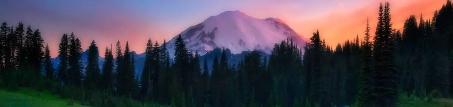
Dense old-growth forest along the Nisqually, busy but generally calm by day.
Campers describe a thick conifer setting next to the river that feels remote despite the size, with daytime quiet because most people are out hiking and evenings picking up as sites refill. A few reviewers note crowding and late arrivals breaking the calm during peak weekends.
Sites
02 / 06
Loop and site choice matters more here than at most NPS campgrounds.
Reviewers consistently single out Loop E as the tent-friendly, no-generator loop and interior Loop C sites for the best privacy and shade, while Loops A and B are closer to the park road and noisier. Pads are often uneven and rocky, so leveling blocks come up repeatedly.
Booking
03 / 06
Reservable June 21 to September 3, first-come the rest of the open season.
The campground is on Recreation.gov for the peak window and shifts to first-come-first-served on the shoulders, running roughly late May through early October. No-generator Loop E books out fastest according to multiple reviewers.
Facilities
04 / 06
Flush toilets and potable water, no showers, and the dump station is closed for 2026.
Each loop has flush restrooms and a spigot, plus bear boxes, fire rings, and picnic tables at every site. Reviewers repeatedly flag the closed RV dump and fill station for the 2026 season and the lack of any showers or hookups.
Access
05 / 06
Two miles down to Longmire, roughly fifteen minutes up to Paradise.
Campers describe Longmire as a quick downhill run for the museum and store and Paradise as a 10 to 20 minute drive uphill for the marquee hikes. The Wonderland Trail and Carter Falls trailhead are walkable from the campground.
Weather
06 / 06
Cold nights even in midsummer, occasional rain, dense canopy keeps sites cool.
Multiple reviewers warn that July and August nights run cool and shoulder-season nights can drop near freezing, so warmer bags than expected come up often. The heavy tree cover keeps sites shaded and damp, which campers also note kills solar charging.
Synthesized from public trip reports and forum discussion, summarized in our words and never quoted. This is durable sentiment, not a live feed.
The campground at a glance
01 · CHARACTER
Reads strongest on shade and reservability. Softest on roomy sites.
Six axes, each scored relative to every other federal campground in the region: quiet (miles to a major road), cool (elevation), roomy (average site spacing), shade, RV-fit (longest rig), and how reservable it is. All six come from data, nothing hand-tuned.
When to go
02 · CLIMATE
avg highavg lowfrost-freedriest · Jul
May-Oct
Comfortable window: nights stay above 35°F, days below 90°F.
85%
Of summer weekend-days are dry.
May 8
Last spring frost; first fall frost Oct 16.
52°F
Average July low. Bring a fleece.
Getting there
03 · ACCESS
01
Yakima
97 mi
2h27
02
Seattle
95 mi
2h29
03
Spokane
297 mi
6h03
By drive time
Routed road time (OSRM). Nearest major highway 6.1 mi away.
We synthesize public data layers: RIDB and Recreation.gov facility and site records, Open-Meteo climate normals, OpenStreetMap roads, trails, and water, OSRM drive times, and USGS elevation. We take no bookings, no ads, and no paid placements. Independence is the entire point.