Bureau of Land ManagementBears Ears National Monument · Utah
Creek Pasture Group Site
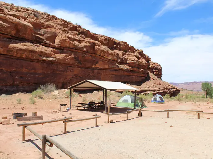
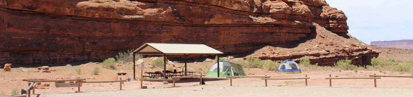
Overview The Creek Pasture Group Site at Creek Pasture Campground is ideal for large groups wishing to recreate in the Indian Creek area, or camp close to the Bears Ears National Monument Indian Creek
Sites1all reservable
Elev.4,839ft
Comf.Apr-Oct5 months
Max rigtents1 pull-thru
Electricnonesites
From Moab1h47real road time
The honest read
Synthesized from RIDB · Open-Meteo OSM · OSRM Updated 2026-05-27
At 4,839 ft, Creek Pasture Group Site has a 5-month comfortable window (Apr-Oct). Winter nights average around 21°F, so the shoulder seasons turn cold fast. All 1 sites are reservable in advance, so plan ahead. Popular weekends book out. Of the sites, 1 pull-through. Within about 4 miles: 1 named hiking route, 3 peaks, lake or river access.
The campground at a glance
01 · CHARACTER
Reads strongest on reservability and quiet. Softest on shade.
Six axes, each scored relative to every other federal campground in the region: quiet (miles to a major road), cool (elevation), roomy (average site spacing), shade, RV-fit (longest rig), and how reservable it is. All six come from data, nothing hand-tuned.
When to go
02 · CLIMATE
avg highavg lowfrost-freedriest · Jun
Apr-Oct
Comfortable window: nights stay above 35°F, days below 90°F.
99%
Of summer weekend-days are dry.
Apr 16
Last spring frost; first fall frost Oct 21.
71°F
Average July low. Bring a fleece.
Getting there
03 · ACCESS
01
Moab
68 mi
1h47
02
Salt Lake City
302 mi
6h23
03
St. George
407 mi
7h25
By drive time
Routed road time (OSRM). Nearest major highway 13.7 mi away.
Picking your site
04 · 1 SITES
1
Pull-thru
0
Walk-in
0
50-amp
0
Accessible
0
Prime
1
Sites
What's within four miles
05 · TRAILS · PEAKS · WATER
Trails & Peaks
Named hiking routes
1
Trail segments
6
Peaks
3
Viewpoints
3
Water & Access
Lake / river access
yes
To nearest major road
13.7 mi
Method
We synthesize public data layers: RIDB and Recreation.gov facility and site records, Open-Meteo climate normals, OpenStreetMap roads, trails, and water, OSRM drive times, and USGS elevation. We take no bookings, no ads, and no paid placements. Independence is the entire point.