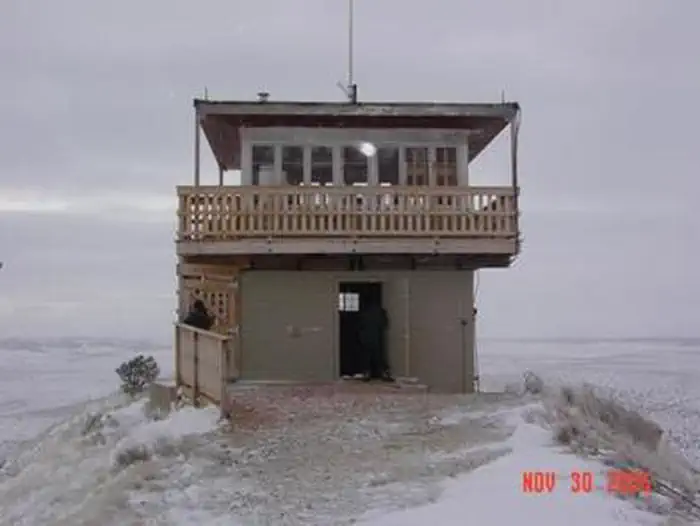
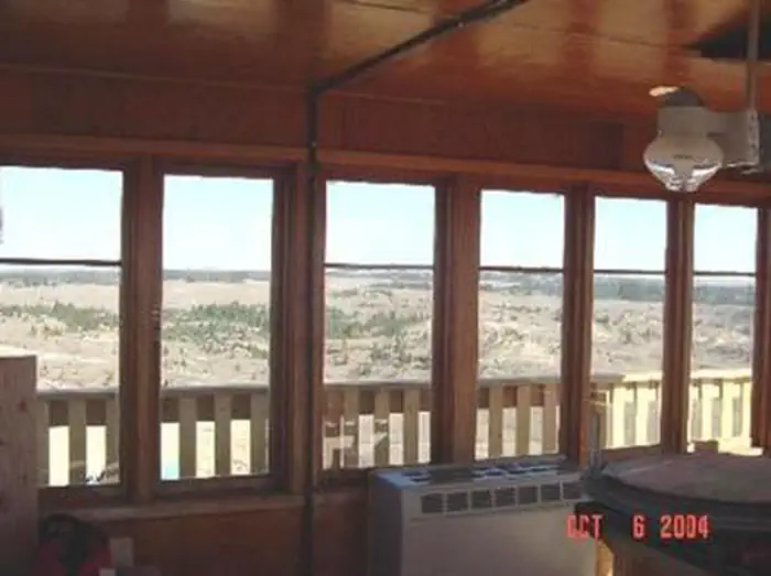
Overview Diamond Butte Lookout is perched atop a 30-foot masonry tower on Diamond Butte at an altitude of 4,245 feet in the Custer National Forest approximately 40 miles from Ashland, Montana.
Sites1all reservable
Elev.4,203ft
Comf.May-Sep5 months
Max rigtents
Electricnonesites
From Billings4h08real road time
The honest read
Synthesized from RIDB · Open-Meteo OSM · OSRM Updated 2026-05-27
At 4,203 ft, Diamond Butte Lookout has a 5-month comfortable window (May-Sep). Winter nights average around 18°F, so the shoulder seasons turn cold fast. All 1 sites are reservable in advance, so plan ahead. Popular weekends book out. Within about 4 miles: 2 peaks.
The campground at a glance
01 · CHARACTER
Reads strongest on reservability and cool nights. Softest on shade.
Six axes, each scored relative to every other federal campground in the region: quiet (miles to a major road), cool (elevation), roomy (average site spacing), shade, RV-fit (longest rig), and how reservable it is. All six come from data, nothing hand-tuned.
When to go
02 · CLIMATE
avg highavg lowfrost-freedriest · Jan
May-Sep
Comfortable window: nights stay above 35°F, days below 90°F.
88%
Of summer weekend-days are dry.
May 11
Last spring frost; first fall frost Oct 1.
60°F
Average July low. Bring a fleece.
Getting there
03 · ACCESS
01
Billings
161 mi
4h08
02
Bozeman
303 mi
6h31
03
Helena
401 mi
8h19
04
Missoula
506 mi
9h48
By drive time
Picking your site
04 · 1 SITES
0
Pull-thru
0
Walk-in
0
50-amp
0
Accessible
0
Prime
1
Sites
What's within four miles
05 · TRAILS · PEAKS · WATER
Trails & Peaks
Peaks
2
Water & Access
Method
We synthesize public data layers: RIDB and Recreation.gov facility and site records, Open-Meteo climate normals, OpenStreetMap roads, trails, and water, OSRM drive times, and USGS elevation. We take no bookings, no ads, and no paid placements. Independence is the entire point.