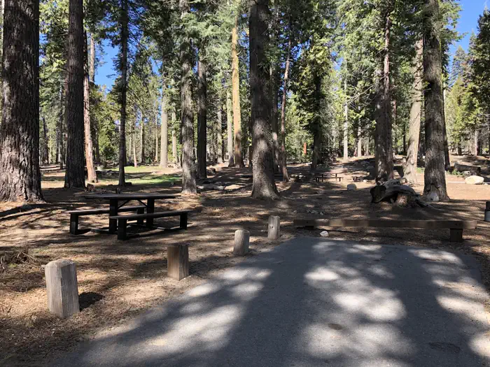
Overview Dinkey Creek is spread out along the banks of its namesake creek in a thick forest of Ponderosa pines and cedars.
Sites123120 reservable
Elev.5,797ft
Comf.May-Nov7 months
Max rig50 ft
Electricnonesites
From Fresno1h12real road time
The honest read
Synthesized from RIDB · Open-Meteo OSM · OSRM Updated 2026-05-27
At 5,797 ft, Dinkey Creek has a 7-month comfortable window (May-Nov). Winter nights average around 27°F, so the shoulder seasons turn cold fast. 123 sites total: 120 reservable and 3 first-come, first-served. Of the sites, 2 walk-in, and the longest takes a 50-ft rig. Within about 4 miles: 3 peaks, lake or river access.
What campers say
SYNTHESIZED · MODERATE SIGNAL
Vibe
01 / 05
Big, family-heavy campground that can feel crowded and loud on summer weekends.
Multiple reviewers describe a busy social scene with neighbors hanging out all day and music into the night. Several recommend it for families looking for activity, not for campers seeking solitude.
Water
02 / 05
Granite swimming holes are the main draw, and the rocks are genuinely slippery.
The Slicks and Honeymoon Pool, both about a mile from the loops, get praised across sources for swimming and wading. Reviewers repeatedly warn that the polished granite causes falls, and one trip report noted Honeymoon Pool was more crowded than expected.
Sites
03 / 05
Site quality varies widely by loop; J and K loops read as the quieter pick.
Reviewers point to J and K loops and hike-in spots like E48 and E50 for more privacy, while some G-loop sites were called out as unlevel and cramped. E and F loops sit closest to the creek.
Facilities
04 / 05
Flush and vault toilets plus potable water on site, but no showers in the campground.
Restrooms get consistent praise for being clean and well kept. Showers and a small store with groceries and a cafe are at the nearby Dinkey Creek Inn, not inside the loops.
Wildlife & sky
05 / 05
Yellowjackets are the recurring complaint, not bears.
Several reviewers across sources flag aggressive meat bees at meal times, with one family reportedly catching dozens in a day and leaving early. Bears are mentioned in USFS guidance but trip reports note there are no food lockers at sites, so bring your own storage.
Synthesized from public trip reports and forum discussion, summarized in our words and never quoted. This is durable sentiment, not a live feed.
The campground at a glance
01 · CHARACTER
Reads strongest on reservability and shade. Softest on roomy sites.
Six axes, each scored relative to every other federal campground in the region: quiet (miles to a major road), cool (elevation), roomy (average site spacing), shade, RV-fit (longest rig), and how reservable it is. All six come from data, nothing hand-tuned.
When to go
02 · CLIMATE
avg highavg lowfrost-freedriest · Jul
May-Nov
Comfortable window: nights stay above 35°F, days below 90°F.
98%
Of summer weekend-days are dry.
May 22
Last spring frost; first fall frost Oct 20.
60°F
Average July low. Bring a fleece.
Getting there
03 · ACCESS
01
Fresno
54 mi
1h12
02
Sacramento
214 mi
4h45
03
San Francisco
241 mi
5h21
04
Los Angeles
279 mi
6h12
05
San Diego
418 mi
9h17
By drive time
Routed road time (OSRM). Nearest major highway 8.9 mi away.
We synthesize public data layers: RIDB and Recreation.gov facility and site records, Open-Meteo climate normals, OpenStreetMap roads, trails, and water, OSRM drive times, and USGS elevation. We take no bookings, no ads, and no paid placements. Independence is the entire point.