NPSSequoia & Kings Canyon National Parks · California
Dorst Creek Campground-Sequoia And Kings Canyon National Park
Overview Dorst Creek Campground is located in the breathtaking Sequoia and Kings Canyon National Parks in central California's rugged Sierra Nevada range.
Sites204203 reservable
Elev.6,795ft
Comf.May-Oct6 months
Max rig133 ft10 pull-thru
Electricnonesites
From Fresno1h35real road time
The honest read
Synthesized from RIDB · Open-Meteo OSM · OSRM Updated 2026-05-27
At 6,795 ft, Dorst Creek Campground-Sequoia And Kings Canyon National Park has a 6-month comfortable window (May-Oct). Winter nights average around 24°F, so the shoulder seasons turn cold fast. 204 sites total: 203 reservable and 1 first-come, first-served. Of the sites, 10 pull-through, 24 walk-in, and the longest takes a 133-ft rig. Within about 4 miles: 1 named hiking route, 2 peaks.
What campers say
SYNTHESIZED · RICH SIGNAL
Vibe
01 / 06
Quieter, woodier alternative to Lodgepole but cramped on busy weekends.
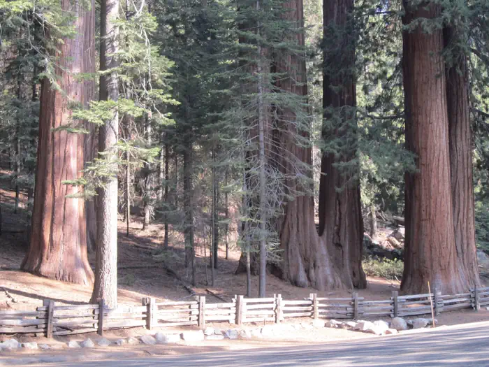
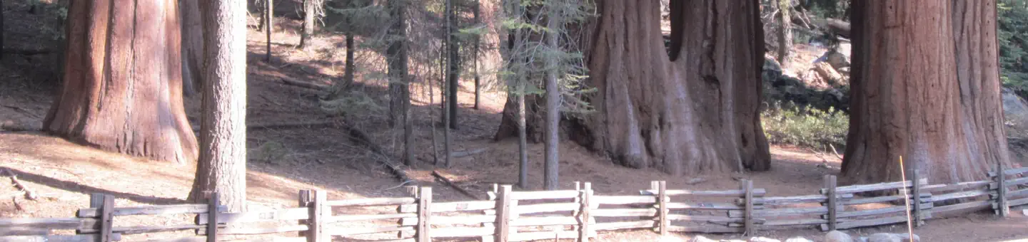
Campers describe a forested setting under firs, pines, and scattered sequoias with granite outcrops and the creek nearby, and most call it calmer than Lodgepole on weekdays. Weekends pick up with group noise, and several reviewers note loops where sites sit close enough that you hear neighbors clearly.
Sites
02 / 06
Spacing varies sharply by loop, with tent-only sites at the back rated best.
Sites 164 through 192 are tent-only and get the most recommendations for quiet and seclusion, while loops in the 150s are repeatedly called tight and exposed. Several reviewers single out site 97 for creek proximity and site 105 in the 99 to 127 loop for layout.
Booking
03 / 06
Five-month rolling window fills fast, and the campground is closed for 2026 recovery.
Reservations open about five months ahead on Recreation.gov and summer dates go quickly once released. As of the 2026 season the campground is not taking reservations due to ongoing post-fire recovery work, so trip planning should assume Lodgepole or out-of-park alternatives.
Weather
04 / 06
Warm days, cold nights, and a short mid-June to early September window.
At roughly 6,800 feet, daytime temperatures are comfortable but nights drop enough that multiple campers recommend a real sleeping bag and layers even in July. The operating season is short and shoulder weeks can see lingering snow or early closures.
Wildlife & sky
05 / 06
Active bear zone with frequent overnight visits, food lockers are mandatory.
Reviewers consistently report bear activity at night, including raids tied to careless neighbors and rangers running bear talks at check-in. Every site has a metal locker and the consensus is to keep coolers, trash, and anything scented inside it day and night, not in the vehicle.
Trails & access
06 / 06
Muir Grove trail leaves from camp and avoids the Giant Forest crowds.
The Muir Grove trail starts at the back of the campground and runs roughly four miles round trip to a quiet sequoia stand that reviewers repeatedly call the highlight of staying here. From the campground itself it is about a 20 to 30 minute drive south on Generals Highway to General Sherman and the main Giant Forest sights.
Synthesized from public trip reports and forum discussion, summarized in our words and never quoted. This is durable sentiment, not a live feed.
The campground at a glance
01 · CHARACTER
Reads strongest on reservability and shade. Softest on roomy sites.
Six axes, each scored relative to every other federal campground in the region: quiet (miles to a major road), cool (elevation), roomy (average site spacing), shade, RV-fit (longest rig), and how reservable it is. All six come from data, nothing hand-tuned.
When to go
02 · CLIMATE
avg highavg lowfrost-freedriest · Jul
May-Oct
Comfortable window: nights stay above 35°F, days below 90°F.
92%
Of summer weekend-days are dry.
Jun 11
Last spring frost; first fall frost Oct 12.
56°F
Average July low. Bring a fleece.
Getting there
03 · ACCESS
01
Fresno
71 mi
1h35
02
Los Angeles
236 mi
5h15
03
Sacramento
259 mi
5h45
04
San Francisco
278 mi
6h11
05
San Diego
373 mi
8h17
By drive time
Routed road time (OSRM). Nearest major highway 10.2 mi away.
We synthesize public data layers: RIDB and Recreation.gov facility and site records, Open-Meteo climate normals, OpenStreetMap roads, trails, and water, OSRM drive times, and USGS elevation. We take no bookings, no ads, and no paid placements. Independence is the entire point.