USFSMt. Baker-Snoqualmie National Forest · Washington
Evergreen Mountain Lookout
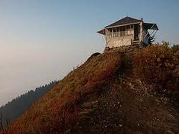
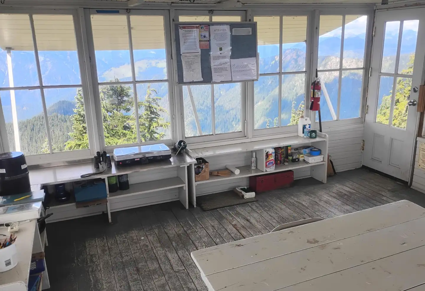
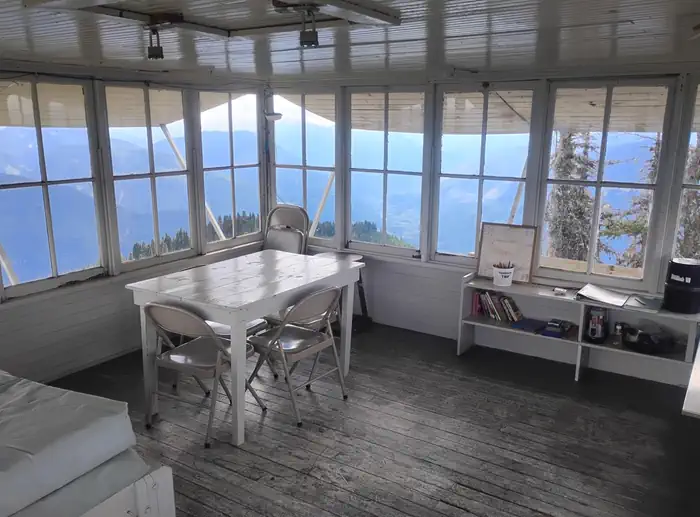
Overview Perched atop its namesake mountain at an elevation of 5,587 feet, Evergreen Mountain Lookout was built in 1935 for detecting wildfires.
Sites1all reservable
Elev.5,518ft
Comf.Jun-Sep4 months
Max rigtents
Electricnonesites
From Seattle2h41real road time
The honest read
Synthesized from RIDB · Open-Meteo OSM · OSRM Updated 2026-05-27
At 5,518 ft, Evergreen Mountain Lookout has a 4-month comfortable window (Jun-Sep). Winter nights average around 18°F, so the shoulder seasons turn cold fast. All 1 sites are reservable in advance, so plan ahead. Popular weekends book out. Within about 4 miles: 4 named hiking routes, 5 peaks, lake or river access.
The campground at a glance
01 · CHARACTER
Reads strongest on reservability and quiet. Softest on shade.
Six axes, each scored relative to every other federal campground in the region: quiet (miles to a major road), cool (elevation), roomy (average site spacing), shade, RV-fit (longest rig), and how reservable it is. All six come from data, nothing hand-tuned.
When to go
02 · CLIMATE
avg highavg lowfrost-freedriest · Aug
Jun-Sep
Comfortable window: nights stay above 35°F, days below 90°F.
76%
Of summer weekend-days are dry.
Jun 20
Last spring frost; first fall frost Aug 30.
42°F
Average July low. Bring a fleece.
Getting there
03 · ACCESS
01
Seattle
87 mi
2h41
02
Yakima
163 mi
4h08
03
Spokane
263 mi
6h02
By drive time
Routed road time (OSRM). Nearest major highway 8.3 mi away.
Picking your site
04 · 1 SITES
0
Pull-thru
0
Walk-in
0
50-amp
0
Accessible
0
Prime
1
Sites
★ The standout
Site 01
AREA EVERGREEN MOUNTAIN LOOKOUT.
0
Type
Standard
What's within four miles
05 · TRAILS · PEAKS · WATER
Trails & Peaks
Named hiking routes
4
Trail segments
9
Peaks
5
Water & Access
Lake / river access
yes
To nearest major road
8.3 mi
Method
We synthesize public data layers: RIDB and Recreation.gov facility and site records, Open-Meteo climate normals, OpenStreetMap roads, trails, and water, OSRM drive times, and USGS elevation. We take no bookings, no ads, and no paid placements. Independence is the entire point.