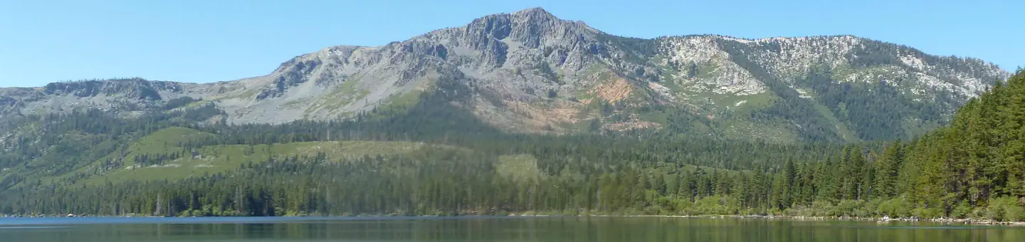
Overview Fallen Leaf Campground is situated on the north shore of Fallen Leaf Lake and adjacent to Taylor Creek.
Sites208193 reservable
Elev.6,342ft
Comf.May-Oct6 months
Max rig187 ft23 pull-thru
Electricnonesites
From Sacramento2h21real road time
The honest read
Synthesized from RIDB · Open-Meteo OSM · OSRM Updated 2026-05-27
At 6,342 ft, Fallen Leaf Campground has a 6-month comfortable window (May-Oct). Winter nights average around 27°F, so the shoulder seasons turn cold fast. 208 sites total: 193 reservable and 15 first-come, first-served. Of the sites, 23 pull-through, and the longest takes a 187-ft rig. Within about 4 miles: 6 peaks, lake or river access.
What campers say
SYNTHESIZED · RICH SIGNAL
Booking
01 / 06
Reservation-only and books out fast for the mid-May to mid-October window.
Campers consistently say you need to book months ahead for summer weekends, with cancellations as the main last-minute shot. The forest enforces a 14-day annual stay cap and the campground does not take first-come, first-served.
Sites
02 / 06
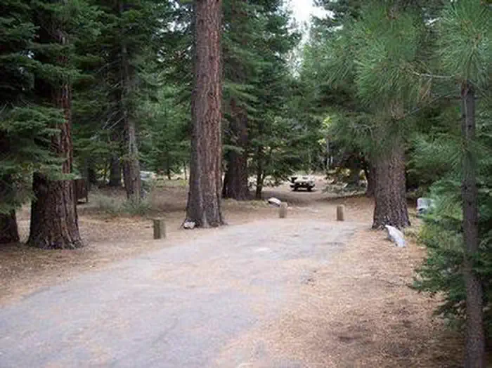
Big paved pads under pines, but privacy depends heavily on which loop you draw.
Outer-loop sites get praised as spacious and screened by trees and brush, while inner-loop sites are reported as close together with neighbors visible on multiple sides. Every site has a bear locker, fire ring, and picnic table, and yurts are an option for groups up to six.
Wildlife & sky
03 / 06
Bears are routine visitors, including in daylight, so food discipline is non-negotiable.
Multiple reviews describe a sow with cubs working through sites and bears nosing around at night, with hosts intervening on tagged repeat offenders. Yellow jackets also come up often as a daytime nuisance around food.
Water
04 / 06
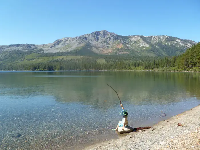
Five-minute walk to a cold, clear alpine lake with limited public shoreline.
Fallen Leaf Lake is described as crystal clear and good for kayaks and paddleboards more than swimming, with afternoon wind often picking up. Campers note that most of the shoreline is privately owned, so beach and fishing access from the lake itself is restricted.
Trails & access
05 / 06
Direct access to Desolation Wilderness plus a paved bike path to Lake Tahoe.
Reviewers point to the one-mile Moraine Trail from camp and short drives to the Glen Alpine and Mount Tallac trailheads as the main draws. A paved bike path links the campground area to Taylor Creek and the South Lake Tahoe shore without needing to drive.
Facilities
06 / 06
Clean flush toilets and coin showers, but no hookups, no dump station, spotty cell.
Campers report well-kept restrooms, hot showers at roughly a dollar for three minutes, and a small store with firewood and ice. No site has hookups, the nearest dump station is a paid stop at Camp Richardson, and cell coverage is weak to absent across carriers.
Synthesized from public trip reports and forum discussion, summarized in our words and never quoted. This is durable sentiment, not a live feed.
The campground at a glance
01 · CHARACTER
Reads strongest on shade and reservability. Softest on roomy sites.
Six axes, each scored relative to every other federal campground in the region: quiet (miles to a major road), cool (elevation), roomy (average site spacing), shade, RV-fit (longest rig), and how reservable it is. All six come from data, nothing hand-tuned.
When to go
02 · CLIMATE
avg highavg lowfrost-freedriest · Jul
May-Oct
Comfortable window: nights stay above 35°F, days below 90°F.
92%
Of summer weekend-days are dry.
May 29
Last spring frost; first fall frost Oct 16.
58°F
Average July low. Bring a fleece.
Getting there
03 · ACCESS
01
Sacramento
106 mi
2h21
02
San Francisco
197 mi
4h23
03
Fresno
197 mi
4h23
04
Los Angeles
457 mi
10h09
05
San Diego
596 mi
13h15
By drive time
Routed road time (OSRM). Nearest major highway 0.5 mi away.
AREA FALLEN LEAF CAMPGROUND · pull-through · shaded.
To neighbor
155 ft
Max rig
40 ft
Type
Pull-thru
What's within four miles
05 · TRAILS · PEAKS · WATER
Trails & Peaks
Trail segments
570
Peaks
6
Viewpoints
4
Water & Access
Lake / river access
yes
To nearest major road
0.5 mi
Method
We synthesize public data layers: RIDB and Recreation.gov facility and site records, Open-Meteo climate normals, OpenStreetMap roads, trails, and water, OSRM drive times, and USGS elevation. We take no bookings, no ads, and no paid placements. Independence is the entire point.