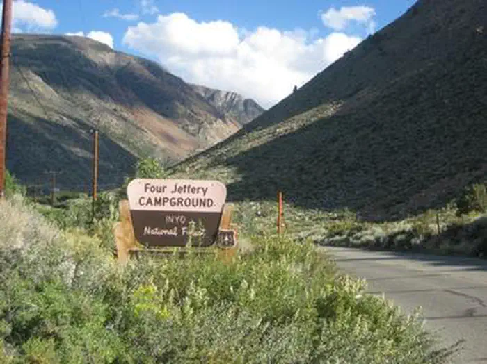
Overview Four Jeffrey is a mostly shaded campground with gorgeous views of Table Mountain along the South Fork of Bishop Creek.
Sites10631 reservable
Elev.9,816ft
Comf.Jun-Oct5 months
Max rig40 ft1 pull-thru
Electricnonesites
From Fresno2h13real road time
The honest read
Synthesized from RIDB · Open-Meteo OSM · OSRM Updated 2026-05-27
At 9,816 ft, Four Jeffrey has a 5-month comfortable window (Jun-Oct). Winter nights average around 17°F, so the shoulder seasons turn cold fast. 106 sites total: 31 reservable and 75 first-come, first-served. Of the sites, 1 pull-through, and the longest takes a 40-ft rig. This is bear country, and food-storage lockers are provided. Within about 4 miles: 2 peaks, lake or river access.
What campers say
SYNTHESIZED · MODERATE SIGNAL
Sites
01 / 05
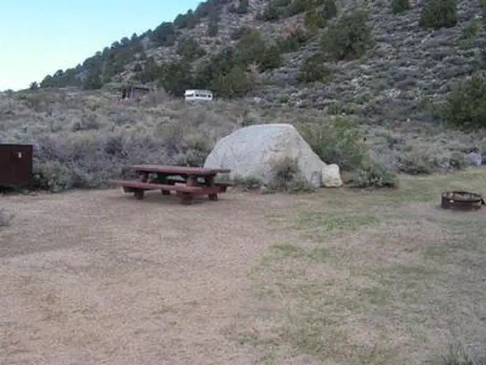
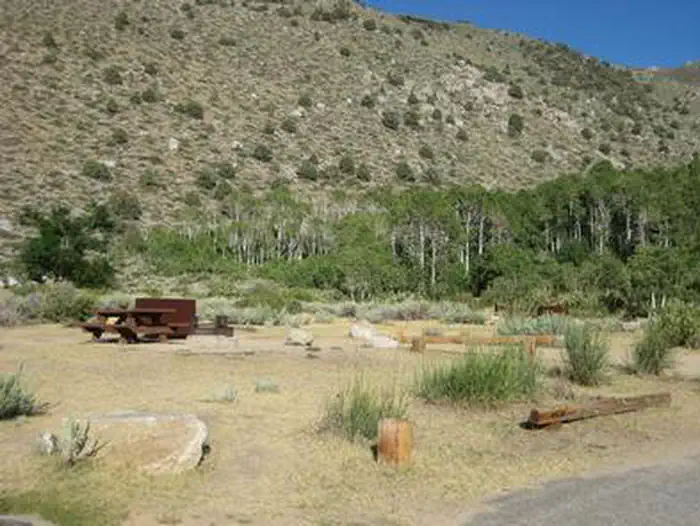
Lower creek-and-aspen loop is the prize; hillside sites are exposed and sandy.
Reservable sites 1-30 back up to the South Fork with aspen shade and more privacy. The first-come hillside sites above are sagebrush and ash with little cover, and several campers say they would not return to those if a creek site was not available.
Weather
02 / 05
At 8,100 ft it runs about 20 degrees cooler than Bishop, cold after dark.
Summer days are pleasant but nights drop sharply and shoulder-season trips can see frost or snow on the surrounding peaks into June. Bring warmer bags than the Owens Valley forecast suggests.
Water
03 / 05
Recurring coliform advisories on the potable water; plan to boil or bring your own.
Multiple recent visitors report seeing posted boil-water notices at the spigots. Check with the Bishop Ranger Station before the drive up rather than counting on the taps.
Wildlife & sky
04 / 05
Active bear country, bear boxes mandatory and hosts enforce it.
USFS lists the canyon as active bear habitat and campers note hosts are clear about food storage rules from check-in. Deer wandering through camp in the late afternoon is a routine sighting.
Food
05 / 05
Stocked trout creek runs through camp with an on-site fish cleaning station.
South Fork Bishop Creek holds rainbow, brown, brook, and Alpers trout and many sites sit within a short walk of fishable water. Anglers consistently rate this as the main draw alongside the South Lake trailheads up the road.
Synthesized from public trip reports and forum discussion, summarized in our words and never quoted. This is durable sentiment, not a live feed.
The campground at a glance
01 · CHARACTER
Reads strongest on cool nights and quiet. Softest on roomy sites.
Six axes, each scored relative to every other federal campground in the region: quiet (miles to a major road), cool (elevation), roomy (average site spacing), shade, RV-fit (longest rig), and how reservable it is. All six come from data, nothing hand-tuned.
When to go
02 · CLIMATE
avg highavg lowfrost-freedriest · Oct
Jun-Oct
Comfortable window: nights stay above 35°F, days below 90°F.
89%
Of summer weekend-days are dry.
Jun 17
Last spring frost; first fall frost Oct 1.
51°F
Average July low. Bring a fleece.
Getting there
03 · ACCESS
01
Fresno
100 mi
2h13
02
Sacramento
240 mi
5h20
03
San Francisco
280 mi
6h13
04
Los Angeles
288 mi
6h24
05
San Diego
420 mi
9h20
By drive time
Routed road time (OSRM). Nearest major highway 9.9 mi away.
We synthesize public data layers: RIDB and Recreation.gov facility and site records, Open-Meteo climate normals, OpenStreetMap roads, trails, and water, OSRM drive times, and USGS elevation. We take no bookings, no ads, and no paid placements. Independence is the entire point.