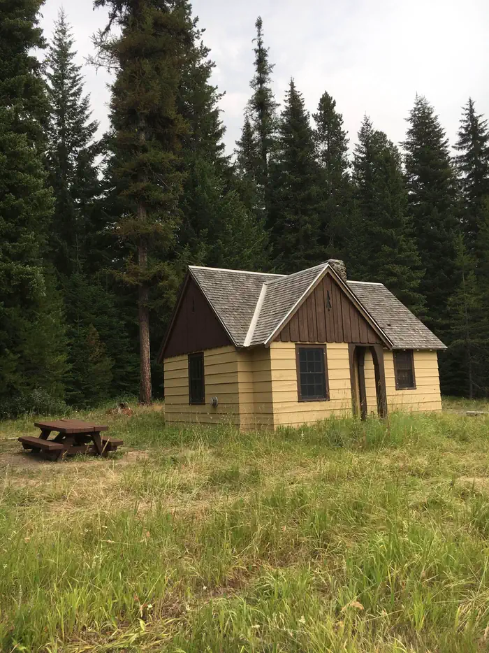
Overview Fry Meadows Guard Station offers the peaceful solitude of a remote nature-lover's paradise just south of the Wenaha-Tucannon Wilderness and west of the Grande Ronde Wild and Scenic River.
Sites1all reservable
Elev.4,196ft
Comf.May-Oct6 months
Max rigtents
Electricnonesites
From Portland6h28real road time
The honest read
Synthesized from RIDB · Open-Meteo OSM · OSRM Updated 2026-05-27
At 4,196 ft, Fry Meadows Guard Station has a 6-month comfortable window (May-Oct). Winter nights average around 22°F, so the shoulder seasons turn cold fast. All 1 sites are reservable in advance, so plan ahead. Popular weekends book out. Within about 4 miles: lake or river access.
The campground at a glance
01 · CHARACTER
Reads strongest on reservability and quiet. Softest on shade.
Six axes, each scored relative to every other federal campground in the region: quiet (miles to a major road), cool (elevation), roomy (average site spacing), shade, RV-fit (longest rig), and how reservable it is. All six come from data, nothing hand-tuned.
When to go
02 · CLIMATE
avg highavg lowfrost-freedriest · Jul
May-Oct
Comfortable window: nights stay above 35°F, days below 90°F.
90%
Of summer weekend-days are dry.
May 13
Last spring frost; first fall frost Oct 15.
53°F
Average July low. Bring a fleece.
Getting there
03 · ACCESS
01
Portland
303 mi
6h28
02
Bend
336 mi
7h32
03
Eugene
412 mi
8h38
04
Medford
508 mi
11h27
By drive time
Routed road time (OSRM). Nearest major highway 10.2 mi away.
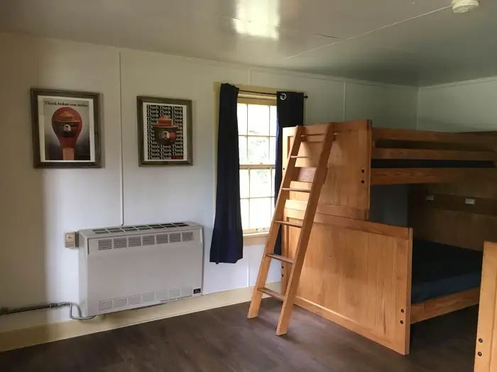
Picking your site
04 · 1 SITES
0
Pull-thru
0
Walk-in
0
50-amp
0
Accessible
0
Prime
1
Sites
What's within four miles
05 · TRAILS · PEAKS · WATER
Trails & Peaks
Water & Access
Lake / river access
yes
To nearest major road
10.2 mi
Method
We synthesize public data layers: RIDB and Recreation.gov facility and site records, Open-Meteo climate normals, OpenStreetMap roads, trails, and water, OSRM drive times, and USGS elevation. We take no bookings, no ads, and no paid placements. Independence is the entire point.