Overview Glacier View Campground is located next to beautiful Redfish Lake, beneath the Sawtooth Mountain Range, at an elevation of 6,500 feet.
Sites7863 reservable
Elev.6,545ft
Comf.Jun-Sep4 months
Max rig67 ft
Electricnonesites
From Boise3h35real road time
The honest read
Synthesized from RIDB · Open-Meteo OSM · OSRM Updated 2026-05-27
At 6,545 ft, Glacier View Campground has a 4-month comfortable window (Jun-Sep). Winter nights average around 12°F, so the shoulder seasons turn cold fast. 78 sites total: 63 reservable and 15 first-come, first-served. Within about 4 miles: 4 named hiking routes, lake or river access.
What campers say
SYNTHESIZED · RICH SIGNAL
Booking
01 / 06
Books out the moment the six-month window opens.
Campers report refreshing recreation.gov at 8am six months ahead and still missing out, especially for July and August. August is peak and every loop runs full.
Sites
02 / 06
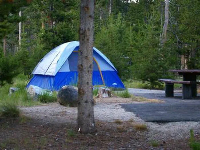
Loop 2 has the views, loops 1 and 3 sit in the trees.
The middle loop on the hill (roughly sites 27-43) gets the open Sawtooth vista. Loop 1 along the creek is more secluded and loop 3 is tucked in lodgepole pine with no lake or mountain sightline.
Vibe
03 / 06
Largest of the Redfish campgrounds, so livelier than Point or Outlet.
Repeat visitors flag that the size brings more daytime traffic, generator hum, and kid activity than the smaller neighbors. Nights settle down once quiet hours hit.
Facilities
04 / 06
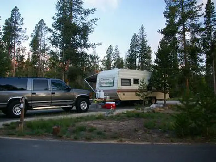
Flush toilets clean but dated, showers and dump are a short drive.
Sites are paved and level with picnic tables and fire rings, but there are no hookups. Pay showers, coin laundry, and the RV dump sit near the lodge a mile or two off.
Access
05 / 06
Closest base for the lodge, dog beach, and hiker shuttle.
Campers pick Glacier View specifically for the short walk to Redfish Lake Lodge, the designated dog beach, and the boat that drops hikers at the Bench Lakes and Redfish Lake Creek trailheads.
Weather
06 / 06
Cool nights, afternoon storms, and real wildfire risk through summer.
At 6,500 feet expect 40-degree nights even in July plus 1-2 days of afternoon rain a week. Stanley basin fire season runs June through mid-October and recent years have brought smoke and fire-area closures near Redfish.
Synthesized from public trip reports and forum discussion, summarized in our words and never quoted. This is durable sentiment, not a live feed.
The campground at a glance
01 · CHARACTER
Reads strongest on shade and reservability. Softest on roomy sites.
Six axes, each scored relative to every other federal campground in the region: quiet (miles to a major road), cool (elevation), roomy (average site spacing), shade, RV-fit (longest rig), and how reservable it is. All six come from data, nothing hand-tuned.
When to go
02 · CLIMATE
avg highavg lowfrost-freedriest · Jul
Jun-Sep
Comfortable window: nights stay above 35°F, days below 90°F.
85%
Of summer weekend-days are dry.
Jun 22
Last spring frost; first fall frost Sep 16.
45°F
Average July low. Bring a fleece.
Getting there
03 · ACCESS
01
Boise
140 mi
3h35
02
Idaho Falls
208 mi
4h31
03
Coeur d'Alene
426 mi
9h00
By drive time
Routed road time (OSRM). Nearest major highway 1.6 mi away.
We synthesize public data layers: RIDB and Recreation.gov facility and site records, Open-Meteo climate normals, OpenStreetMap roads, trails, and water, OSRM drive times, and USGS elevation. We take no bookings, no ads, and no paid placements. Independence is the entire point.