Overview Take a step back in time and traverse the same scenic wonders that explorers such as John Wesley Powell and William Ashley once explored.
Sites17all reservable
Elev.5,568ft
Comf.May-Oct6 months
Max rigtents
Electricnonesites
From Salt Lake City4h40real road time
The honest read
Synthesized from RIDB · Open-Meteo OSM · OSRM Updated 2026-05-27
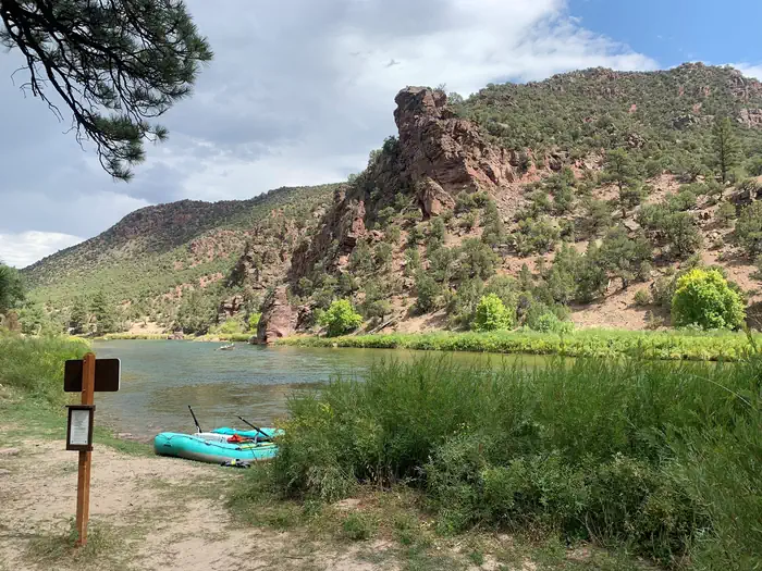
At 5,568 ft, Green River Float-IN Campsites has a 6-month comfortable window (May-Oct). Winter nights average around 13°F, so the shoulder seasons turn cold fast. All 17 sites are reservable in advance, so plan ahead. Popular weekends book out. Of the sites, 7 walk-in. Within about 4 miles: lake or river access.
The campground at a glance
01 · CHARACTER
Reads strongest on shade and reservability. Softest on roomy sites.
Six axes, each scored relative to every other federal campground in the region: quiet (miles to a major road), cool (elevation), roomy (average site spacing), shade, RV-fit (longest rig), and how reservable it is. All six come from data, nothing hand-tuned.
When to go
02 · CLIMATE
avg highavg lowfrost-freedriest · Jul
May-Oct
Comfortable window: nights stay above 35°F, days below 90°F.
96%
Of summer weekend-days are dry.
May 10
Last spring frost; first fall frost Oct 7.
62°F
Average July low. Bring a fleece.
Getting there
03 · ACCESS
01
Salt Lake City
211 mi
4h40
02
Moab
277 mi
6h03
03
St. George
451 mi
8h43
By drive time
Routed road time (OSRM). Nearest major highway 4.9 mi away.
We synthesize public data layers: RIDB and Recreation.gov facility and site records, Open-Meteo climate normals, OpenStreetMap roads, trails, and water, OSRM drive times, and USGS elevation. We take no bookings, no ads, and no paid placements. Independence is the entire point.