Overview Hayward Flat is one of the most popular campgrounds on Trinity Lake, offering excellent lake access and plenty of shade from Ponderosa pines and Douglas firs.
Sites10967 reservable
Elev.2,510ft
Comf.Jan-Dec10 months
Max rig45 ft3 pull-thru
Electricnonesites
From Sacramento4h59real road time
The honest read
Synthesized from RIDB · Open-Meteo OSM · OSRM Updated 2026-05-27
At 2,510 ft, Hayward Flat has a 10-month comfortable window (Jan-Dec). Winter nights average around 37°F, so the shoulder seasons turn cold fast. 109 sites total: 67 reservable and 42 first-come, first-served. Of the sites, 3 pull-through, and the longest takes a 45-ft rig. Within about 4 miles: 2 peaks, lake or river access.
What campers say
SYNTHESIZED · MODERATE SIGNAL
Sites
01 / 05
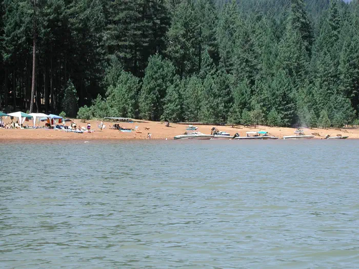
Dogwood and Elderberry loops are the ones to book for lake access.
These two loops give peek-through lake views and informal boat mooring, with the swim beach near Elderberry. Buckeye, Chinquapin, and the multi-use loop sit back in the trees with no water view.
Facilities
02 / 05
Flush toilets and potable water on site, but no showers anywhere in the campground.
Reviewers consistently flag the lack of showers; the nearest paid showers are about 15 minutes away at Camp Bushytail for around $5. Restroom upkeep is hit or miss, with occasional closures reported across multiple recent stays.
Water
03 / 05
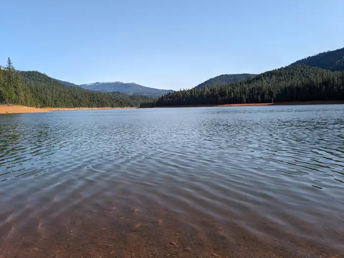
Late-summer drawdown can leave the shoreline well below the campsites.
Trinity Lake is a working reservoir, and campers in drought years describe walking over exposed bank and downed wood to reach water. 2025 levels recovered, but the lake edge in August is rarely where it sits in June.
Vibe
04 / 05
Quiet from the highway, but daytime motorboat noise carries across the cove.
The campground sits two miles off Highway 3 so road noise is minimal, and sites are spaced under big trees. The sheltered arm is a favorite for waterskiing and wakeboarding, so expect engine noise on the water through the afternoon.
Wildlife & sky
05 / 05
Bear country with lockers at most sites, not all.
Black bears, bobcats, and mountain lions are documented in the area and food storage in approved containers is required. Campers report that a handful of sites lack a bear box, so plan to store food in the vehicle if yours is one of them.
Synthesized from public trip reports and forum discussion, summarized in our words and never quoted. This is durable sentiment, not a live feed.
The campground at a glance
01 · CHARACTER
Reads strongest on shade and reservability. Softest on roomy sites.
Six axes, each scored relative to every other federal campground in the region: quiet (miles to a major road), cool (elevation), roomy (average site spacing), shade, RV-fit (longest rig), and how reservable it is. All six come from data, nothing hand-tuned.
When to go
02 · CLIMATE
avg highavg lowfrost-freedriest · Jul
Jan-Dec
Comfortable window: nights stay above 35°F, days below 90°F.
95%
Of summer weekend-days are dry.
Apr 10
Last spring frost; first fall frost Nov 27.
62°F
Average July low. Bring a fleece.
Getting there
03 · ACCESS
01
Sacramento
224 mi
4h59
02
San Francisco
279 mi
6h12
03
Fresno
426 mi
9h28
04
Los Angeles
692 mi
15h23
05
San Diego
836 mi
18h35
By drive time
Routed road time (OSRM). Nearest major highway 1.5 mi away.
We synthesize public data layers: RIDB and Recreation.gov facility and site records, Open-Meteo climate normals, OpenStreetMap roads, trails, and water, OSRM drive times, and USGS elevation. We take no bookings, no ads, and no paid placements. Independence is the entire point.