USFSGeorge Washington & Jefferson National Forest · Virginia
Hurricane Campground
Overview Hurricane Campground is one of the best kept secrets in southwest Virginia.
Sites2711 reservable
Elev.2,815ft
Comf.Mar-Nov9 months
Max rig5560 ft2 pull-thru
Electricnonesites
From Roanoke2h24real road time
The honest read
Synthesized from RIDB · Open-Meteo OSM · OSRM Updated 2026-05-27
At 2,815 ft, Hurricane Campground has a 9-month comfortable window (Mar-Nov). Winter nights average around 27°F, so the shoulder seasons turn cold fast. 27 sites total: 11 reservable and 16 first-come, first-served. Of the sites, 2 pull-through, and the longest takes a 5560-ft rig. Within about 4 miles: 1 named hiking route, 10 peaks, lake or river access.
What campers say
SYNTHESIZED · MODERATE SIGNAL
Vibe
01 / 06
Quiet and uncrowded, and fully off cell service.
Campers come back to the same words: peaceful, low traffic, sometimes only a handful of other parties on site. There is no signal on any carrier here, so treat it as a plan-ahead detail rather than a surprise.
Sites
02 / 06
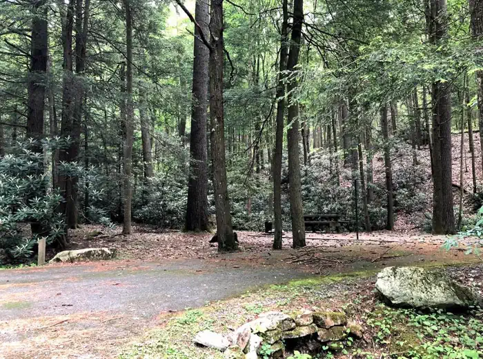
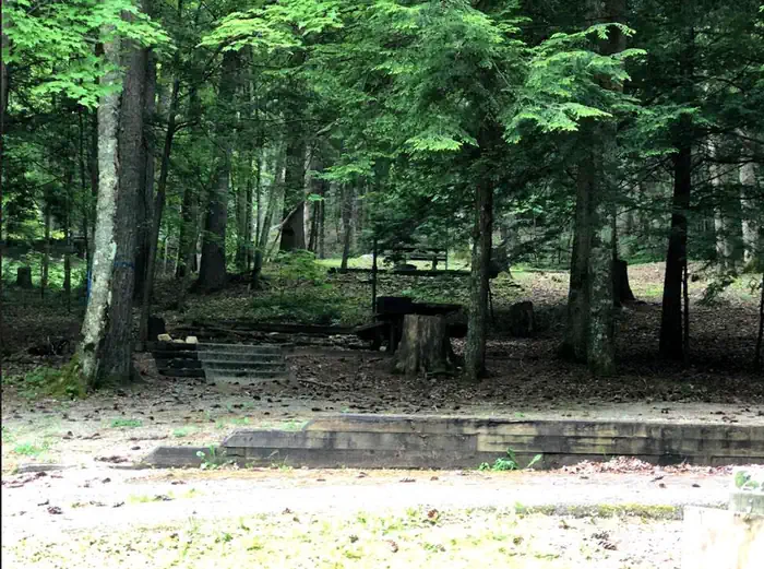
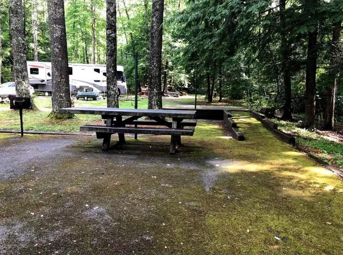
Big, shaded, well-separated sites, many right on the creek.
Sites sit under an oak and hemlock canopy with rhododendron screening one from the next. Site 19 gets named as a level, paved, streamside favorite, and the first sites along the water are good forested tent spots.
Water
03 / 06
Two creeks run through camp, with stocked trout fishing.
Hurricane and Comers creeks thread the campground and are stocked, and people like falling asleep to the water right at the site. One camper found levels too low to fish on their visit, so the fishing reads as seasonal.
Facilities
04 / 06
Clean bathhouses with warm showers, but no hookups or dump station.
Two bathhouses with flush toilets and warm showers earn steady praise, and the hosts are friendly. There are no electric, water, or sewer hookups and no dump station on site; the nearest one is at Raccoon Branch.
Trails & access
05 / 06
Strong trail access is a headline reason to come.
The Hurricane Knob loop is a short climb of about a mile along the creek and over two footbridges, and the Appalachian Trail is roughly half a mile away. Grayson Highlands and the Virginia Creeper Trail are short drives.
Access
06 / 06
Small campground, mixed booking, and recovering from 2024 flooding.
It runs around two dozen sites, some reservable and the rest first-come, and the access road and turns make it a poor fit for rigs over 30 feet. Flooding from the 2024 storms closed it late that season, and a few creekside sites stayed closed for repairs into 2025, so check current site status before you book.
Synthesized from public trip reports and forum discussion, summarized in our words and never quoted. This is durable sentiment, not a live feed.
The campground at a glance
01 · CHARACTER
Reads strongest on big-rig fit and shade. Softest on roomy sites.
Six axes, each scored relative to every other federal campground in the region: quiet (miles to a major road), cool (elevation), roomy (average site spacing), shade, RV-fit (longest rig), and how reservable it is. All six come from data, nothing hand-tuned.
When to go
02 · CLIMATE
avg highavg lowfrost-freedriest · Nov
Mar-Nov
Comfortable window: nights stay above 35°F, days below 90°F.
63%
Of summer weekend-days are dry.
Apr 25
Last spring frost; first fall frost Oct 30.
66°F
Average July low. Bring a fleece.
Getting there
03 · ACCESS
01
Roanoke
114 mi
2h24
02
Richmond
290 mi
5h35
03
Washington DC
341 mi
6h36
04
Norfolk
381 mi
7h23
By drive time
Routed road time (OSRM). Nearest major highway 1.2 mi away.
We synthesize public data layers: RIDB and Recreation.gov facility and site records, Open-Meteo climate normals, OpenStreetMap roads, trails, and water, OSRM drive times, and USGS elevation. We take no bookings, no ads, and no paid placements. Independence is the entire point.