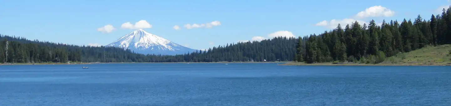
Overview Nestled high in the Cascade Mountains among towering firs and pines, the Hyatt Lake Recreation Area is located in the northern corner of Cascade-Siskiyou National Monument on the shores of be
Sites63all reservable
Elev.5,108ft
Comf.May-Oct6 months
Max rig70 ft2 pull-thru
Electric1sites
From Medford0h53real road time
The honest read
Synthesized from RIDB · Open-Meteo OSM · OSRM Updated 2026-05-27
At 5,108 ft, Hyatt Lake Recreation Area has a 6-month comfortable window (May-Oct). Winter nights average around 24°F, so the shoulder seasons turn cold fast. All 63 sites are reservable in advance, so plan ahead. Popular weekends book out. Of the sites, 2 pull-through, 1 walk-in, and the longest takes a 70-ft rig. Within about 4 miles: 2 named hiking routes, 6 peaks, lake or river access.
What campers say
SYNTHESIZED · MODERATE SIGNAL
Vibe
01 / 06
Quiet high-elevation campground broken mainly by vocal geese on the lake.
Campers across multiple sources describe the three loops as calm with little road noise, though waterfowl on the reservoir get loud at dawn and dusk. A few reports flag running generators as the main disruption when neighbors do not self-regulate.
Booking
02 / 06
Reservation-only with no walk-ins, even when sites look empty.
Multiple reviewers were turned away or confused by closed gates because every site at the main campground must be booked through Recreation.gov in advance. Phone reservations are possible but campers report long hold times.
Access
03 / 06
Narrow switchback climb from I-5 rattles drivers of larger rigs.
The 20 mile route up from Ashland gains roughly 3,000 feet on winding mountain road that several reviewers call white-knuckle for trailers and big motorhomes. Sites themselves are paved and level but run smaller than the advertised 70 foot maximum suggests.
Trails & access
04 / 06
Pacific Crest Trail crosses the campground for direct out-and-back hikes.
The PCT intersects the recreation area, with the popular six mile round trip to Little Hyatt Lake leaving straight from camp. The equestrian loop has its own spur to the trail, which horse campers consistently call out as a draw.
Water
05 / 06
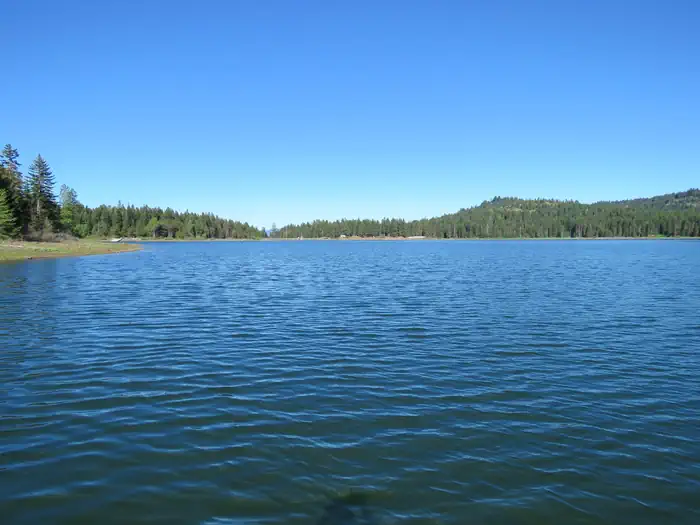
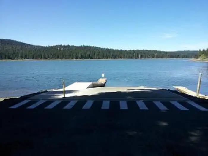
Lake levels swing low and swimming gets flagged for leeches and algae.
Visitors in drier years report exposed shoreline and boat ramps that become hard to use, and BLM postings periodically warn about cyanobacteria blooms. Several campers mention signage about leeches that pushed them to skip swimming entirely.
Facilities
06 / 06
Hot showers and flush toilets are a real perk but cleanliness is uneven.
Bathhouses with warm showers, distributed water spigots, and a dump station put this above most BLM sites in the region. Reviewers repeatedly note the restrooms could be cleaner, particularly later in the day.
Synthesized from public trip reports and forum discussion, summarized in our words and never quoted. This is durable sentiment, not a live feed.
The campground at a glance
01 · CHARACTER
Reads strongest on shade and reservability. Softest on roomy sites.
Six axes, each scored relative to every other federal campground in the region: quiet (miles to a major road), cool (elevation), roomy (average site spacing), shade, RV-fit (longest rig), and how reservable it is. All six come from data, nothing hand-tuned.
When to go
02 · CLIMATE
avg highavg lowfrost-freedriest · Jul
May-Oct
Comfortable window: nights stay above 35°F, days below 90°F.
93%
Of summer weekend-days are dry.
Jun 8
Last spring frost; first fall frost Oct 9.
51°F
Average July low. Bring a fleece.
Getting there
03 · ACCESS
01
Medford
35 mi
0h53
02
Bend
184 mi
3h58
03
Eugene
202 mi
4h08
04
Portland
307 mi
6h12
By drive time
Routed road time (OSRM). Nearest major highway 5.6 mi away.
We synthesize public data layers: RIDB and Recreation.gov facility and site records, Open-Meteo climate normals, OpenStreetMap roads, trails, and water, OSRM drive times, and USGS elevation. We take no bookings, no ads, and no paid placements. Independence is the entire point.