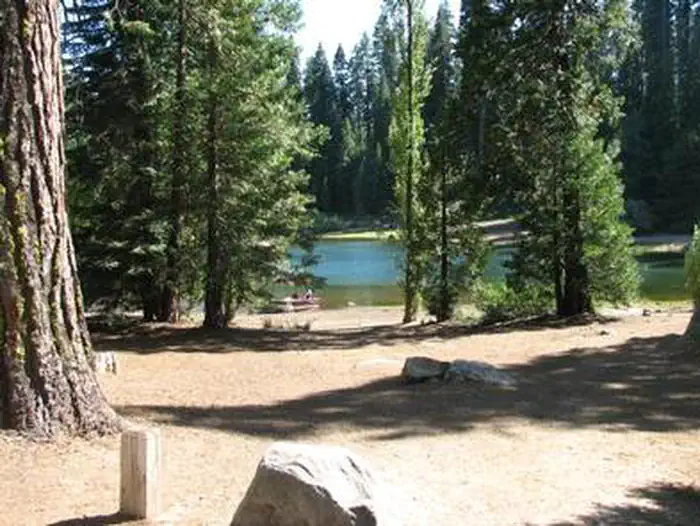
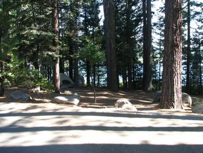
Overview Ice House Campground is surrounded by a mixed conifer forest on the shores of Ice House Reservoir.
Sites9054 reservable
Elev.5,436ft
Comf.May-Oct6 months
Max rig45 ft8 pull-thru
Electricnonesites
From Sacramento1h51real road time
The honest read
Synthesized from RIDB · Open-Meteo OSM · OSRM Updated 2026-05-27
At 5,436 ft, Ice House has a 6-month comfortable window (May-Oct). Winter nights average around 27°F, so the shoulder seasons turn cold fast. 90 sites total: 54 reservable and 36 first-come, first-served. Of the sites, 8 pull-through, and the longest takes a 45-ft rig. Within about 4 miles: 1 peak, lake or river access.
What campers say
SYNTHESIZED · MODERATE SIGNAL
Sites
01 / 05
Sites feel spread out but pads vary; first loop is shadier with bigger spurs.
Campers consistently say the layout doesn't feel crowded even when full, though several note parking spurs in later loops are narrow or short for trailers. The first loop draws the most repeat praise for shade and spacing, and sites 9 and 10 get singled out for lake proximity.
Water
02 / 05
Reservoir stays cold all summer; kayak, SUP, and motorboats all share it.
Multiple reviewers warn the water is freezing year-round even in July, so swimming is brief for most. The lake takes motorized boats from the on-site ramp alongside paddlers and anglers, and campers report easy walking access to the shore from most loops.
Wildlife & sky
03 / 05
Black bears visit nightly; hosts flag site 3 as a regular stop.
Camp hosts have told arriving campers that three bears, including a sow with cub, cycle through the campground after dark. Reviewers also report bald eagles and cormorants on the reservoir, so food locker discipline comes up repeatedly.
Booking
04 / 05
Summer weekends book the full six-month window almost immediately.
Repeat visitors say you need to be on Recreation.gov the morning the window opens for July and August weekends. Midweek and shoulder season (late May, late September) are noticeably easier to grab.
Facilities
05 / 05
2022 renovation left vaults clean; showers only at the boat launch.
Reviewers across sources praise active hosts keeping vault toilets and trash areas tidy after the recent rebuild. Showers exist but are down at the boat launch rather than in the loops, and cell coverage is weak on both major carriers.
Synthesized from public trip reports and forum discussion, summarized in our words and never quoted. This is durable sentiment, not a live feed.
The campground at a glance
01 · CHARACTER
Reads strongest on shade and reservability. Softest on roomy sites.
Six axes, each scored relative to every other federal campground in the region: quiet (miles to a major road), cool (elevation), roomy (average site spacing), shade, RV-fit (longest rig), and how reservable it is. All six come from data, nothing hand-tuned.
When to go
02 · CLIMATE
avg highavg lowfrost-freedriest · Jul
May-Oct
Comfortable window: nights stay above 35°F, days below 90°F.
94%
Of summer weekend-days are dry.
Jun 9
Last spring frost; first fall frost Oct 19.
55°F
Average July low. Bring a fleece.
Getting there
03 · ACCESS
01
Sacramento
83 mi
1h51
02
San Francisco
173 mi
3h51
03
Fresno
192 mi
4h16
04
Los Angeles
455 mi
10h07
05
San Diego
596 mi
13h15
By drive time
Routed road time (OSRM). Nearest major highway 3.9 mi away.
We synthesize public data layers: RIDB and Recreation.gov facility and site records, Open-Meteo climate normals, OpenStreetMap roads, trails, and water, OSRM drive times, and USGS elevation. We take no bookings, no ads, and no paid placements. Independence is the entire point.