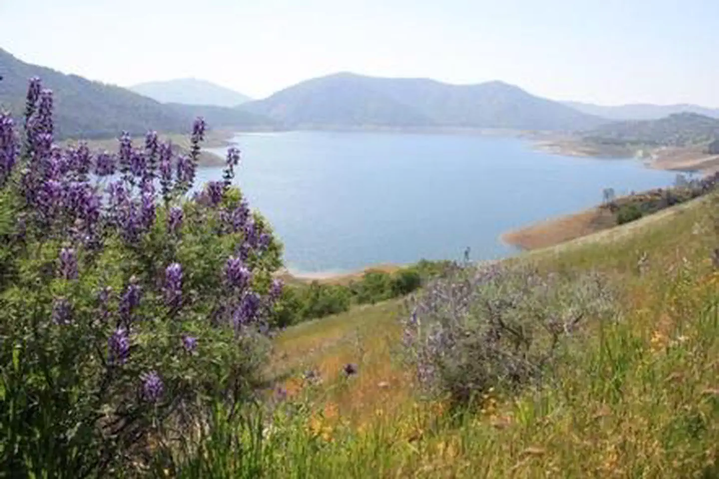
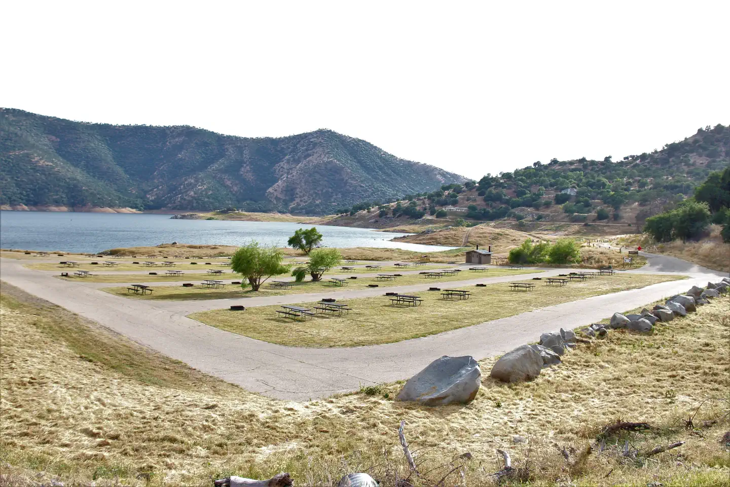
Overview Island Park Recreation Area is the place to go for campers looking for lots of exciting water activities at Pine Flat Lake.
Sites9392 reservable
Elev.948ft
Comf.Jan-Dec8 months
Max rig99 ft52 pull-thru
Electric234×50-amp
From Fresno0h48real road time
The honest read
Synthesized from RIDB · Open-Meteo OSM · OSRM Updated 2026-05-27
At 948 ft, Island Park has a 8-month comfortable window (Jan-Dec). Winter nights average around 39°F, so the shoulder seasons turn cold fast. 93 sites total: 92 reservable and 1 first-come, first-served. Of the sites, 52 pull-through, 4 with 50-amp, and the longest takes a 99-ft rig. Within about 4 miles: 4 peaks, lake or river access.
What campers say
SYNTHESIZED · MODERATE SIGNAL
Weather
01 / 05
Summer is punishing, plan for 100-plus and bring your own shade.
Campers across multiple platforms report daytime highs of 100 to 104 degrees and hot nights from June through August. Lower loop sites have almost no tree cover, so most recommend a canopy or a shoulder-season trip in spring or October.
Water
02 / 05
Lake level swings change the experience week to week.
At low pool, reviewers describe long walks across exposed shoreline to reach water and closed ramps. At high pool, several note flooded picnic areas and even submerged restrooms, with rocky banks rather than real beach in either case.
Access
03 / 05
Entrance road and many sites are tight for big rigs.
Consensus across Campendium, Hipcamp and The Dyrt is a narrow, steep entry that effectively works as one lane, plus unlevel pads. Trailers over about 30 feet are repeatedly flagged as a poor fit even when the listed site length suggests otherwise.
Vibe
04 / 05
Quiet on weekdays, loud and packed on weekends.
Weekday visitors describe calm mornings and minimal neighbors. Weekend reviews consistently mention crowded loops, day-use traffic and motorboat and jet ski noise carrying across the water from late morning on.
Wildlife & sky
05 / 05
Rattlesnakes are a normal part of the visit, watch dogs for foxtails.
Posted warnings and firsthand sightings of rattlesnakes show up across reviews and the official Recreation.gov alerts from spring through late summer. Dog owners on Campendium also call out foxtails in the dry grass around sites.
Synthesized from public trip reports and forum discussion, summarized in our words and never quoted. This is durable sentiment, not a live feed.
The campground at a glance
01 · CHARACTER
Reads strongest on reservability and quiet. Softest on roomy sites.
Six axes, each scored relative to every other federal campground in the region: quiet (miles to a major road), cool (elevation), roomy (average site spacing), shade, RV-fit (longest rig), and how reservable it is. All six come from data, nothing hand-tuned.
When to go
02 · CLIMATE
avg highavg lowfrost-freedriest · Jul
Jan-Dec
Comfortable window: nights stay above 35°F, days below 90°F.
98%
Of summer weekend-days are dry.
Mar 3
Last spring frost; first fall frost Dec 12.
71°F
Average July low.
Getting there
03 · ACCESS
01
Fresno
36 mi
0h48
02
Sacramento
218 mi
4h51
03
San Francisco
236 mi
5h15
04
Los Angeles
265 mi
5h53
05
San Diego
405 mi
9h00
By drive time
Routed road time (OSRM). Nearest major highway 9.4 mi away.
We synthesize public data layers: RIDB and Recreation.gov facility and site records, Open-Meteo climate normals, OpenStreetMap roads, trails, and water, OSRM drive times, and USGS elevation. We take no bookings, no ads, and no paid placements. Independence is the entire point.