Overview Kalaloch Campground is on the reservation system May 15, 2026 - September 20, 2026.
Sites168145 reservable
Elev.66ft
Comf.Jan-Dec12 months
Max rig52 ft5 pull-thru
Electricnonesites
From Seattle4h02real road time
The honest read
Synthesized from RIDB · Open-Meteo OSM · OSRM Updated 2026-05-27
At 66 ft, Kalaloch has a 12-month comfortable window (Jan-Dec). Winter nights average around 40°F, so the shoulder seasons turn cold fast. 168 sites total: 145 reservable and 23 first-come, first-served. Of the sites, 5 pull-through, and the longest takes a 52-ft rig. Within about 4 miles: 1 named hiking route, lake or river access.
What campers say
SYNTHESIZED · RICH SIGNAL
Views
01 / 06
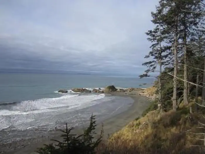
Bluff-edge sites in loops A and D deliver the iconic open Pacific overlook.
Campers single out loops A, D, E, and F for unobstructed ocean views, with sites like D24 and D37 named repeatedly for cliff-edge perches. Short staircases between A19-A22 and D24-D31 drop directly to the beach.
Booking
02 / 06
Staggered 6-month release means oceanfront sites vanish within minutes.
A and B loops open six months ahead, C and D two weeks out, and E and F just four days before arrival, so most campers report needing a logged-in Recreation.gov account ready at the exact release time. Off-season is first-come, first-served.
Weather
03 / 06
Overnight fog, steady wind, and damp air are the norm even in summer.
Reviewers describe daytime highs in the 60s with marine fog rolling in most evenings and humidity often above 75 percent. Sunshine happens but cool ocean breeze and mist are the default, not the exception.
Facilities
04 / 06
No showers, no hookups, and the nearest rinse is six miles south.
Flush toilets and potable water are clean and consistent, but campers consistently flag the lack of showers and recommend bringing wipes. The dump station runs ten dollars and is not bundled into the site fee.
Sites
05 / 06
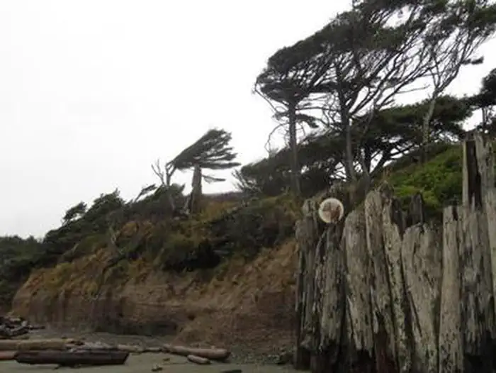
Highway 101 noise reaches the inland sites and erosion has closed bluff spots.
Sites backing the highway pick up steady truck noise during the day that fades at night, and several oceanfront sites in A, D, and E loops have been permanently closed due to bluff erosion. Interior forest sites trade the view for privacy under dense canopy.
Wildlife & sky
06 / 06
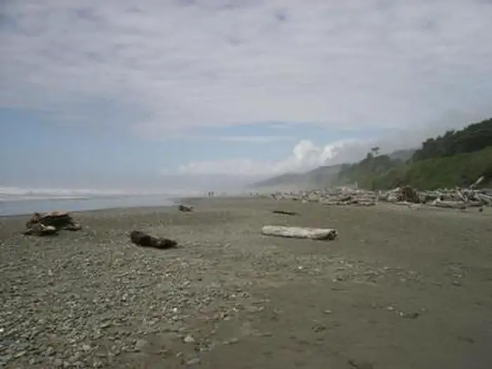
Beach 4 tidepools and offshore marine life are the standout draws.
At low tide, campers report sea stars, green anemones, purple urchins, chitons, and crabs at Beach 4 a short drive north, plus regular sightings of seals, sea otters, and occasional whales from the bluff. Arriving thirty minutes before low tide is the repeated advice.
Synthesized from public trip reports and forum discussion, summarized in our words and never quoted. This is durable sentiment, not a live feed.
The campground at a glance
01 · CHARACTER
Reads strongest on reservability and shade. Softest on quiet.
Six axes, each scored relative to every other federal campground in the region: quiet (miles to a major road), cool (elevation), roomy (average site spacing), shade, RV-fit (longest rig), and how reservable it is. All six come from data, nothing hand-tuned.
When to go
02 · CLIMATE
avg highavg lowfrost-freedriest · Jul
Jan-Dec
Comfortable window: nights stay above 35°F, days below 90°F.
85%
Of summer weekend-days are dry.
Mar 24
Last spring frost; first fall frost Nov 25.
54°F
Average July low.
Getting there
03 · ACCESS
01
Seattle
183 mi
4h02
02
Yakima
278 mi
6h03
03
Spokane
442 mi
8h47
By drive time
Routed road time (OSRM). Nearest major highway 0 mi away.
We synthesize public data layers: RIDB and Recreation.gov facility and site records, Open-Meteo climate normals, OpenStreetMap roads, trails, and water, OSRM drive times, and USGS elevation. We take no bookings, no ads, and no paid placements. Independence is the entire point.