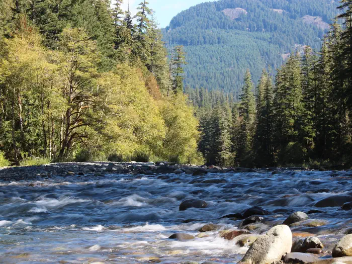
Overview Situated at the confluence of three waterways near Mount Rainier, La Wis Wis is nestled under a canopy of towering Douglas firs and red cedars.
Sites11367 reservable
Elev.1,378ft
Comf.Apr-Nov8 months
Max rig60 ft14 pull-thru
Electricnonesites
From Yakima1h27real road time
The honest read
Synthesized from RIDB · Open-Meteo OSM · OSRM Updated 2026-05-27
At 1,378 ft, LA Wis Wis Campground has a 8-month comfortable window (Apr-Nov). Winter nights average around 33°F, so the shoulder seasons turn cold fast. 113 sites total: 67 reservable and 46 first-come, first-served. Of the sites, 14 pull-through, and the longest takes a 60-ft rig. Within about 4 miles: 4 peaks, lake or river access.
What campers say
SYNTHESIZED · MODERATE SIGNAL
Vibe
01 / 06
Old-growth moss and three rivers give the campground a quiet, cathedral feel.
Campers across platforms describe towering Douglas firs, cedars, and hemlocks at the confluence of the Ohanapecosh, Cowlitz, and Purcell Creek, with the river current loud enough to wash out neighbor noise. Sites feel screened and private despite the 100-plus footprint.
Water
02 / 06
No potable water for the 2026 season; bring everything you need.
The on-site supply tested high for benzene and is shut off through the season, with fees reduced by four dollars to compensate. Multiple reviewers confirm hauling in all drinking, cooking, and dish water.
Sites
03 / 06
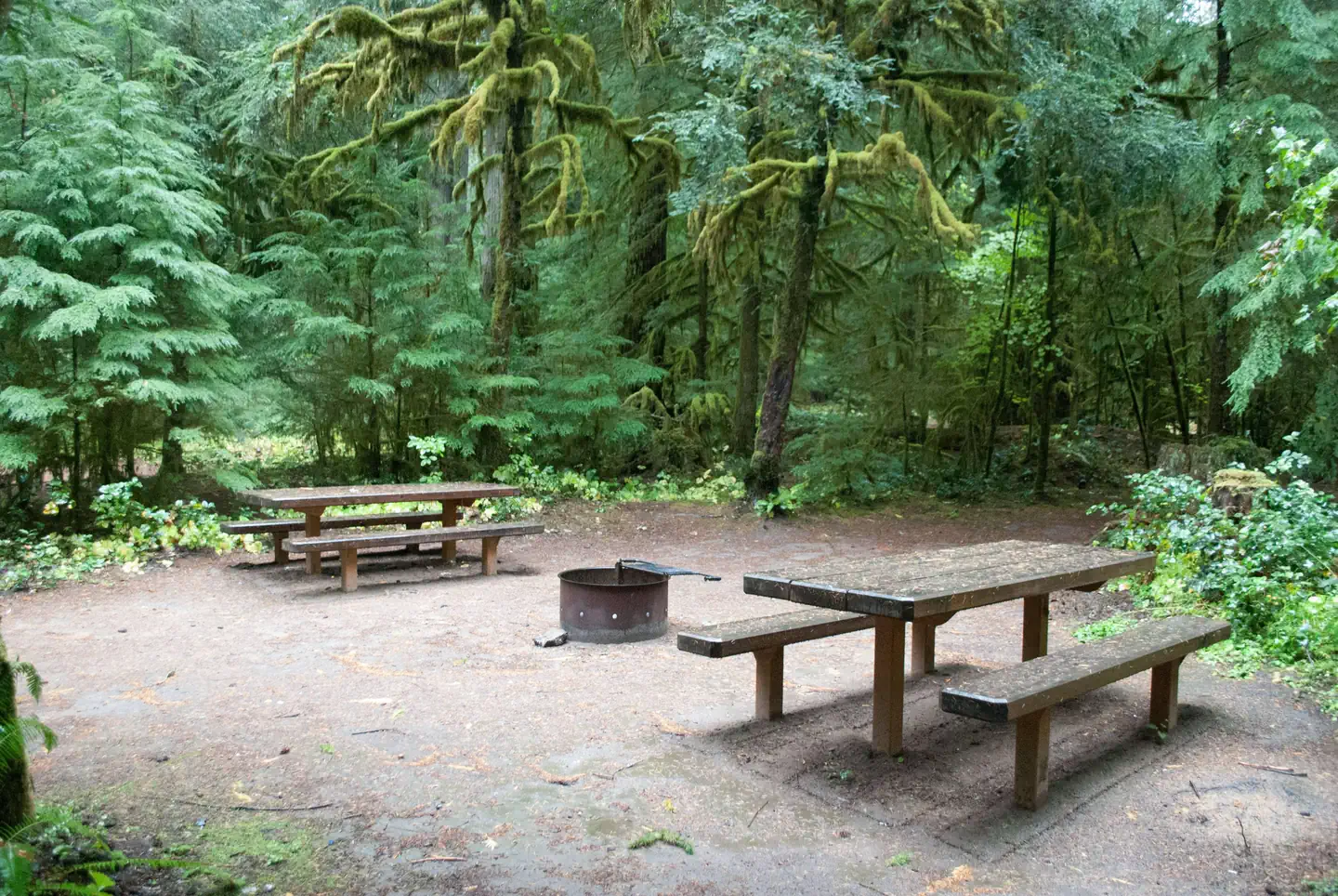
A and D loops for river and privacy; Hatchery loop for anything bigger than a small trailer.
Reviewers consistently steer tent and small-rig campers to the riverside A and D loops, where pads are larger and more secluded. Hatchery is the only loop that handles full-size RVs, and several reviewers describe it as more parking lot than forest.
Access
04 / 06
Narrow interior roads punish anything over about 25 feet.
Owners of 18-foot trailers and Class B vans report just barely fitting through tight turns and short pads outside Hatchery loop. Length limits and reviewer accounts agree that larger rigs should not attempt the main loops.
Trails & access
05 / 06
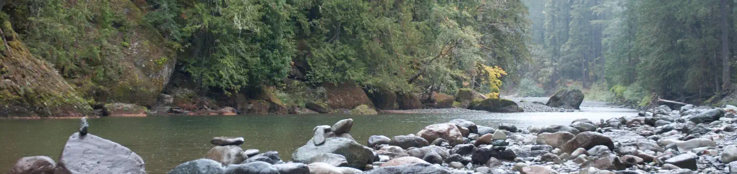
Blue Hole on the Ohanapecosh is the signature swim, and it is cold.
A short trail from Hatchery loop leads to a deep glacial pool with cliff jumps around twenty feet and clear blue water. Every source warns the river is glacier-fed and stays painfully cold even in August.
Facilities
06 / 06
Vault toilets only, no showers, and cell service is effectively zero.
Reviewers note clean and recently updated vaults but flag heat-driven smells in August and occasional toilet paper gaps when hosts are absent. Verizon, AT&T, and T-Mobile users all report no signal, and the nearest hot shower is a Presbyterian church in Packwood.
Synthesized from public trip reports and forum discussion, summarized in our words and never quoted. This is durable sentiment, not a live feed.
The campground at a glance
01 · CHARACTER
Reads strongest on shade and reservability. Softest on roomy sites.
Six axes, each scored relative to every other federal campground in the region: quiet (miles to a major road), cool (elevation), roomy (average site spacing), shade, RV-fit (longest rig), and how reservable it is. All six come from data, nothing hand-tuned.
When to go
02 · CLIMATE
avg highavg lowfrost-freedriest · Jul
Apr-Nov
Comfortable window: nights stay above 35°F, days below 90°F.
81%
Of summer weekend-days are dry.
May 3
Last spring frost; first fall frost Oct 20.
55°F
Average July low.
Getting there
03 · ACCESS
01
Yakima
67 mi
1h27
02
Seattle
101 mi
2h39
03
Spokane
267 mi
5h02
By drive time
Routed road time (OSRM). Nearest major highway 0.2 mi away.
We synthesize public data layers: RIDB and Recreation.gov facility and site records, Open-Meteo climate normals, OpenStreetMap roads, trails, and water, OSRM drive times, and USGS elevation. We take no bookings, no ads, and no paid placements. Independence is the entire point.