USFSGrand Mesa, Uncompahgre and Gunnison National Forest · Colorado
Lakeview Gunnison
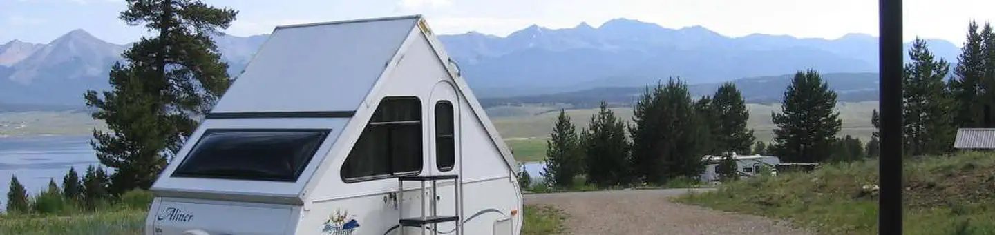
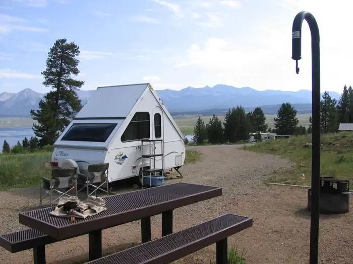
Overview Lakeview Campground is located on Taylor Park Reservoir, at an elevation of 9,400 feet.
Sites6934 reservable
Elev.9,537ft
Comf.Jul-Sep3 months
Max rig99 ft20 pull-thru
Electric9sites
From Colorado Springs3h27real road time
The honest read
Synthesized from RIDB · Open-Meteo OSM · OSRM Updated 2026-05-27
At 9,537 ft, Lakeview Gunnison has a 3-month comfortable window (Jul-Sep). Winter nights average around 5°F, so the shoulder seasons turn cold fast. 69 sites total: 34 reservable and 35 first-come, first-served. Of the sites, 20 pull-through, and the longest takes a 99-ft rig. Within about 4 miles: 2 peaks, lake or river access.
What campers say
SYNTHESIZED · MODERATE SIGNAL
Views
01 / 05
Reservoir and Collegiate Peaks views are the draw, but pines have grown in.
Most sites still see Taylor Reservoir and the Sawatch Range, and reviewers single out site 46 for an unblocked outlook. Several campers note the lodgepoles have closed in over the years and now screen the water from some loops.
Access
02 / 05
Long, slow drive in and rough loop roads once you arrive.
Gunnison is about 32 miles out, with 22 of those miles winding at 40 mph or less from Almont up to the reservoir. Inside the campground the loop roads are repeatedly described as potholed and slow, so plan extra time and easy on the rig.
Facilities
03 / 05
Lower electric loop is in better shape than the older non-electric loops.
The newer vault toilets near the electric sites get clean marks, while the older pit toilets in the upper loops are called stinky and overdue for service. There is no on-site dump station, and the nearest one is roughly five miles away for a fee.
Water
04 / 05
Gold-medal Taylor River trout plus a stocked reservoir right across the road.
The Taylor below the dam is one of Colorado's top-rated trout streams, and the reservoir itself holds northern pike, kokanee, and rainbow, brown, brook, and cutthroat trout. A boat ramp sits just below the campground and the marina rents pontoons.
Vibe
05 / 05
Quiet starry nights and friendly hosts, with loud RV generators the recurring complaint.
Reviewers describe peaceful evenings under dark skies and call the camp hosts welcoming and helpful. The consistent downside is neighbors running full-size generators well into the evening, which carries in the open sites.
Synthesized from public trip reports and forum discussion, summarized in our words and never quoted. This is durable sentiment, not a live feed.
The campground at a glance
01 · CHARACTER
Reads strongest on cool nights and reservability. Softest on roomy sites.
Six axes, each scored relative to every other federal campground in the region: quiet (miles to a major road), cool (elevation), roomy (average site spacing), shade, RV-fit (longest rig), and how reservable it is. All six come from data, nothing hand-tuned.
When to go
02 · CLIMATE
avg highavg lowfrost-freedriest · Jun
Jul-Sep
Comfortable window: nights stay above 35°F, days below 90°F.
We synthesize public data layers: RIDB and Recreation.gov facility and site records, Open-Meteo climate normals, OpenStreetMap roads, trails, and water, OSRM drive times, and USGS elevation. We take no bookings, no ads, and no paid placements. Independence is the entire point.