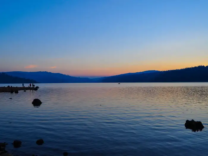
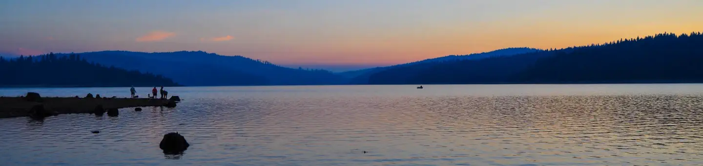
Overview Little Beaver Campground is located on the south-eastern shore of Little Grass Valley Reservoir, approximately four miles from the town of La Porte, CA.
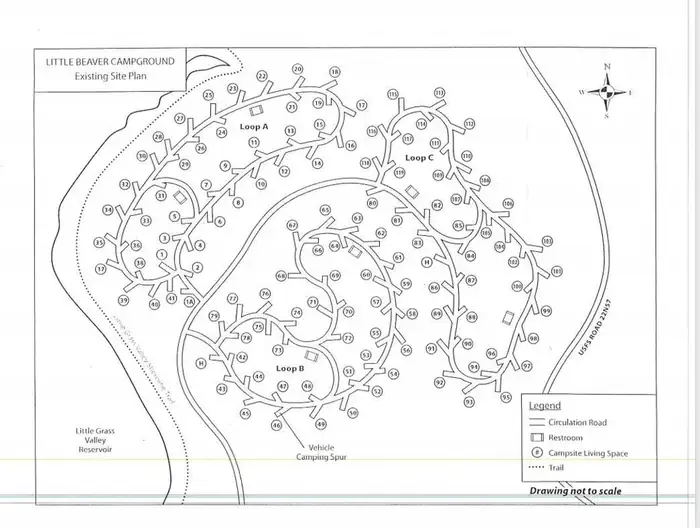
Sites11943 reservable
Elev.5,322ft
Comf.May-Oct6 months
Max rigtents
Electricnonesites
From Sacramento2h27real road time
The honest read
Synthesized from RIDB · Open-Meteo OSM · OSRM Updated 2026-05-27
At 5,322 ft, Little Beaver A Campground has a 6-month comfortable window (May-Oct). Winter nights average around 27°F, so the shoulder seasons turn cold fast. 119 sites total: 43 reservable and 76 first-come, first-served. This is bear country, and food-storage lockers are provided. Within about 4 miles: 1 named hiking route, 5 peaks, lake or river access.
What campers say
SYNTHESIZED · MODERATE SIGNAL
Vibe
01 / 05
Big family campground at scale, not a quiet hideaway.
Reviewers consistently describe Little Beaver as the largest, busiest campground on the reservoir, with group reservations often filling adjacent sites in a loop. Anyone hoping for solitude is steered toward the far corner sites or shoulder-season weekdays.
Sites
02 / 05
Loop A sits closest to the lake; some driveways have steep grade.
Multiple reports name Loop A as the lakefront loop, with sites in the 18 through 37 range and 113 called out by name as favorites. Several driveways slope sharply, so larger trailers may need to back uphill into the pad.
Facilities
03 / 05
Flush toilets and potable water in normal years, but trash overwhelms peak weekends.
The recurring complaint across sources is overflowing dumpsters and litter on busy summer weekends. The campground also has no hookups or showers and no RV fill station on site; the Tooms dump station handles tanks.
Water
04 / 05
Sandy swim beach and boat ramp adjacent to the campground.
Campers reach a designated swim beach and boat launch on foot from the loops, and lakeshore-adjacent sites let people walk straight to the water. The reservoir sits around 5,100 feet, so mornings stay cool even in July.
Access
05 / 05
Roughly 20 miles of twisty mountain road plus gravel to reach La Porte.
Drivers describe a slow, winding approach from either Oroville or the Marysville side, with a gravel stretch just before the campground. Cell service is effectively none across AT&T, Verizon, and T-Mobile, and La Porte four miles away has only limited supplies, so stocking up before the climb is the standard advice.
Synthesized from public trip reports and forum discussion, summarized in our words and never quoted. This is durable sentiment, not a live feed.
The campground at a glance
01 · CHARACTER
Reads strongest on quiet and shade. Softest on roomy sites.
Six axes, each scored relative to every other federal campground in the region: quiet (miles to a major road), cool (elevation), roomy (average site spacing), shade, RV-fit (longest rig), and how reservable it is. All six come from data, nothing hand-tuned.
When to go
02 · CLIMATE
avg highavg lowfrost-freedriest · Jul
May-Oct
Comfortable window: nights stay above 35°F, days below 90°F.
94%
Of summer weekend-days are dry.
May 22
Last spring frost; first fall frost Oct 17.
56°F
Average July low. Bring a fleece.
Getting there
03 · ACCESS
01
Sacramento
110 mi
2h27
02
San Francisco
203 mi
4h31
03
Fresno
283 mi
6h17
04
Los Angeles
548 mi
12h11
05
San Diego
689 mi
15h19
By drive time
Routed road time (OSRM). Nearest major highway 13.4 mi away.
We synthesize public data layers: RIDB and Recreation.gov facility and site records, Open-Meteo climate normals, OpenStreetMap roads, trails, and water, OSRM drive times, and USGS elevation. We take no bookings, no ads, and no paid placements. Independence is the entire point.