NPSSequoia & Kings Canyon National Parks · California
Lodgepole Campground-Sequoia And Kings Canyon National Park
Overview Lodgepole Campground is located in the breathtaking Sequoia and Kings Canyon National Parks in central California's rugged Sierra Nevada range.
Sites206201 reservable
Elev.6,847ft
Comf.May-Oct6 months
Max rig42 ft2 pull-thru
Electricnonesites
From Fresno1h43real road time
The honest read
Synthesized from RIDB · Open-Meteo OSM · OSRM Updated 2026-05-27
At 6,847 ft, Lodgepole Campground-Sequoia And Kings Canyon National Park has a 6-month comfortable window (May-Oct). Winter nights average around 24°F, so the shoulder seasons turn cold fast. 206 sites total: 201 reservable and 5 first-come, first-served. Of the sites, 2 pull-through, 55 walk-in, and the longest takes a 42-ft rig. This is bear country, and food-storage lockers are provided. Within about 4 miles: 13 named hiking routes, 8 peaks, lake or river access.
What campers say
SYNTHESIZED · RICH SIGNAL
Access
01 / 06
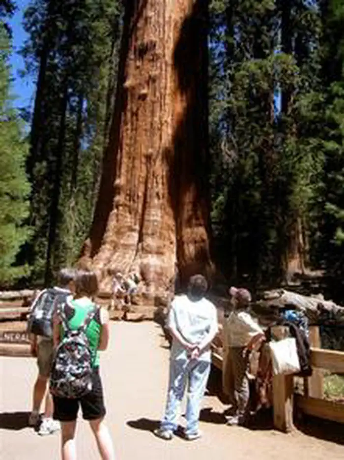
Central base for Giant Forest and General Sherman with shuttle at the door.
Multiple reviewers point to Lodgepole as the easiest sleeping spot for hitting the Giant Forest sequoia grove, with the free park shuttle stopping at the campground so you skip the Sherman Tree parking scramble.
Booking
02 / 06
Sites vanish within minutes of the release window.
Lodgepole opens on Recreation.gov on a rolling window (sources cite four to six months out, 7am PT) and the desirable river and upper-loop sites are gone almost immediately. Plan the exact release date in advance or expect to settle.
Sites
03 / 06
Tight spacing in the lower loops, more breathing room up top.
Lower loops draw RVs and larger groups and reviewers describe shared parking and a fishbowl feel. Upper loops in the higher 90s through 140s are tent-only walk-ins with more shade and quiet, at the cost of a longer walk to bathrooms.
Wildlife & sky
04 / 06
Active bear corridor where the food locker rules are not optional.
Campers consistently report bears moving through day and night, including tents and dumpsters in repeated incidents. The 28 by 33 by 47 inch lockers must hold every scented item, and rangers patrol enforcement.
Water
05 / 06
Marble Fork of the Kaweah runs right through camp.
The river is the signature feature, masking neighbor noise at riverside sites and giving easy access to swim spots and the Tokopah Falls trail that starts from the campground. Flow drops noticeably by late summer.
Facilities
06 / 06
Walkable market, grill, showers, and laundry set it apart from other SEKI camps.
The seasonal Lodgepole Market and Grill, coin showers, and laundry sit next to the campground, which reviewers cite as a real convenience. Showers and the visitor center run on reduced or seasonal hours, so do not count on them shoulder-season.
Synthesized from public trip reports and forum discussion, summarized in our words and never quoted. This is durable sentiment, not a live feed.
The campground at a glance
01 · CHARACTER
Reads strongest on quiet and reservability. Softest on roomy sites.
Six axes, each scored relative to every other federal campground in the region: quiet (miles to a major road), cool (elevation), roomy (average site spacing), shade, RV-fit (longest rig), and how reservable it is. All six come from data, nothing hand-tuned.
When to go
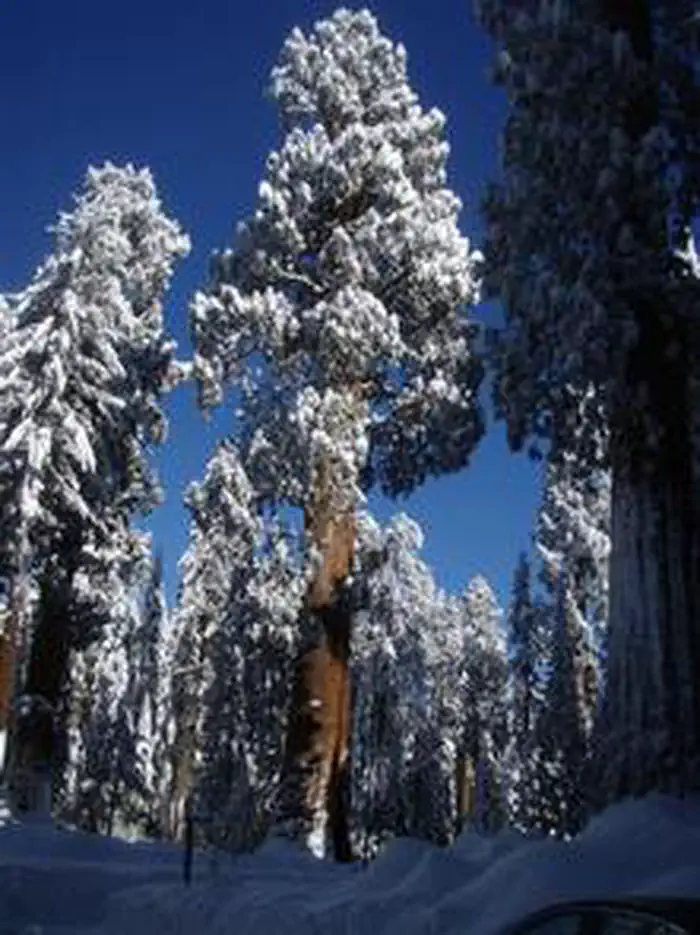
02 · CLIMATE
avg highavg lowfrost-freedriest · Jul
May-Oct
Comfortable window: nights stay above 35°F, days below 90°F.
92%
Of summer weekend-days are dry.
Jun 11
Last spring frost; first fall frost Oct 12.
55°F
Average July low. Bring a fleece.
Getting there
03 · ACCESS
01
Fresno
77 mi
1h43
02
Los Angeles
232 mi
5h09
03
Sacramento
265 mi
5h53
04
San Francisco
284 mi
6h19
05
San Diego
368 mi
8h11
By drive time
Routed road time (OSRM). Nearest major highway 15.2 mi away.
We synthesize public data layers: RIDB and Recreation.gov facility and site records, Open-Meteo climate normals, OpenStreetMap roads, trails, and water, OSRM drive times, and USGS elevation. We take no bookings, no ads, and no paid placements. Independence is the entire point.