Overview Perched on top of Big Flat Mountain, this is one of the largest campgrounds in the park.
Sites213145 reservable
Elev.3,323ft
Comf.Apr-Oct7 months
Max rig55 ft134 pull-thru
Electricnonesites
From Richmond2h34real road time
The honest read
Synthesized from RIDB · Open-Meteo OSM · OSRM Updated 2026-05-27
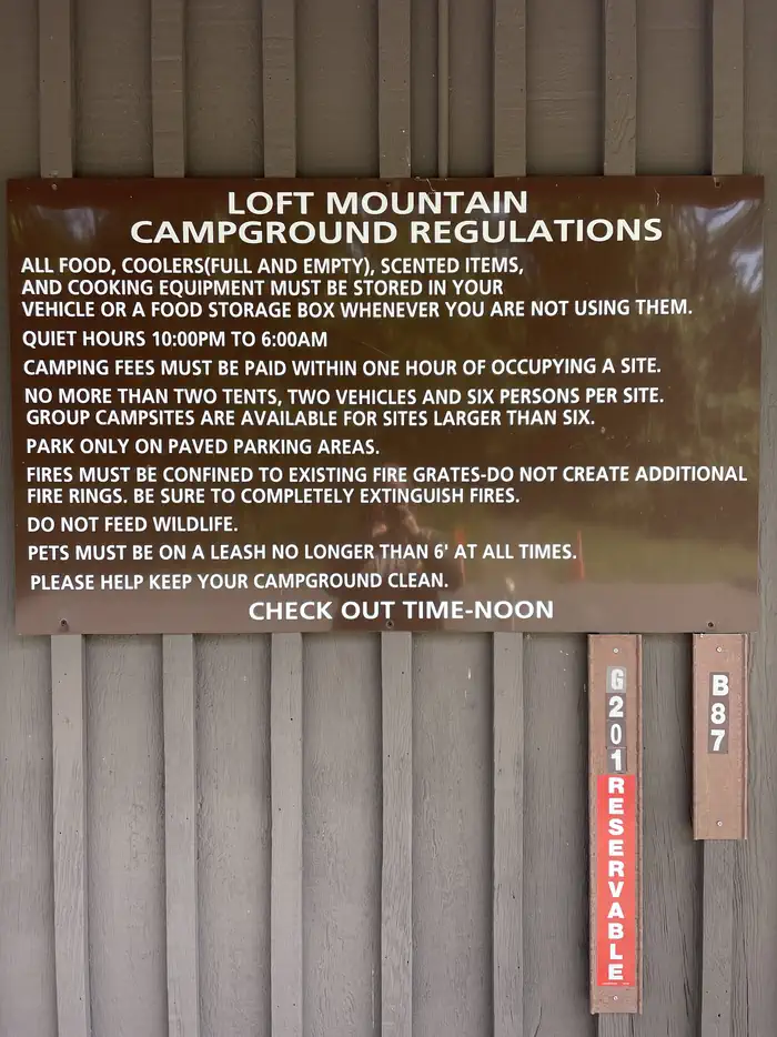
At 3,323 ft, Loft Mountain Campground has a 7-month comfortable window (Apr-Oct). Winter nights average around 20°F, so the shoulder seasons turn cold fast. 213 sites total: 145 reservable and 68 first-come, first-served. Of the sites, 134 pull-through, 53 walk-in, and the longest takes a 55-ft rig. This is bear country, and food-storage lockers are provided. Within about 4 miles: 11 named hiking routes, 14 peaks, lake or river access.
What campers say
SYNTHESIZED · RICH SIGNAL
Views
01 / 07
The ridge-top views are the reason to come.
Loft Mountain sits on a high, open ridge with the Appalachian Trail looping the perimeter, so a one-minute walk from camp gets you both sunrise and sunset. Campers rate the sunsets among the best in the park. The catch is that the big views come from the western-edge sites and the AT, not from every site.
Booking
02 / 07
The most gettable of the big Shenandoah campgrounds.
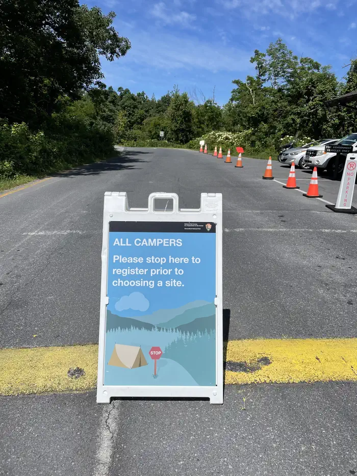
About half the sites are first-come, first-served, and regulars say Loft fills slower than Big Meadows because it is farther south and farther from the popular trails. Normal weekdays and weekends give you decent odds, but peak fall-foliage weekends fill by midday, so arrive early or reserve.
Sites
03 / 07
Aim for the outer western-edge or walk-in sites.
The A loop and outer-perimeter sites get named for views and privacy, with A20 and the A10 to A20 stretch called out for watching sunset from the tent. Walk-in sites are the seclusion play. The common gripe is that many sites are sloped and hard to level, which RV owners feel most.
Weather
04 / 07
Plan for wind, fog, and cold on the ridge.
At about 3,300 feet the weather is part of the experience. Campers describe wind that calls for good stakes, morning fog thick enough that you want a headlamp for night bathroom trips, and cool temperatures even in the shoulder seasons. Tents dry slowly after rain.
Facilities
05 / 07
Good camp store and bathrooms. Coin showers are a walk away.
The wayside store is well stocked, including firewood, and the dump station and laundry get good marks. Bathrooms are free. The showers are coin-operated near the store, a real walk from most sites, and run a few dollars in quarters, so bring change. There are no hookups at any site.
Wildlife & sky
06 / 07
Bear country with a real history of closures.
Bears visit the grounds regularly and have forced closures, so the food lockers are not optional. Deer wander through camp constantly and tend to ignore people.
Trails & access
07 / 07
Trails start right at camp.
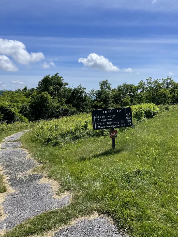
The Frazier Discovery Trail is the easy local loop from the wayside up to a viewpoint that ties into the AT. Doyles River Falls and the longer Big Run routes are the bigger objectives nearby, and the Appalachian Trail is immediate from the campground.
Synthesized from public trip reports and forum discussion, summarized in our words and never quoted. This is durable sentiment, not a live feed.
The campground at a glance
01 · CHARACTER
Reads strongest on shade and reservability. Softest on roomy sites.
Six axes, each scored relative to every other federal campground in the region: quiet (miles to a major road), cool (elevation), roomy (average site spacing), shade, RV-fit (longest rig), and how reservable it is. All six come from data, nothing hand-tuned.
When to go
02 · CLIMATE
avg highavg lowfrost-freedriest · Nov
Apr-Oct
Comfortable window: nights stay above 35°F, days below 90°F.
73%
Of summer weekend-days are dry.
Apr 28
Last spring frost; first fall frost Oct 23.
61°F
Average July low. Bring a fleece.
Getting there
03 · ACCESS
01
Richmond
109 mi
2h34
02
Roanoke
125 mi
2h54
03
Washington DC
126 mi
3h06
04
Norfolk
200 mi
4h22
By drive time
Routed road time (OSRM). Nearest major highway 5.5 mi away.
We synthesize public data layers: RIDB and Recreation.gov facility and site records, Open-Meteo climate normals, OpenStreetMap roads, trails, and water, OSRM drive times, and USGS elevation. We take no bookings, no ads, and no paid placements. Independence is the entire point.