USFSGrand Mesa, Uncompahgre and Gunnison National Forest · Colorado
Lottis Creek Campground
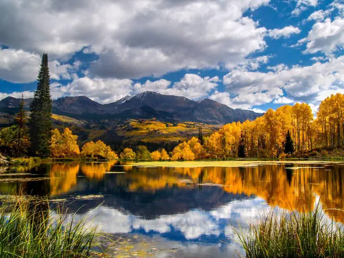
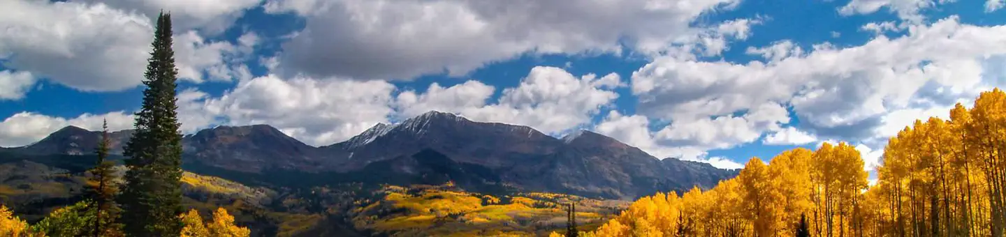
Overview Located in the Grand Mesa Uncompahgre and Gunnison National Forests, Lottis Creek Campground is at an elevation of 8,600 feet above sea level.
Sites5026 reservable
Elev.9,085ft
Comf.Jul-Sep3 months
Max rig107 ft13 pull-thru
Electric439×50-amp
From Colorado Springs3h38real road time
The honest read
Synthesized from RIDB · Open-Meteo OSM · OSRM Updated 2026-05-27
At 9,085 ft, Lottis Creek Campground has a 3-month comfortable window (Jul-Sep). Winter nights average around 8°F, so the shoulder seasons turn cold fast. 50 sites total: 26 reservable and 24 first-come, first-served. Of the sites, 13 pull-through, 9 with 50-amp, and the longest takes a 107-ft rig. Within about 4 miles: 4 peaks, lake or river access.
What campers say
SYNTHESIZED · RICH SIGNAL
Facilities
01 / 06
Vault toilets rate as some of the cleanest campers have used.
Multiple reviews across years single out the pit toilets as spotless and odor-free, with hosts visibly maintaining them on a daily basis. This is one of the most consistent positives across every source.
Sites
02 / 06
Gravel pads run spacious and easy to level for trailers.
Reviewers with 23 to 40 foot trailers report little trouble leveling, and sites feel well separated with tree cover. The Baldy and Union loops both draw specific praise for pad size.
Vibe
03 / 06
Most call the hosts attentive, but one ATV traveler reported a hostile encounter.
Long-running positive reports describe hosts who greet arrivals and keep loops tidy. Two 2019 reviews from ATV travelers describe an aggressive host interaction over off-highway vehicle questions, so groups hauling ATVs may want to read recent reviews before booking.
Water
04 / 06
Taylor River fishing is productive but private water blocks most walking access.
Anglers report steady days on Chernobyl ant and nymph dropper rigs, including a 14 inch brown on a recent August trip. Much of the river within walking distance of the campground is posted private, so most fishing requires driving to public access points.
Access
05 / 06
AT&T does not work, Verizon pulls a 4G signal at most sites.
Campers consistently report no AT&T coverage and needing to drive toward Taylor Reservoir to get a usable signal. Verizon and occasionally T-Mobile are reported as working from sites.
Trails & access
06 / 06
Interior loop roads are dusty and the potholes have lingered for years.
The unpaved loops kick up noticeable dust when vehicles speed through, a complaint repeated across multiple reviews. Several campers across two or more seasons also flag large potholes in the campground roads that have not been patched.
Synthesized from public trip reports and forum discussion, summarized in our words and never quoted. This is durable sentiment, not a live feed.
The campground at a glance
01 · CHARACTER
Reads strongest on shade and quiet. Softest on big-rig fit.
Six axes, each scored relative to every other federal campground in the region: quiet (miles to a major road), cool (elevation), roomy (average site spacing), shade, RV-fit (longest rig), and how reservable it is. All six come from data, nothing hand-tuned.
When to go
02 · CLIMATE
avg highavg lowfrost-freedriest · Nov
Jul-Sep
Comfortable window: nights stay above 35°F, days below 90°F.
71%
Of summer weekend-days are dry.
Jun 19
Last spring frost; first fall frost Sep 16.
42°F
Average July low. Bring a fleece.
Getting there
03 · ACCESS
01
Colorado Springs
135 mi
3h38
02
Grand Junction
151 mi
3h44
03
Denver
162 mi
4h17
04
Fort Collins
224 mi
5h23
By drive time
Routed road time (OSRM). Nearest major highway 12.4 mi away.
Picking your site
04 · 50 SITES
13
Pull-thru
0
Walk-in
9
50-amp
6
Accessible
17
Prime
50
Sites
★ The standout
Site 8
Baldy Loop · prime location · pull-through · shaded.
Location
Prime
Max rig
62 ft
Type
Pull-thru
What's within four miles
05 · TRAILS · PEAKS · WATER
Trails & Peaks
Trail segments
7
Peaks
4
Viewpoints
4
Water & Access
Lake / river access
yes
To nearest major road
12.4 mi
Method
We synthesize public data layers: RIDB and Recreation.gov facility and site records, Open-Meteo climate normals, OpenStreetMap roads, trails, and water, OSRM drive times, and USGS elevation. We take no bookings, no ads, and no paid placements. Independence is the entire point.