campgrounds.fyiIndependent · federal campgrounds · no paid placements
← All campgrounds
Mathews Arm Campground Traces/Overall Run Trail-head
Mathews Arm Campground Ash BucketsMathews Arm Campground
NPSShenandoah National Park · Virginia

Mathews Arm Campground

Overview Secluded in the thick trees and rolling hills of the Shenandoah National Park, Mathews Arm Campground is the ideal spot for a camping getaway.
Sites166115 reservable
Elev.2,736ft
Comf.Apr-Oct7 months
Max rig50 ft19 pull-thru
Electricnonesites
From Washington DC2h21real road time
The honest read
Synthesized from
RIDB · Open-Meteo
OSM · OSRM
Updated 2026-05-27

At 2,736 ft, Mathews Arm Campground has a 7-month comfortable window (Apr-Oct). Winter nights average around 21°F, so the shoulder seasons turn cold fast. 166 sites total: 115 reservable and 51 first-come, first-served. Of the sites, 19 pull-through, and the longest takes a 50-ft rig. This is bear country, and food-storage lockers are provided. Within about 4 miles: 8 named hiking routes, 40 peaks, lake or river access.

What campers say

SYNTHESIZED · RICH SIGNAL
Vibe
01 / 06
The quiet, woodsy one, and the least busy of the park's three big campgrounds.
As the north-district campground off Skyline Drive, it draws fewer people than central Big Meadows and fills up later, so it is the pick for solitude. It is heavily forested with deep shade and no views from camp itself. Fair warning, a few campers report loud groups past quiet hours, so it is usually calm but not guaranteed.
Booking
02 / 06
Your best first-come, first-served odds of the three.
Mathews Arm keeps some sites first-come, first-served and is the least popular of the reservable campgrounds, so a normal weekday is easy. A fall-foliage Saturday is not, and regulars say arrive Thursday to be safe. Reservable sites release in phases, about half at six months out, then more at two weeks and four days.
Sites
03 / 06
Aim for the Loop A perimeter. Skip cramped Loop C.
Interior sites sit close together and Loop C gets called the most cramped and noisy. The Loop A outer sites win for room and privacy, and the best of those are first-come, first-served. The ground is rocky, so bring solid stakes. For RVs, posted limits run high but many pads are unlevel and the dump station is tight, so big rigs find it a squeeze.
Facilities
04 / 06
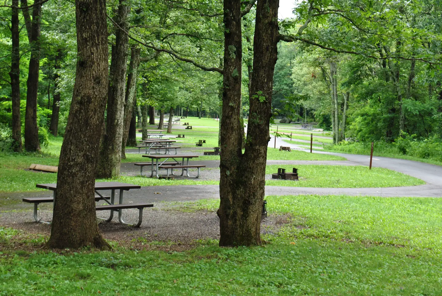
No showers. That is the thing to know.
Plan around it, because the nearest showers are at Big Meadows, 30 to 45 minutes south. Otherwise it is basic and fine, with flush toilets, drinking water, a dump station, and an amphitheater, plus the Elkwallow Wayside about two miles off for snacks and supplies. No hookups, and cell service is poor.
Trails & access
05 / 06
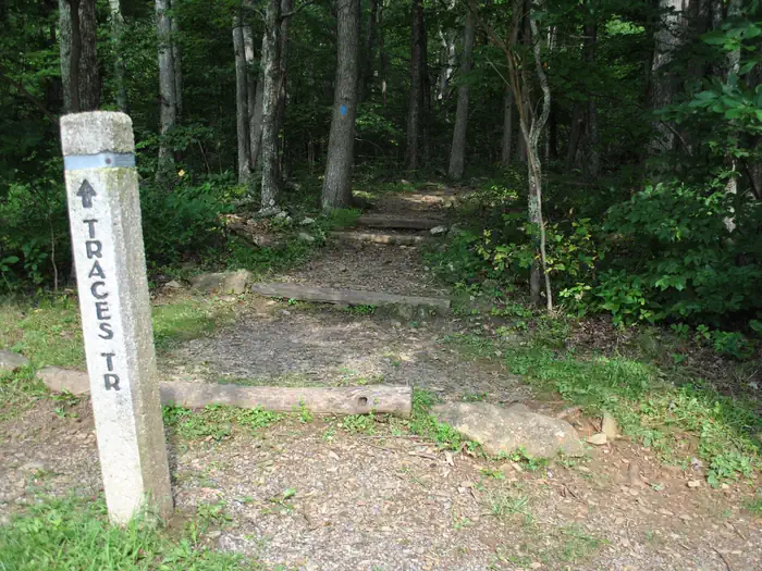
A loop circles the campground and launches the park's tallest waterfall hike.
The easy Traces Trail rings the campground in about 1.7 miles and connects to Overall Run Falls, the tallest in the park. One honest note, the falls slow to a trickle in dry spells, and most hikers say the wide valley overlooks on that route are the real reward.
Wildlife & sky
06 / 06
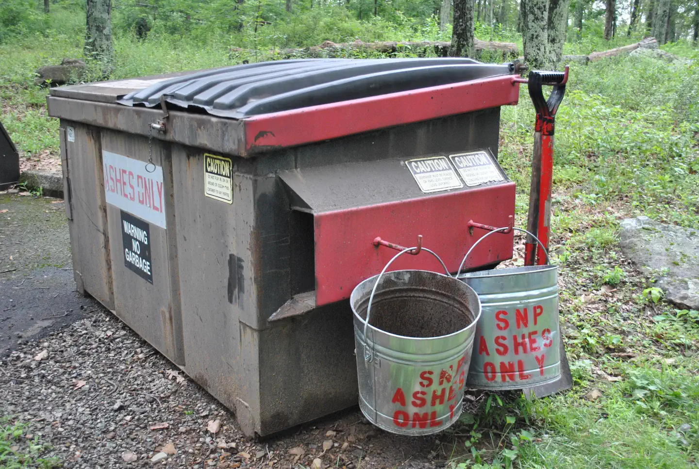
Active bear country. Storage rules are enforced.
Rangers enforce food storage and will fine you, and bear boxes are at some sites but not all, so plan to use yours or your car. The north end of the park tends to see less bear trouble than the south, but the rules still apply. Deer wander through camp.

Synthesized from public trip reports and forum discussion, summarized in our words and never quoted. This is durable sentiment, not a live feed.

The campground at a glance

01 · CHARACTER
QuietCoolRoomyShadeRV-fitReserv.

Reads strongest on shade and reservability. Softest on roomy sites.

Six axes, each scored relative to every other federal campground in the region: quiet (miles to a major road), cool (elevation), roomy (average site spacing), shade, RV-fit (longest rig), and how reservable it is. All six come from data, nothing hand-tuned.

When to go

02 · CLIMATE
JFMAMJJASOND
avg highavg lowfrost-freedriest · Nov
Apr-Oct
Comfortable window: nights stay above 35°F, days below 90°F.
76%
Of summer weekend-days are dry.
Apr 27
Last spring frost; first fall frost Oct 28.
62°F
Average July low. Bring a fleece.

Getting there

03 · ACCESS
01
Washington DC
91 mi
2h21
02
Richmond
125 mi
3h01
03
Roanoke
162 mi
3h23
04
Norfolk
210 mi
4h43
By drive time
Washington DC · 2h21Richmond · 3h01Roanoke · 3h23Norfolk · 4h43Camp

Routed road time (OSRM). Nearest major highway 4 mi away.

Picking your site

04 · 166 SITES
Color byShow only

166 mapped sites · dot color = seclusion · click a dot for details. Basemap © OpenStreetMap.

19
Pull-thru
0
Walk-in
0
50-amp
4
Accessible
0
Prime
166
Sites
★ The standout
Site A056 Generator Prohibited
A - 14 Day Advance Purchase · pull-through · shaded.
To neighbor
89 ft
Max rig
30 ft
Type
Pull-thru

What's within four miles

05 · TRAILS · PEAKS · WATER

Trails & Peaks

Named hiking routes
8
Trail segments
611
Peaks
40
Viewpoints
9

Water & Access

Lake / river access
yes
To nearest major road
4 mi
Method

We synthesize public data layers: RIDB and Recreation.gov facility and site records, Open-Meteo climate normals, OpenStreetMap roads, trails, and water, OSRM drive times, and USGS elevation. We take no bookings, no ads, and no paid placements. Independence is the entire point.

Check availability on Recreation.gov →