USFSArapaho & Roosevelt National Forests Pawnee NG · Colorado
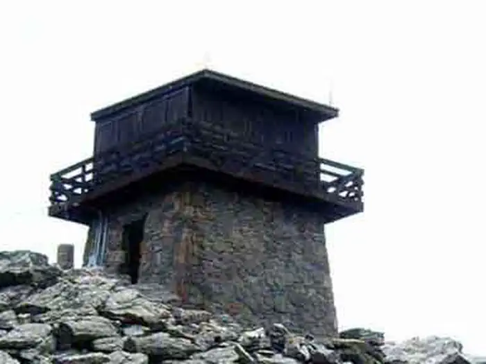
Mestaa’ėHehe Mountain Fire Lookout
Overview The Mestaa’ėhehe (pronounced mess-taw-HAY) Mountain Fire Lookout is located directly off of Colorado Highway 103 west of Bergen Park and sits at the summit of Mestaa’ėhehe Mountain, which is
Sites1all reservable
Elev.11,434ft
Comf.Jul-Sep3 months
Max rig20 ft
Electricnonesites
From Denver0h56real road time
The honest read
Synthesized from RIDB · Open-Meteo OSM · OSRM Updated 2026-05-27
At 11,434 ft, Mestaa’ėHehe Mountain Fire Lookout has a 3-month comfortable window (Jul-Sep). Winter nights average around 6°F, so the shoulder seasons turn cold fast. All 1 sites are reservable in advance, so plan ahead. Popular weekends book out. Of the sites, 1 walk-in, and the longest takes a 20-ft rig. Within about 4 miles: 1 named hiking route, 12 peaks, lake or river access.
What campers say
SYNTHESIZED · MODERATE SIGNAL
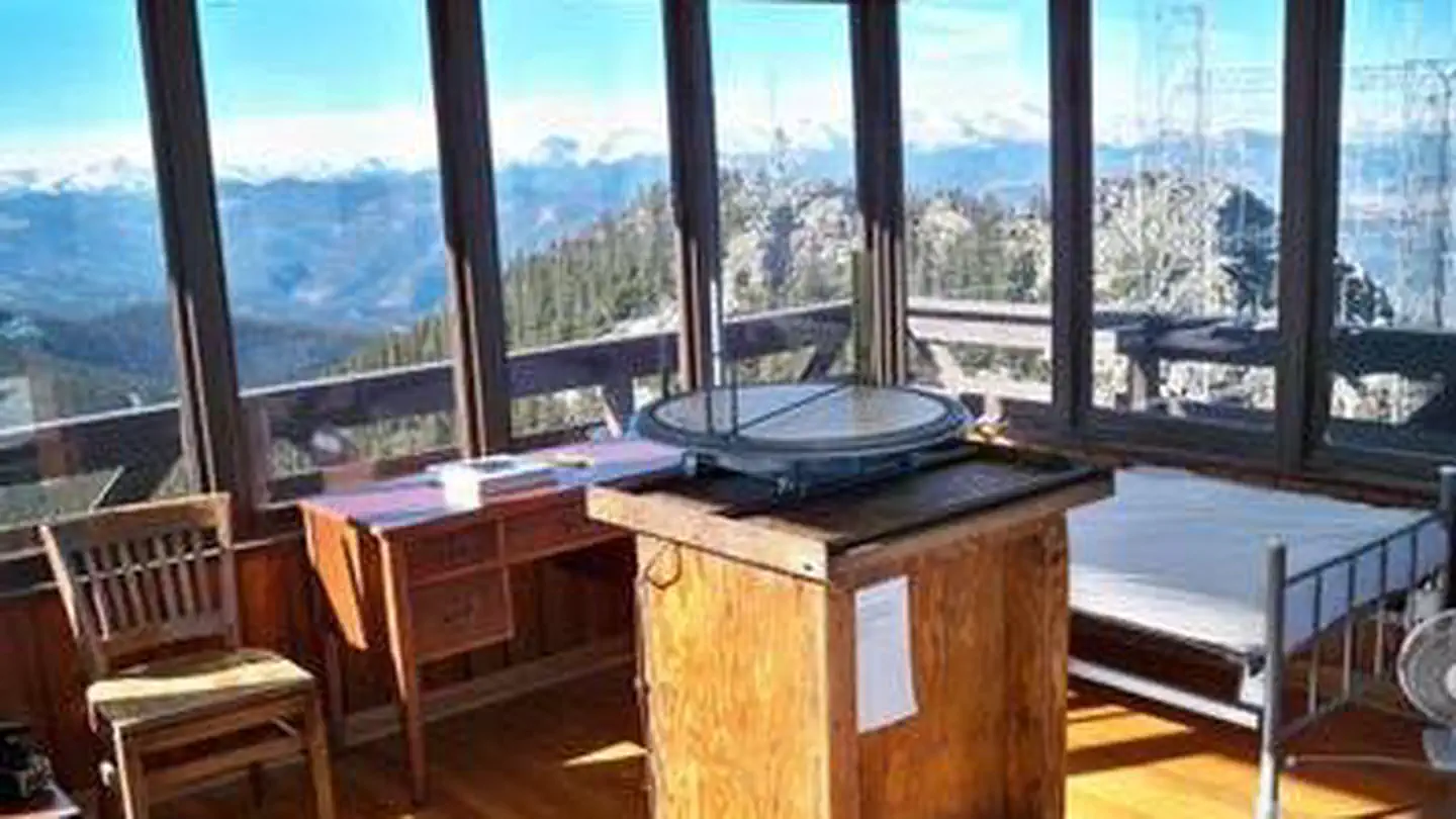
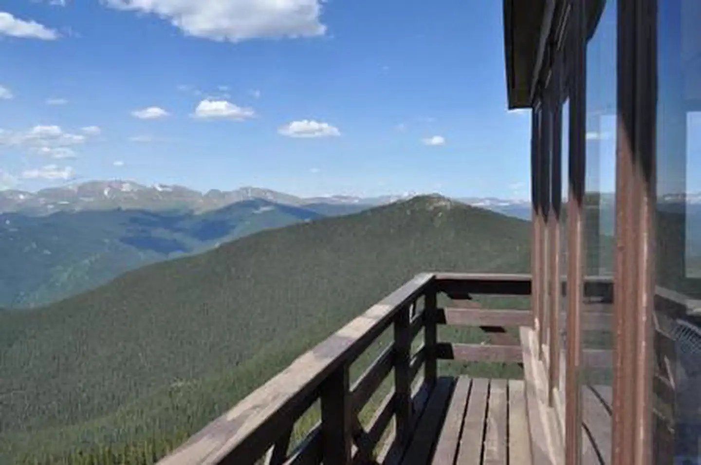
Views
01 / 05
360-degree panorama from 11,500 feet, with the Continental Divide front and center.
Visitors consistently describe sightlines that wrap from Mount Blue Sky across the Front Range, with Denver visible to the east on clear days. After dark the site reads as a designated dark-sky perch, and stargazing comes up in nearly every report.
Weather
02 / 05
Wind is the defining condition and it rarely lets up.
Multiple stays mention the cabin rattling through the night and gusts strong enough to make the short walk to the vault toilet a chore. Winter guests note icy access steps and sub-zero overnight lows even with the propane heater running.
Access
03 / 05
Roughly a 1-mile hike-in from the parking area, with real elevation.
Guests haul gear, water, and bedding up a service road to the summit, and the altitude makes the climb harder than the distance suggests. Winter visitors report needing traction devices and report the final approach can be sheet ice.
Water
04 / 05
No water on site, pack in everything you plan to drink and cook with.
Reports are unanimous that there is no spigot, no well, and no nearby source. Guests recommend planning for at least a gallon per person per day plus extra for dishes, since melting snow is slow on the small propane stove.
Booking
05 / 05
Releases six months out on Recreation.gov and the calendar fills within minutes.
Trip reports describe setting alarms for the 10 a.m. Mountain Time release and still missing summer weekends. Mid-week winter nights are the most realistic window for a first-time booking, and the single-occupancy cap of one party keeps supply tight.
Synthesized from public trip reports and forum discussion, summarized in our words and never quoted. This is durable sentiment, not a live feed.
The campground at a glance
01 · CHARACTER
Reads strongest on reservability and cool nights. Softest on shade.
Six axes, each scored relative to every other federal campground in the region: quiet (miles to a major road), cool (elevation), roomy (average site spacing), shade, RV-fit (longest rig), and how reservable it is. All six come from data, nothing hand-tuned.
When to go
02 · CLIMATE
avg highavg lowfrost-freedriest · Nov
Jul-Sep
Comfortable window: nights stay above 35°F, days below 90°F.
52%
Of summer weekend-days are dry.
Jun 21
Last spring frost; first fall frost Sep 13.
42°F
Average July low. Bring a fleece.
Getting there
03 · ACCESS
01
Denver
35 mi
0h56
02
Fort Collins
95 mi
2h01
03
Colorado Springs
101 mi
2h07
04
Grand Junction
221 mi
4h26
By drive time
Routed road time (OSRM). Nearest major highway 4.3 mi away.
Picking your site
04 · 1 SITES
0
Pull-thru
1
Walk-in
0
50-amp
0
Accessible
1
Prime
1
Sites
★ The standout
Site Mestaa’ėhehe Mountain Fire LO
Mestaa’ėhehe Mountain Fire LO · prime location · walk-in.
Location
Prime
Max rig
20 ft
Type
Walk-in
What's within four miles
05 · TRAILS · PEAKS · WATER
Trails & Peaks
Named hiking routes
1
Trail segments
27
Peaks
12
Water & Access
Lake / river access
yes
To nearest major road
4.3 mi
Method
We synthesize public data layers: RIDB and Recreation.gov facility and site records, Open-Meteo climate normals, OpenStreetMap roads, trails, and water, OSRM drive times, and USGS elevation. We take no bookings, no ads, and no paid placements. Independence is the entire point.