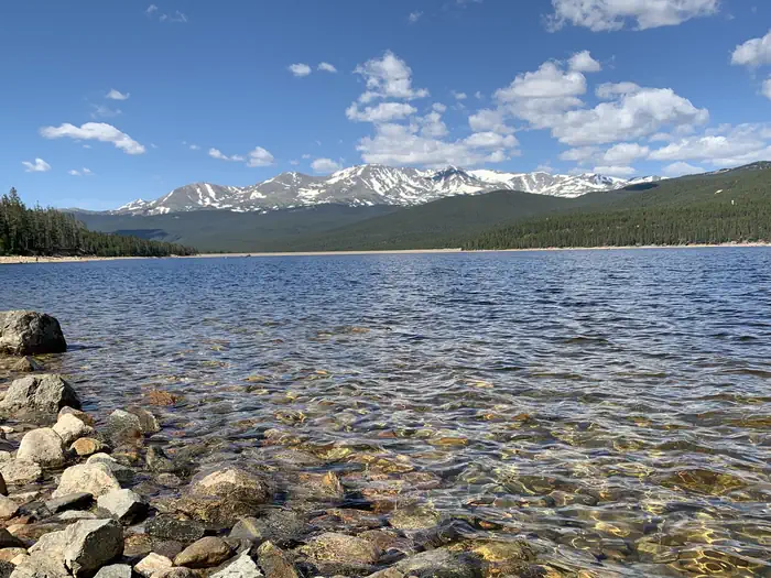
Overview Named after the "unsinkable" Molly Brown on the Titanic, Molly Brown Campground, on the eastern shore of Turquoise Lake, sits in a shaded lodgepole pine forest.
Sites5045 reservable
Elev.9,915ft
Comf.Jul-Sep3 months
Max rig40 ft
Electricnonesites
From Denver2h11real road time
The honest read
Synthesized from RIDB · Open-Meteo OSM · OSRM Updated 2026-05-27
At 9,915 ft, Molly Brown has a 3-month comfortable window (Jul-Sep). Winter nights average around 7°F, so the shoulder seasons turn cold fast. 50 sites total: 45 reservable and 5 first-come, first-served. Within about 4 miles: 1 named hiking route, 1 peak, lake or river access.
What campers say
SYNTHESIZED · MODERATE SIGNAL
Facilities
01 / 05
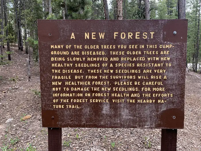
No potable water in 2026; haul in everything you plan to drink and douse fires.
The Forest Service has shut off water at the campground for the 2026 season, confirmed in the official site notice and echoed by recent campers. Bring enough for drinking, cooking, and fully extinguishing your fire, since the nearby White Star dump and fill is also closed.
Sites
02 / 05
Well spaced sites tucked into lodgepole pines with a short walk to the lake.
Reviewers consistently describe roomy, tree-screened sites that feel private rather than packed in, with shade from the lodgepole canopy. Most sites sit a few minutes from the shoreline, though waterfront spots get foot traffic from other campers cutting through to the lake.
Booking
03 / 05
Books out months ahead and stays full all season.
Campers report needing to reserve weeks to months in advance, with weekend two and three night minimums and very few day-of openings. Midweek and cancellation windows are the realistic path in if you missed the early booking.
Vibe
04 / 05
Host quality swings hard between rotations, from helpful to confrontational.
Some visitors describe hosts as friendly and informative, while others report being scolded over cooler placement, firewood, or noise before quiet hours, with one account of a sheriff threat. Treat host experience as a coin flip and keep your site tidy.
Weather
05 / 05
Cool nights at 9,900 feet and mosquitoes thick from June into August.
Even midsummer nights drop into the 40s with mild 60s days, so bring real layers and expect altitude to slow you down the first day. Mosquitoes are worst at dawn and dusk near the water, and lake breezes are the main relief when they kick up.
Synthesized from public trip reports and forum discussion, summarized in our words and never quoted. This is durable sentiment, not a live feed.
The campground at a glance
01 · CHARACTER
Reads strongest on shade and reservability. Softest on roomy sites.
Six axes, each scored relative to every other federal campground in the region: quiet (miles to a major road), cool (elevation), roomy (average site spacing), shade, RV-fit (longest rig), and how reservable it is. All six come from data, nothing hand-tuned.
When to go
02 · CLIMATE
avg highavg lowfrost-freedriest · Jun
Jul-Sep
Comfortable window: nights stay above 35°F, days below 90°F.
82%
Of summer weekend-days are dry.
Jun 21
Last spring frost; first fall frost Sep 13.
41°F
Average July low. Bring a fleece.
Getting there
03 · ACCESS
01
Denver
103 mi
2h11
02
Colorado Springs
128 mi
2h46
03
Grand Junction
174 mi
3h15
04
Fort Collins
163 mi
3h16
By drive time
Routed road time (OSRM). Nearest major highway 1.6 mi away.
We synthesize public data layers: RIDB and Recreation.gov facility and site records, Open-Meteo climate normals, OpenStreetMap roads, trails, and water, OSRM drive times, and USGS elevation. We take no bookings, no ads, and no paid placements. Independence is the entire point.