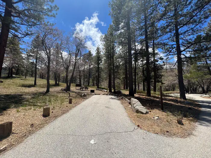
Overview Escape to Mountain Oak Campground in the Angeles National Forest for a restful, refreshing getaway from city life.
Sites2811 reservable
Elev.6,188ft
Comf.Apr-Nov8 months
Max rig38 ft
Electricnonesites
From Los Angeles1h05real road time
The honest read
Synthesized from RIDB · Open-Meteo OSM · OSRM Updated 2026-05-27
At 6,188 ft, Mountain Oak has a 8-month comfortable window (Apr-Nov). Winter nights average around 31°F, so the shoulder seasons turn cold fast. 28 sites total: 11 reservable and 17 first-come, first-served. Within about 4 miles: 3 named hiking routes, 3 peaks, lake or river access.
The campground at a glance
01 · CHARACTER
Reads strongest on shade and cool nights. Softest on roomy sites.
Six axes, each scored relative to every other federal campground in the region: quiet (miles to a major road), cool (elevation), roomy (average site spacing), shade, RV-fit (longest rig), and how reservable it is. All six come from data, nothing hand-tuned.
When to go
02 · CLIMATE
avg highavg lowfrost-freedriest · Oct
Apr-Nov
Comfortable window: nights stay above 35°F, days below 90°F.
96%
Of summer weekend-days are dry.
May 10
Last spring frost; first fall frost Oct 28.
65°F
Average July low. Bring a fleece.
Getting there
03 · ACCESS
01
Los Angeles
49 mi
1h05
02
San Diego
157 mi
3h29
03
Fresno
259 mi
5h45
04
San Francisco
456 mi
10h08
05
Sacramento
464 mi
10h19
By drive time
Routed road time (OSRM). Nearest major highway 1.1 mi away.
We synthesize public data layers: RIDB and Recreation.gov facility and site records, Open-Meteo climate normals, OpenStreetMap roads, trails, and water, OSRM drive times, and USGS elevation. We take no bookings, no ads, and no paid placements. Independence is the entire point.