Overview Ohanapecosh Campground, on the southeast side of Mount Rainier National Park, is surrounded by old growth forest and crossed by an exceptionally beautiful snow-fed river.
Sites192106 reservable
Elev.1,982ft
Comf.May-Oct6 months
Max rig32 ft
Electricnonesites
From Yakima1h27real road time
The honest read
Synthesized from RIDB · Open-Meteo OSM · OSRM Updated 2026-05-27
At 1,982 ft, Ohanapecosh Campground has a 6-month comfortable window (May-Oct). Winter nights average around 31°F, so the shoulder seasons turn cold fast. 192 sites total: 106 reservable and 86 first-come, first-served. Of the sites, 8 walk-in, and the longest takes a 32-ft rig. Within about 4 miles: 4 named hiking routes, 1 peak, lake or river access.
What campers say
SYNTHESIZED · RICH SIGNAL
Vibe
01 / 06
Deep old-growth forest along a glacier-fed river, no Rainier view from camp.
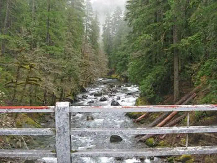
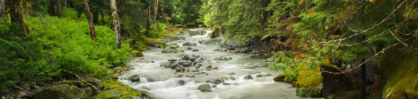
Sites sit at 1,914 feet under 300-foot Douglas firs with the Ohanapecosh River running through, producing dense shade and steady water sound. Reviewers consistently note you do not see the mountain itself from the campground; the draw is the forest and river.
Booking
02 / 06
Closed for rehab through November 2026, expected to reopen for 2027 season.
A full infrastructure rehabilitation has the campground, visitor center, amphitheater, and bathrooms closed for the duration. When it reopens, summer sites historically fill within roughly half an hour of the booking window opening, so plan five months out.
Sites
03 / 06
Outer-loop and riverside sites are the prize; E1 and inner spots feel exposed.
Multi-source consensus points to loops E, F, G, and H as the most spacious and quiet, with site 18 in F repeatedly called out as a standout. Inner-loop sites and E1 draw complaints about passing cars and weak privacy boundaries.
Facilities
04 / 06
Flush toilets in every loop, no showers, no hookups, no dump station.
Bathrooms are basic and the standing critique is wear: motion lights that misfire, aging fixtures, occasional drainage issues in tent pads after rain. The nearest dump station sits about 28 miles away in Packwood.
Weather
05 / 06
Cool, wet, and shaded even in summer; nights can drop near freezing.
The dense canopy keeps sites cold and damp, and reviewers warn nights drop into the 30s and 40s even when Paradise is sunny. Rain is the default assumption and mosquitoes show up in early summer.
Trails & access
06 / 06
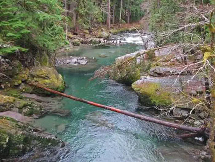
Grove of the Patriarchs closed until at least 2027; Silver Falls access rerouted.
The suspension bridge to the Grove has been out since the November 2021 flood and bridge construction is not scheduled to start until summer 2027. Silver Falls is still hikeable in 2026 but only as out-and-back from the Stevens Canyon or SR 123 trailheads, not as the campground loop.
Synthesized from public trip reports and forum discussion, summarized in our words and never quoted. This is durable sentiment, not a live feed.
The campground at a glance
01 · CHARACTER
Reads strongest on shade and reservability. Softest on roomy sites.
Six axes, each scored relative to every other federal campground in the region: quiet (miles to a major road), cool (elevation), roomy (average site spacing), shade, RV-fit (longest rig), and how reservable it is. All six come from data, nothing hand-tuned.
When to go
02 · CLIMATE
avg highavg lowfrost-freedriest · Jul
May-Oct
Comfortable window: nights stay above 35°F, days below 90°F.
81%
Of summer weekend-days are dry.
May 6
Last spring frost; first fall frost Oct 18.
53°F
Average July low.
Getting there
03 · ACCESS
01
Yakima
70 mi
1h27
02
Seattle
96 mi
2h27
03
Spokane
269 mi
5h03
By drive time
Routed road time (OSRM). Nearest major highway 2.4 mi away.
We synthesize public data layers: RIDB and Recreation.gov facility and site records, Open-Meteo climate normals, OpenStreetMap roads, trails, and water, OSRM drive times, and USGS elevation. We take no bookings, no ads, and no paid placements. Independence is the entire point.