Overview Poole Creek Campground is nestled in a forest of lodgepole pine, mountain hemlock and Shasta red fir, just south of the mouth of Poole Creek on the west shore of Lemolo Lake.
Sites61all reservable
Elev.4,232ft
Comf.May-Oct6 months
Max rig45 ft23 pull-thru
Electricnonesites
From Medford2h24real road time
The honest read
Synthesized from RIDB · Open-Meteo OSM · OSRM Updated 2026-05-27
At 4,232 ft, Poole Creek has a 6-month comfortable window (May-Oct). Winter nights average around 29°F, so the shoulder seasons turn cold fast. All 61 sites are reservable in advance, so plan ahead. Popular weekends book out. Of the sites, 23 pull-through, and the longest takes a 45-ft rig. Within about 4 miles: 5 peaks, lake or river access.
What campers say
SYNTHESIZED · MODERATE SIGNAL
Sites
01 / 05
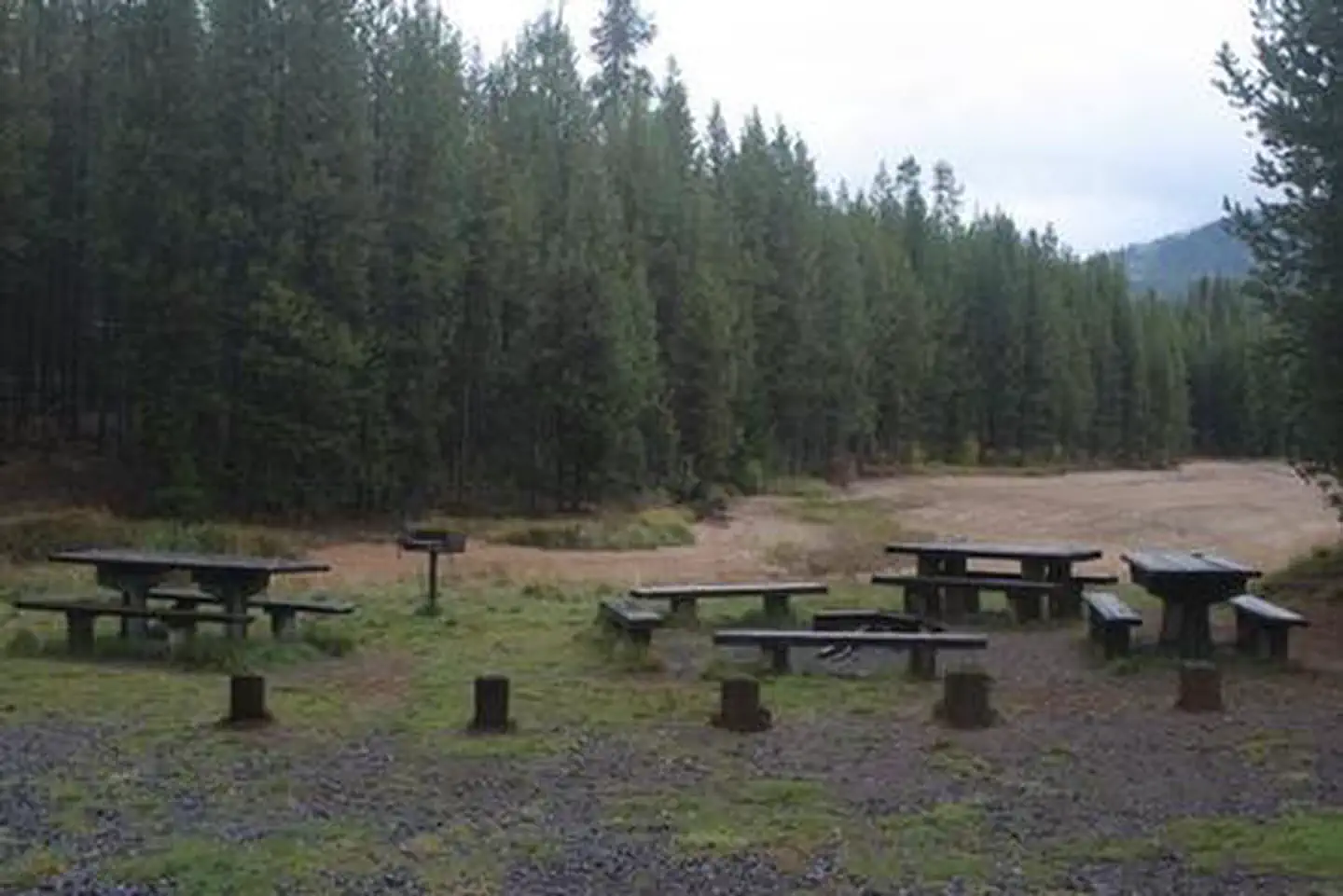
Roomy shaded sites under conifers, a dozen lakefront, others a short walk from shore.
Sites sit in lodgepole pine and hemlock with decent tree screening between neighbors, and the dozen lakefront pads are the ones to target. Pads are uneven and most visitors report needing levelers, with the 35-foot length cap making the loops tight for larger trailers.
Water
02 / 05
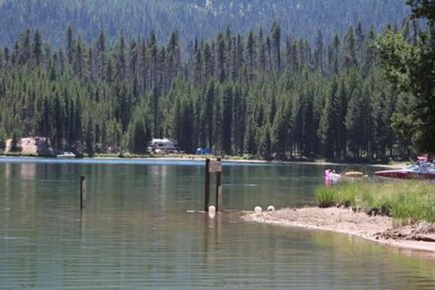
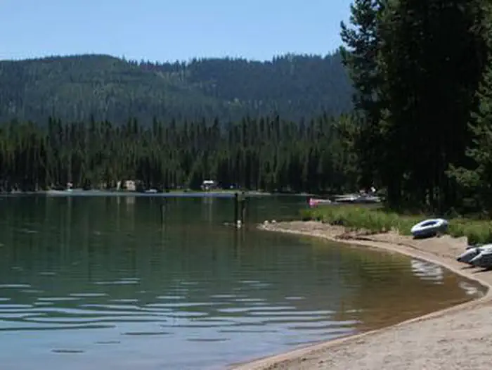
Lemolo is swimmable early season but blue-green algae shows up in late summer.
Mid-summer through fall, campers regularly flag algae blooms strong enough that they keep kids and dogs out of the water, and bloom timing varies year to year. Earlier in the season the lake reads clean for swimming off the beach and launching from the ramp next to the campground.
Wildlife & sky
03 / 05
Mosquitoes are the dominant complaint, biting through clothing into midsummer.
Nearly every review mentions persistent mosquitoes, with people reporting bites through fabric and recommending DEET plus long sleeves rather than citronella. The bugs ease later in the season once nights cool off.
Facilities
04 / 05
Vault toilets, potable water, no hookups, and a boat ramp on site.
Expect clean but basic vaults that occasionally run out of paper, drinking water spigots, and a paved ramp adjacent to the campground. There is no cell service and no showers or RV hookups, so plan to arrive self-contained.
Access
05 / 05
Roughly 72 miles east of Roseburg on OR-138, then four miles in on FR 2610.
The paved approach off the North Umpqua Highway is straightforward in a passenger car or trailer rig, and the campground sits at about 4,150 feet so nights stay cool even in August. Reservations through Recreation.gov require booking at least two days ahead, and the site is generally a summer-only operation.
Synthesized from public trip reports and forum discussion, summarized in our words and never quoted. This is durable sentiment, not a live feed.
The campground at a glance
01 · CHARACTER
Reads strongest on shade and reservability. Softest on roomy sites.
Six axes, each scored relative to every other federal campground in the region: quiet (miles to a major road), cool (elevation), roomy (average site spacing), shade, RV-fit (longest rig), and how reservable it is. All six come from data, nothing hand-tuned.
When to go
02 · CLIMATE
avg highavg lowfrost-freedriest · Jul
May-Oct
Comfortable window: nights stay above 35°F, days below 90°F.
91%
Of summer weekend-days are dry.
May 27
Last spring frost; first fall frost Oct 13.
52°F
Average July low. Bring a fleece.
Getting there
03 · ACCESS
01
Medford
95 mi
2h24
02
Bend
107 mi
2h26
03
Eugene
112 mi
3h06
04
Portland
217 mi
5h11
By drive time
Routed road time (OSRM). Nearest major highway 3.6 mi away.
POOLE CREEK · prime location · pull-through · shaded.
To neighbor
158 ft
Location
Prime
Max rig
30 ft
Type
Pull-thru
What's within four miles
05 · TRAILS · PEAKS · WATER
Trails & Peaks
Trail segments
14
Peaks
5
Water & Access
Lake / river access
yes
To nearest major road
3.6 mi
Method
We synthesize public data layers: RIDB and Recreation.gov facility and site records, Open-Meteo climate normals, OpenStreetMap roads, trails, and water, OSRM drive times, and USGS elevation. We take no bookings, no ads, and no paid placements. Independence is the entire point.