USFSGeorge Washington & Jefferson National Forest · Virginia
Raccoon Branch Campground
Overview Raccoon Branch Campground, nestled at the base of Dickey Knob, offers scenic mountain views, hiking trail access from campsites and cool mountain streams.
Sites209 reservable
Elev.2,772ft
Comf.Mar-Nov9 months
Max rig60 ft
Electric8sites
From Roanoke2h13real road time
The honest read
Synthesized from RIDB · Open-Meteo OSM · OSRM Updated 2026-05-27
At 2,772 ft, Raccoon Branch Campground has a 9-month comfortable window (Mar-Nov). Winter nights average around 27°F, so the shoulder seasons turn cold fast. 20 sites total: 9 reservable and 11 first-come, first-served. Within about 4 miles: 1 named hiking route, 7 peaks, lake or river access.
What campers say
SYNTHESIZED · THIN SIGNAL
Sites
01 / 05
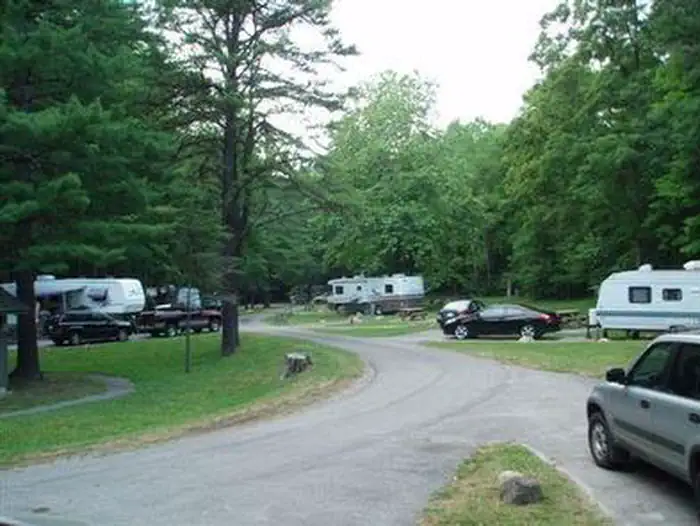
Wooded creekside sites along Dickey Creek.
Sites sit in the trees along the creek, with the water a real part of the appeal. Some sites face the road more than others, so the specific number matters.
Access
02 / 05
Route 16 runs right past, so road noise reaches the near sites.
The highway is close enough that campers on the road side notice traffic, while the back sites are quieter. There is no cell service here.
Facilities
03 / 05
Flush toilets and a dump station, but no showers.
The campground has flush toilets and an on-site dump station, which is why neighboring Hurricane sends people here, but there are no showers. One camper reported the tap water ran discolored on their stay, so it is worth checking your own.
Trails & access
04 / 05
Dickey Knob climbs from camp, with Mount Rogers access nearby.
The Dickey Knob trail leaves from the campground and climbs to a view, and the wider Mount Rogers area and Appalachian Trail are short drives away.
Booking
05 / 05
A small campground with a confusing first-come and reservable mix.
Some sites are first-come and others are reservable, and campers find the split unclear, so confirm your site's status before counting on a spot.
Synthesized from public trip reports and forum discussion, summarized in our words and never quoted. This is durable sentiment, not a live feed.
The campground at a glance
01 · CHARACTER
Reads strongest on shade and reservability. Softest on quiet.
Six axes, each scored relative to every other federal campground in the region: quiet (miles to a major road), cool (elevation), roomy (average site spacing), shade, RV-fit (longest rig), and how reservable it is. All six come from data, nothing hand-tuned.
When to go
02 · CLIMATE
avg highavg lowfrost-freedriest · Sep
Mar-Nov
Comfortable window: nights stay above 35°F, days below 90°F.
72%
Of summer weekend-days are dry.
Apr 25
Last spring frost; first fall frost Oct 29.
64°F
Average July low. Bring a fleece.
Getting there
03 · ACCESS
01
Roanoke
110 mi
2h13
02
Richmond
285 mi
5h25
03
Washington DC
336 mi
6h26
04
Norfolk
376 mi
7h13
By drive time
Routed road time (OSRM). Nearest major highway 0 mi away.
We synthesize public data layers: RIDB and Recreation.gov facility and site records, Open-Meteo climate normals, OpenStreetMap roads, trails, and water, OSRM drive times, and USGS elevation. We take no bookings, no ads, and no paid placements. Independence is the entire point.