Overview Rancheria Campground is located on the shores of Huntington Lake near the Kaiser Wilderness.
Sites128117 reservable
Elev.7,021ft
Comf.Jun-Oct5 months
Max rig71 ft
Electric3sites
From Fresno1h27real road time
The honest read
Synthesized from RIDB · Open-Meteo OSM · OSRM Updated 2026-05-27
At 7,021 ft, Rancheria has a 5-month comfortable window (Jun-Oct). Winter nights average around 21°F, so the shoulder seasons turn cold fast. 128 sites total: 117 reservable and 11 first-come, first-served. Of the sites, 19 walk-in, and the longest takes a 71-ft rig. Within about 4 miles: 2 named hiking routes, 6 peaks, lake or river access.
What campers say
SYNTHESIZED · MODERATE SIGNAL
Sites
01 / 05
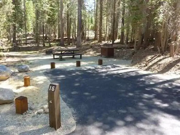
Large 125-site layout under dense pine and fir, sites spaced enough that the scale doesn't feel crowded.
Reviewers across multiple platforms say the canopy keeps sites shaded and the spacing holds up even when the campground is full. Terrain varies though, and several note steep pads that don't suit larger RVs, so checking satellite imagery before booking a specific site comes up repeatedly.
Water
02 / 05
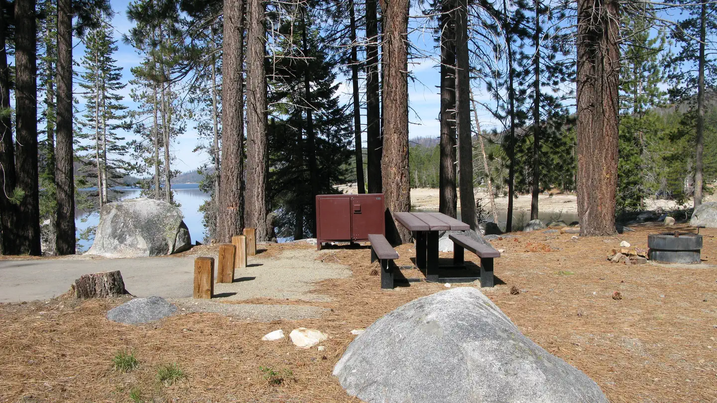
Tent-only walk-in sites sit on the shoreline with informal boat mooring, but the lake runs cold and windy.
Campers describe lakefront walk-ins as the standout sites, with short carries from the car and the option to tie up a small boat at camp. The tradeoff is exposure: the same afternoon wind that draws sailboat races makes those sites breezier and the water too cold for long swims.
Weather
03 / 05
Reliable afternoon wind off the lake and chilly nights at 7,000 feet.
Multiple trip reports mention strong daily winds that keep the lake busy with sailboats and limit powerboat traffic, which keeps the campground itself quieter. Even in midsummer, nights cool off noticeably and campers recommend packing layers.
Facilities
04 / 05
Flush and vault toilets kept in good shape, no showers, and RVs need to arrive with full tanks.
Bathrooms with flush toilets, sinks, and mirrors get consistent praise, though a few reviewers say the vault units get unpleasant by late in a busy weekend. There are no showers and no hookups, and the on-site potable water isn't set up to fill RV tanks, so trailers should top off in Shaver Lake on the way up.
Booking
05 / 05
Reservations required and open six months out, but less of a scramble than other Huntington Lake campgrounds.
Multiple campers note that Rancheria is easier to land than the smaller Huntington Lake loops, even close to the date. Group sites (Granite and Jeffrey) open a year ahead, and the campground hosts are mentioned by name in review after review as a reason regulars come back.
Synthesized from public trip reports and forum discussion, summarized in our words and never quoted. This is durable sentiment, not a live feed.
The campground at a glance
01 · CHARACTER
Reads strongest on shade and reservability. Softest on roomy sites.
Six axes, each scored relative to every other federal campground in the region: quiet (miles to a major road), cool (elevation), roomy (average site spacing), shade, RV-fit (longest rig), and how reservable it is. All six come from data, nothing hand-tuned.
When to go
02 · CLIMATE
avg highavg lowfrost-freedriest · Jul
Jun-Oct
Comfortable window: nights stay above 35°F, days below 90°F.
93%
Of summer weekend-days are dry.
Jun 6
Last spring frost; first fall frost Oct 17.
51°F
Average July low. Bring a fleece.
Getting there
03 · ACCESS
01
Fresno
65 mi
1h27
02
Sacramento
204 mi
4h32
03
San Francisco
237 mi
5h16
04
Los Angeles
295 mi
6h33
05
San Diego
433 mi
9h37
By drive time
Routed road time (OSRM). Nearest major highway 10.2 mi away.
We synthesize public data layers: RIDB and Recreation.gov facility and site records, Open-Meteo climate normals, OpenStreetMap roads, trails, and water, OSRM drive times, and USGS elevation. We take no bookings, no ads, and no paid placements. Independence is the entire point.