Overview Sam Owen Campground is nestled on the banks of Lake Pend Oreille in a densely wooded forest of pine and cedar.
Sites8280 reservable
Elev.2,110ft
Comf.Apr-Oct7 months
Max rig60 ft6 pull-thru
Electricnonesites
From Coeur d'Alene1h31real road time
The honest read
Synthesized from RIDB · Open-Meteo OSM · OSRM Updated 2026-05-27
At 2,110 ft, Sam Owen has a 7-month comfortable window (Apr-Oct). Winter nights average around 31°F, so the shoulder seasons turn cold fast. 82 sites total: 80 reservable and 2 first-come, first-served. Of the sites, 6 pull-through, and the longest takes a 60-ft rig. Within about 4 miles: 2 peaks, lake or river access.
What campers say
SYNTHESIZED · RICH SIGNAL
Views
01 / 06
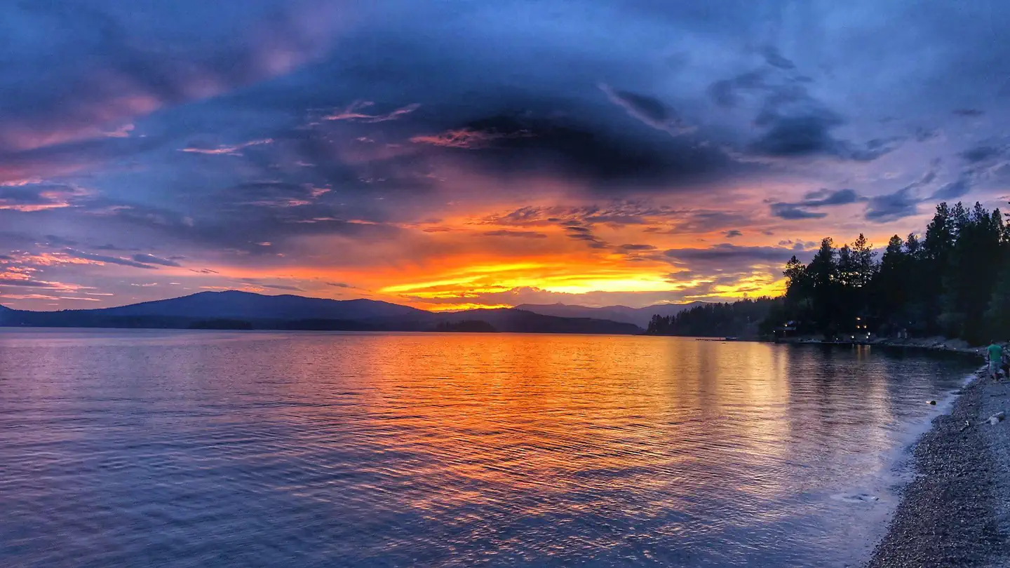
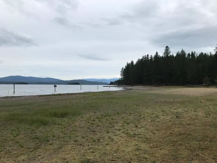
Peninsula sites open onto Lake Pend Oreille with the Cabinet Mountains across the water.
Campers consistently describe the lakefront and beach as the main draw, with mature pine and cedar framing the shoreline and long views down the lake. The Skipping Stone loop sits closest to the water.
Sites
02 / 06
Four loops with very different personalities, and not all pads are level.
Scented Leaf is the newer loop with paved, larger pads that fit bigger rigs, while Skipping Stone hugs the lake on steeper ground that often needs blocks. Red Sun is more open and Dancing Shadows holds the central facilities.
Facilities
03 / 06
Flush toilets and water on site, but no showers and the dump station charges extra.
Reviewers note clean restrooms, potable water spigots through the loops, and bear-resistant trash, but there are no hookups and no showers anywhere in the campground. The RV dump carries a separate fee on top of the nightly rate.
Booking
04 / 06
Summer weekends fill the full six-month window, and 2026 may bring a construction closure.
July and August weekends book out as soon as the rolling window opens, so plan ahead or aim for shoulder season. The Forest Service has flagged possible construction work in 2026 that could keep the campground closed for the season, so confirm status before planning a trip.
Wildlife & sky
05 / 06
Deer wander the loops thanks to the adjacent game preserve.
The campground shares the peninsula with the Sam Owen Game Preserve, and campers regularly mention deer moving through sites along with birds and the occasional black bear in the surrounding woods. Food storage discipline is expected.
Access
06 / 06
Cell service is thin and only Verizon is usable in spots.
Multiple campers report AT&T and T-Mobile drop to SOS across most of the loops, while Verizon picks up intermittent LTE, often stronger near the beach. Plan for offline maps on the drive in from Sandpoint.
Synthesized from public trip reports and forum discussion, summarized in our words and never quoted. This is durable sentiment, not a live feed.
The campground at a glance
01 · CHARACTER
Reads strongest on reservability and shade. Softest on roomy sites.
Six axes, each scored relative to every other federal campground in the region: quiet (miles to a major road), cool (elevation), roomy (average site spacing), shade, RV-fit (longest rig), and how reservable it is. All six come from data, nothing hand-tuned.
When to go
02 · CLIMATE
avg highavg lowfrost-freedriest · Jul
Apr-Oct
Comfortable window: nights stay above 35°F, days below 90°F.
86%
Of summer weekend-days are dry.
Apr 20
Last spring frost; first fall frost Oct 21.
61°F
Average July low.
Getting there
03 · ACCESS
01
Coeur d'Alene
66 mi
1h31
02
Idaho Falls
481 mi
8h57
03
Boise
443 mi
9h40
By drive time
Routed road time (OSRM). Nearest major highway 0.8 mi away.
We synthesize public data layers: RIDB and Recreation.gov facility and site records, Open-Meteo climate normals, OpenStreetMap roads, trails, and water, OSRM drive times, and USGS elevation. We take no bookings, no ads, and no paid placements. Independence is the entire point.