USFSGeorge Washington & Jefferson National Forest · Virginia
Sherando Lake Recreation Area Family Camping
Overview Sherando Lake Recreation Area's Family Campground provides an ideal camping destination.
Sites65all reservable
Elev.1,965ft
Comf.Mar-Nov9 months
Max rig40 ft
Electric3030×50-amp
From Roanoke2h06real road time
The honest read
Synthesized from RIDB · Open-Meteo OSM · OSRM Updated 2026-05-27
At 1,965 ft, Sherando Lake Recreation Area Family Camping has a 9-month comfortable window (Mar-Nov). Winter nights average around 27°F, so the shoulder seasons turn cold fast. All 65 sites are reservable in advance, so plan ahead. Popular weekends book out. Of the sites, 30 with 50-amp, and the longest takes a 40-ft rig. This is bear country, and food-storage lockers are provided. Within about 4 miles: 16 named hiking routes, 18 peaks, lake or river access.
What campers say
SYNTHESIZED · RICH SIGNAL
Water
01 / 06
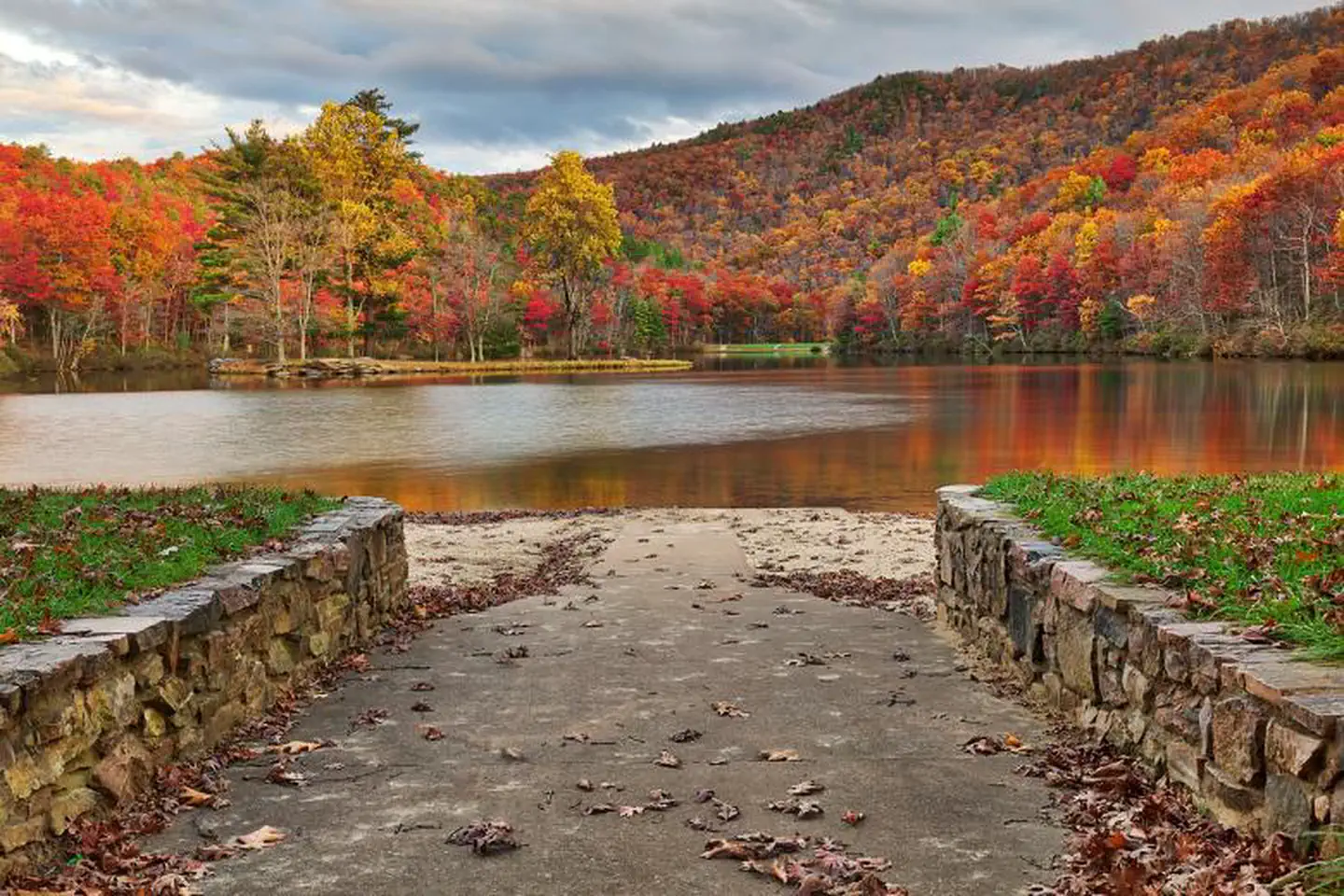
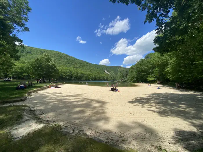
The cold, spring-fed lake and sand beach are the whole point.
The lower lake has a designated swimming area with a sand beach and a bathhouse, and people like swimming out to the small island. It is spring-fed, so it stays cold even in midsummer, which catches some people off guard. Both lakes are stocked with trout and there are fishing piers.
Sites
02 / 06
Loop A for shade and tents, the B and C loops for electric.
Loop A (White Oak) is heavily wooded with raised tent pads and the most privacy, and A6 gets named for seclusion, but it is non-electric and suits units under about 20 feet. Loops B and C carry electric hookups and fit larger rigs, though they are more open with less screening. No site has a lake view.
Booking
03 / 06
Book months ahead, especially for an electric site.
Summer weekends go fast once the window opens about six months out, and the electric sites are the hardest to land. Showing up Friday hoping for an opening is risky.
Facilities
04 / 06
Unusually clean and well kept for a forest-service site.
Reviewers credit the camp hosts, and the 1930s CCC stone and log structures add character. There are flush toilets and showers, though the hot water is not guaranteed and the system occasionally shuts off. Bear boxes are at the sites. No firewood is sold on-site, so buy it locally for around $20.
Vibe
05 / 06
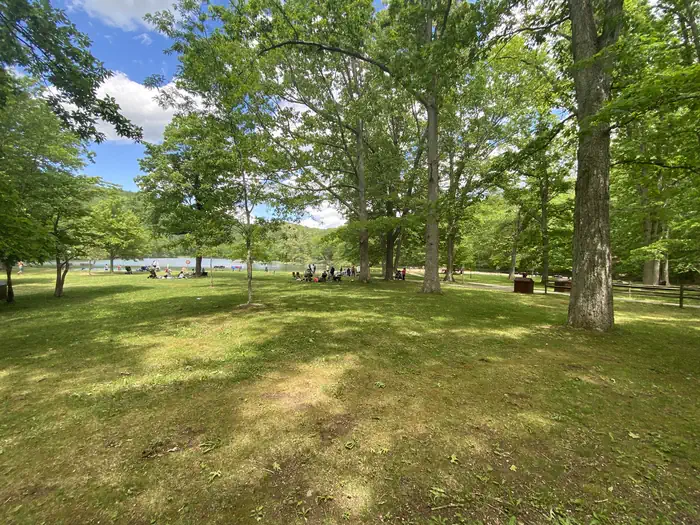
A family campground, busy and loud on summer weekends.
Kids and dogs run late and quiet hours are not really enforced, so anyone after calm is steered to weekdays or the spring and fall shoulder seasons. Cell service is basically nonexistent.
Trails & access
06 / 06
An easy lakeside loop plus a serious ridge climb.
A flat trail circles the lower lake for an easy family walk. The bigger objective is the strenuous Torry Ridge and White Rock Falls loop, about 9.5 miles with ridge views, a waterfall, and a swimming hole. The route threads through the campground roads with many junctions, so download a map first.
Synthesized from public trip reports and forum discussion, summarized in our words and never quoted. This is durable sentiment, not a live feed.
The campground at a glance
01 · CHARACTER
Reads strongest on reservability and shade. Softest on roomy sites.
Six axes, each scored relative to every other federal campground in the region: quiet (miles to a major road), cool (elevation), roomy (average site spacing), shade, RV-fit (longest rig), and how reservable it is. All six come from data, nothing hand-tuned.
When to go
02 · CLIMATE
avg highavg lowfrost-freedriest · Mar
Mar-Nov
Comfortable window: nights stay above 35°F, days below 90°F.
69%
Of summer weekend-days are dry.
Apr 19
Last spring frost; first fall frost Oct 30.
67°F
Average July low.
Getting there
03 · ACCESS
01
Roanoke
93 mi
2h06
02
Richmond
107 mi
2h14
03
Washington DC
151 mi
3h32
04
Norfolk
198 mi
4h02
By drive time
Routed road time (OSRM). Nearest major highway 7.9 mi away.
We synthesize public data layers: RIDB and Recreation.gov facility and site records, Open-Meteo climate normals, OpenStreetMap roads, trails, and water, OSRM drive times, and USGS elevation. We take no bookings, no ads, and no paid placements. Independence is the entire point.