Overview Table Mountain, just a short journey northwest of the Los Angeles metro area, provides a beautiful escape from urban life.
Sites17884 reservable
Elev.7,306ft
Comf.Apr-Oct7 months
Max rig61 ft2 pull-thru
Electricnonesites
From Los Angeles1h08real road time
The honest read
Synthesized from RIDB · Open-Meteo OSM · OSRM Updated 2026-05-27
At 7,306 ft, Table Mountain (Angeles) has a 7-month comfortable window (Apr-Oct). Winter nights average around 25°F, so the shoulder seasons turn cold fast. 178 sites total: 84 reservable and 94 first-come, first-served. Of the sites, 2 pull-through, and the longest takes a 61-ft rig. This is bear country, and food-storage lockers are provided. Within about 4 miles: 3 named hiking routes, 3 peaks, lake or river access.
What campers say
SYNTHESIZED · MODERATE SIGNAL
Vibe
01 / 06
Tall pines and quiet weekdays, but it fills up and gets loud on weekends.
Reviewers across multiple sites describe a peaceful, shaded pine setting on weekdays and recommend midweek visits if quiet matters. Weekends draw crowds from the LA basin and noise enforcement is reported as inconsistent.
Sites
02 / 06
Paved spurs but sloped terrain, and perimeter loops hold the real views.
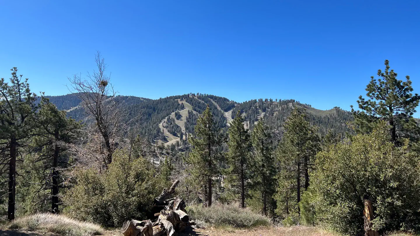
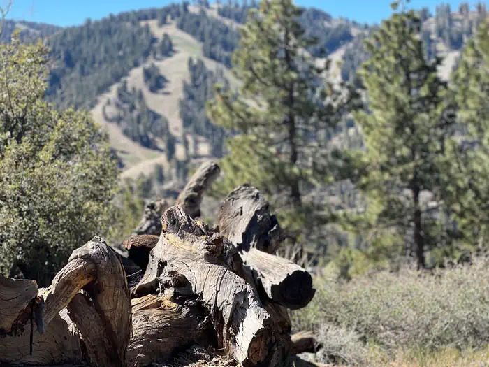
The campground sits on a hillside, so most sites have uneven parking and tent pads that take work to level. Edge sites looking out toward the San Gabriels or the desert floor are the ones campers single out, while interior and main-road sites are more ordinary.
Weather
03 / 06
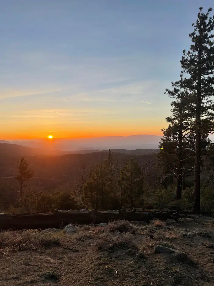
Cool nights at 7,000 feet and afternoon wind is the recurring complaint.
Daytime summer temps run in the low 80s with notably cool nights thanks to elevation. Afternoon gusts whistle through the pines and hit the exposed view sites hardest, especially in spring and fall.
Facilities
04 / 06
Clean vault toilets, water spigots every few sites, attentive hosts.
Pit toilets are consistently called well kept and there are enough potable water spigots that no site is a long walk from one. Camp hosts get repeated praise for being helpful, and firewood is sold on site.
Wildlife & sky
05 / 06
Bears in the area, plus deer, squirrels, and the occasional condor overhead.
Food must go in approved containers and many sites have bear lockers. Campers regularly report deer and squirrels in camp and birders mention California condor sightings on the ridge.
Access
06 / 06
Five minutes to Wrightwood for supplies, but tight for larger RVs.
The town sits a short drive down Big Pines Highway with restaurants and a market, which reviewers value for resupply. The paved access road is fine for cars and mid-size rigs, but narrow turns and sloped spurs make many sites a poor fit for trailers and motorhomes over about 30 feet despite the posted length limits.
Synthesized from public trip reports and forum discussion, summarized in our words and never quoted. This is durable sentiment, not a live feed.
The campground at a glance
01 · CHARACTER
Reads strongest on cool nights and shade. Softest on roomy sites.
Six axes, each scored relative to every other federal campground in the region: quiet (miles to a major road), cool (elevation), roomy (average site spacing), shade, RV-fit (longest rig), and how reservable it is. All six come from data, nothing hand-tuned.
When to go
02 · CLIMATE
avg highavg lowfrost-freedriest · Jun
Apr-Oct
Comfortable window: nights stay above 35°F, days below 90°F.
92%
Of summer weekend-days are dry.
May 19
Last spring frost; first fall frost Oct 13.
60°F
Average July low. Bring a fleece.
Getting there
03 · ACCESS
01
Los Angeles
51 mi
1h08
02
San Diego
155 mi
3h27
03
Fresno
261 mi
5h48
04
San Francisco
459 mi
10h12
05
Sacramento
466 mi
10h21
By drive time
Routed road time (OSRM). Nearest major highway 0.5 mi away.
We synthesize public data layers: RIDB and Recreation.gov facility and site records, Open-Meteo climate normals, OpenStreetMap roads, trails, and water, OSRM drive times, and USGS elevation. We take no bookings, no ads, and no paid placements. Independence is the entire point.