USFSNational Forests in North Carolina · North Carolina
Wash Creek Horse Camp
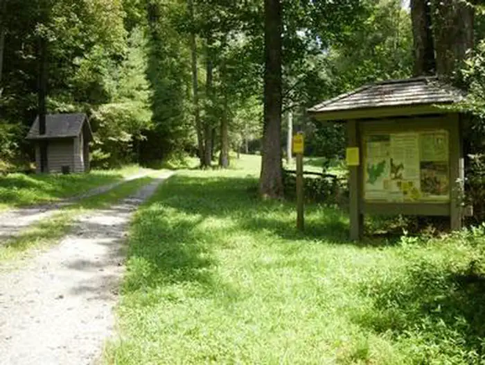
Overview Wash Creek Horse Camp is a small group area designed for equestrian use located two miles northeast of the North Mills River Recreation Area and Bent Creek of the Pisgah Ranger District.
Sites1all reservable
Elev.2,589ft
Comf.Mar-Nov9 months
Max rigtents
Electricnonesites
From Asheville1h06real road time
The honest read
Synthesized from RIDB · Open-Meteo OSM · OSRM Updated 2026-05-27
At 2,589 ft, Wash Creek Horse Camp has a 9-month comfortable window (Mar-Nov). Winter nights average around 30°F, so the shoulder seasons turn cold fast. All 1 sites are reservable in advance, so plan ahead. Popular weekends book out. Within about 4 miles: 28 named hiking routes, 27 peaks, lake or river access.
The campground at a glance
01 · CHARACTER
Reads strongest on shade and reservability. Softest on cool nights.
Six axes, each scored relative to every other federal campground in the region: quiet (miles to a major road), cool (elevation), roomy (average site spacing), shade, RV-fit (longest rig), and how reservable it is. All six come from data, nothing hand-tuned.
When to go
02 · CLIMATE
avg highavg lowfrost-freedriest · Nov
Mar-Nov
Comfortable window: nights stay above 35°F, days below 90°F.
73%
Of summer weekend-days are dry.
Apr 1
Last spring frost; first fall frost Nov 1.
63°F
Average July low. Bring a fleece.
Getting there
03 · ACCESS
01
Asheville
27 mi
1h06
02
Charlotte
119 mi
3h00
03
Raleigh
265 mi
5h48
By drive time
Routed road time (OSRM). Nearest major highway 5.1 mi away.
Picking your site
04 · 1 SITES
0
Pull-thru
0
Walk-in
0
50-amp
0
Accessible
0
Prime
1
Sites
What's within four miles
05 · TRAILS · PEAKS · WATER
Trails & Peaks
Named hiking routes
28
Trail segments
93
Peaks
27
Viewpoints
8
Water & Access
Lake / river access
yes
To nearest major road
5.1 mi
Method
We synthesize public data layers: RIDB and Recreation.gov facility and site records, Open-Meteo climate normals, OpenStreetMap roads, trails, and water, OSRM drive times, and USGS elevation. We take no bookings, no ads, and no paid placements. Independence is the entire point.