USFSBeaverhead-Deerlodge National Forest · Montana
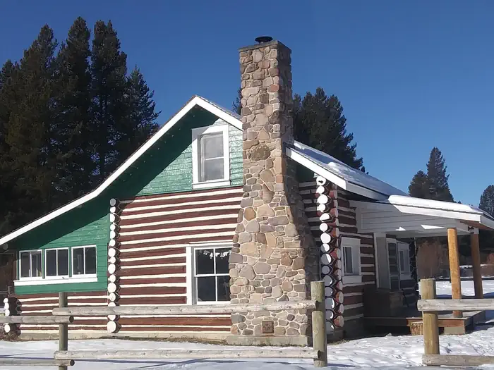
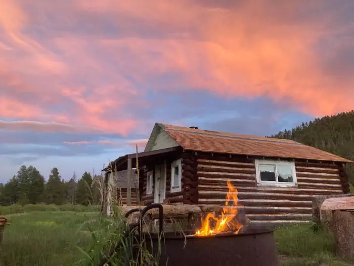
West Fork Of Rock Creek Cabin (MT)
Overview The West Fork of Rock Creek Cabin is located on the western edge of the Beaverhead-Deerlodge National Forest and is open for reservations year-round.
Sites1all reservable
Elev.5,374ft
Comf.Jun-Sep4 months
Max rigtents
Electricnonesites
From Missoula1h58real road time
The honest read
Synthesized from RIDB · Open-Meteo OSM · OSRM Updated 2026-05-27
At 5,374 ft, West Fork Of Rock Creek Cabin (MT) has a 4-month comfortable window (Jun-Sep). Winter nights average around 15°F, so the shoulder seasons turn cold fast. All 1 sites are reservable in advance, so plan ahead. Popular weekends book out. Within about 4 miles: 1 peak, lake or river access.
The campground at a glance
01 · CHARACTER
Reads strongest on shade and reservability. Softest on cool nights.
Six axes, each scored relative to every other federal campground in the region: quiet (miles to a major road), cool (elevation), roomy (average site spacing), shade, RV-fit (longest rig), and how reservable it is. All six come from data, nothing hand-tuned.
When to go
02 · CLIMATE
avg highavg lowfrost-freedriest · Jul
Jun-Sep
Comfortable window: nights stay above 35°F, days below 90°F.
82%
Of summer weekend-days are dry.
Jun 13
Last spring frost; first fall frost Sep 25.
47°F
Average July low. Bring a fleece.
Getting there
03 · ACCESS
01
Missoula
96 mi
1h58
02
Helena
111 mi
2h20
03
Bozeman
146 mi
2h46
04
Billings
287 mi
5h06
By drive time
Routed road time (OSRM). Nearest major highway 10.8 mi away.
Picking your site
04 · 1 SITES
0
Pull-thru
0
Walk-in
0
50-amp
0
Accessible
1
Prime
1
Sites
What's within four miles
05 · TRAILS · PEAKS · WATER
Trails & Peaks
Trail segments
24
Peaks
1
Water & Access
Lake / river access
yes
To nearest major road
10.8 mi
Method
We synthesize public data layers: RIDB and Recreation.gov facility and site records, Open-Meteo climate normals, OpenStreetMap roads, trails, and water, OSRM drive times, and USGS elevation. We take no bookings, no ads, and no paid placements. Independence is the entire point.