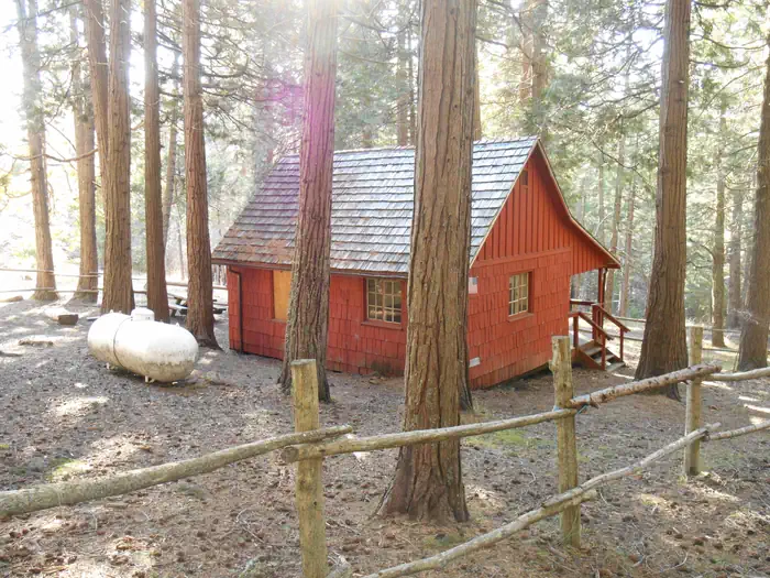
Overview Whisky Camp, built in the 1940s, was the summer home of a fireguard whose primary duties were to fight and prevent fires, serve as a relief lookout, and perform maintenance on phone lines and
Sites1all reservable
Elev.3,967ft
Comf.May-Oct6 months
Max rigtents
Electricnonesites
From Medford2h15real road time
The honest read
Synthesized from RIDB · Open-Meteo OSM · OSRM Updated 2026-05-27
At 3,967 ft, Whisky Camp Guard Station has a 6-month comfortable window (May-Oct). Winter nights average around 27°F, so the shoulder seasons turn cold fast. All 1 sites are reservable in advance, so plan ahead. Popular weekends book out. Within about 4 miles: 2 peaks.
The campground at a glance
01 · CHARACTER
Reads strongest on shade and reservability. Softest on cool nights.
Six axes, each scored relative to every other federal campground in the region: quiet (miles to a major road), cool (elevation), roomy (average site spacing), shade, RV-fit (longest rig), and how reservable it is. All six come from data, nothing hand-tuned.
When to go
02 · CLIMATE
avg highavg lowfrost-freedriest · Jul
May-Oct
Comfortable window: nights stay above 35°F, days below 90°F.
92%
Of summer weekend-days are dry.
Jun 6
Last spring frost; first fall frost Oct 9.
49°F
Average July low. Bring a fleece.
Getting there
03 · ACCESS
01
Medford
55 mi
2h15
02
Eugene
143 mi
3h45
03
Bend
155 mi
4h27
04
Portland
248 mi
5h50
By drive time
Routed road time (OSRM). Nearest major highway 13.6 mi away.
Picking your site
04 · 1 SITES
0
Pull-thru
0
Walk-in
0
50-amp
1
Accessible
0
Prime
1
Sites
What's within four miles
05 · TRAILS · PEAKS · WATER
Trails & Peaks
Trail segments
1
Peaks
2
Water & Access
To nearest major road
13.6 mi
Method
We synthesize public data layers: RIDB and Recreation.gov facility and site records, Open-Meteo climate normals, OpenStreetMap roads, trails, and water, OSRM drive times, and USGS elevation. We take no bookings, no ads, and no paid placements. Independence is the entire point.