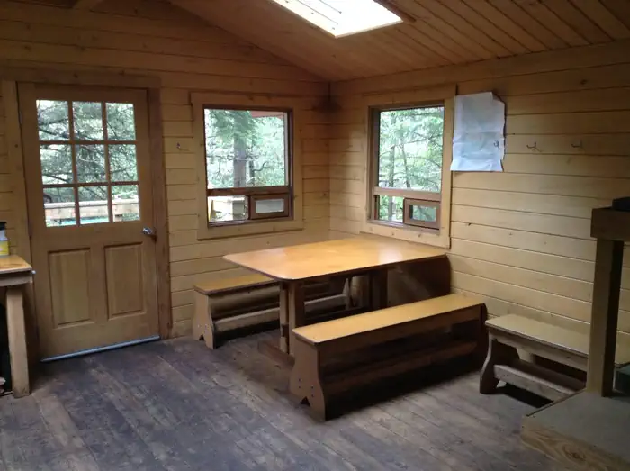
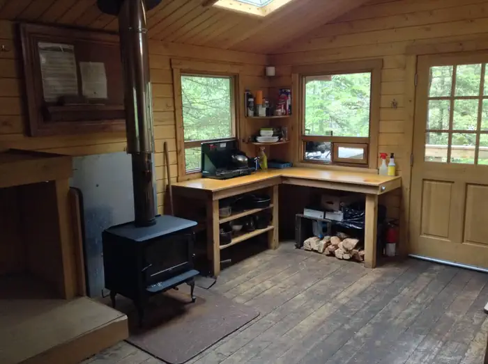
Overview White Sulphur Springs Cabin is located on the northern shore of Bertha Bay, 65 miles northwest of Sitka, Alaska, on Chichagof Island within the West Chichagof-Yakobi Wilderness Area.
Sites1all reservable
Elev.52ft
Comf.Apr-Oct7 months
Max rigtents
Electricnonesites
From Juneau7h46real road time
The honest read
Synthesized from RIDB · Open-Meteo OSM · OSRM Updated 2026-05-27
At 52 ft, White Sulphur Springs Cabin has a 7-month comfortable window (Apr-Oct). Winter nights average around 29°F, so the shoulder seasons turn cold fast. All 1 sites are reservable in advance, so plan ahead. Popular weekends book out. Within about 4 miles: 7 peaks, lake or river access.
The campground at a glance
01 · CHARACTER
Reads strongest on reservability and cool nights. Softest on shade.
Six axes, each scored relative to every other federal campground in the region: quiet (miles to a major road), cool (elevation), roomy (average site spacing), shade, RV-fit (longest rig), and how reservable it is. All six come from data, nothing hand-tuned.
When to go
02 · CLIMATE
avg highavg lowfrost-freedriest · Jun
Apr-Oct
Comfortable window: nights stay above 35°F, days below 90°F.
53%
Of summer weekend-days are dry.
Apr 29
Last spring frost; first fall frost Oct 19.
53°F
Average July low.
Getting there
03 · ACCESS
01
Juneau
144 mi
7h46
02
Fairbanks
854 mi
29h40
03
Anchorage
971 mi
32h18
By drive time
Picking your site
04 · 1 SITES
0
Pull-thru
0
Walk-in
0
50-amp
0
Accessible
0
Prime
1
Sites
★ The standout
Site SO1
AREA WHITE SULPHUR SPRINGS CABIN.
0
Type
Standard
What's within four miles
05 · TRAILS · PEAKS · WATER
Trails & Peaks
Peaks
7
Water & Access
Lake / river access
yes
Method
We synthesize public data layers: RIDB and Recreation.gov facility and site records, Open-Meteo climate normals, OpenStreetMap roads, trails, and water, OSRM drive times, and USGS elevation. We take no bookings, no ads, and no paid placements. Independence is the entire point.