campgrounds.fyiIndependent · federal campgrounds · no paid placements
← All campgrounds
WILEY CREEK
Wiley Creek Group CampWiley Creek Group Camp
USFSMt. Baker-Snoqualmie National Forest · Washington

Wiley Creek Group Camp

Overview Wiley Creek, a popular campground for youth groups and organizations, is situated in an old-growth Douglas fir forest with lovely shaded trails.
Sites2all reservable
Elev.1,276ft
Comf.Apr-Nov8 months
Max rig99 ft
Electricnonesites
From Seattle1h27real road time
The honest read
Synthesized from
RIDB · Open-Meteo
OSM · OSRM
Updated 2026-05-27

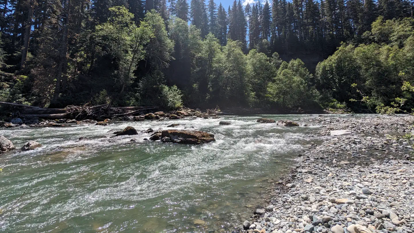
At 1,276 ft, Wiley Creek Group Camp has a 8-month comfortable window (Apr-Nov). Winter nights average around 34°F, so the shoulder seasons turn cold fast. All 2 sites are reservable in advance, so plan ahead. Popular weekends book out. Within about 4 miles: 9 named hiking routes, 2 peaks, lake or river access.

The campground at a glance

01 · CHARACTER
QuietCoolRoomyShadeRV-fitReserv.

Reads strongest on reservability and quiet. Softest on shade.

Six axes, each scored relative to every other federal campground in the region: quiet (miles to a major road), cool (elevation), roomy (average site spacing), shade, RV-fit (longest rig), and how reservable it is. All six come from data, nothing hand-tuned.

When to go

02 · CLIMATE
JFMAMJJASOND
avg highavg lowfrost-freedriest · Jul
Apr-Nov
Comfortable window: nights stay above 35°F, days below 90°F.
72%
Of summer weekend-days are dry.
Apr 13
Last spring frost; first fall frost Oct 29.
56°F
Average July low.

Getting there

03 · ACCESS
01
Seattle
58 mi
1h27
02
Yakima
190 mi
3h59
03
Spokane
327 mi
6h25
By drive time
Seattle · 1h27Yakima · 3h59Spokane · 6h25Camp

Routed road time (OSRM). Nearest major highway 14.3 mi away.

Picking your site

04 · 2 SITES
Color byShow only

2 mapped sites · dot color = seclusion · click a dot for details. Basemap © OpenStreetMap.

0
Pull-thru
0
Walk-in
0
50-amp
0
Accessible
0
Prime
2
Sites

What's within four miles

05 · TRAILS · PEAKS · WATER

Trails & Peaks

Named hiking routes
9
Trail segments
38
Peaks
2

Water & Access

Lake / river access
yes
To nearest major road
14.3 mi
Method

We synthesize public data layers: RIDB and Recreation.gov facility and site records, Open-Meteo climate normals, OpenStreetMap roads, trails, and water, OSRM drive times, and USGS elevation. We take no bookings, no ads, and no paid placements. Independence is the entire point.

Check availability on Recreation.gov →