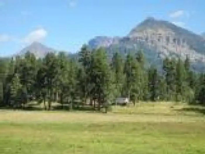
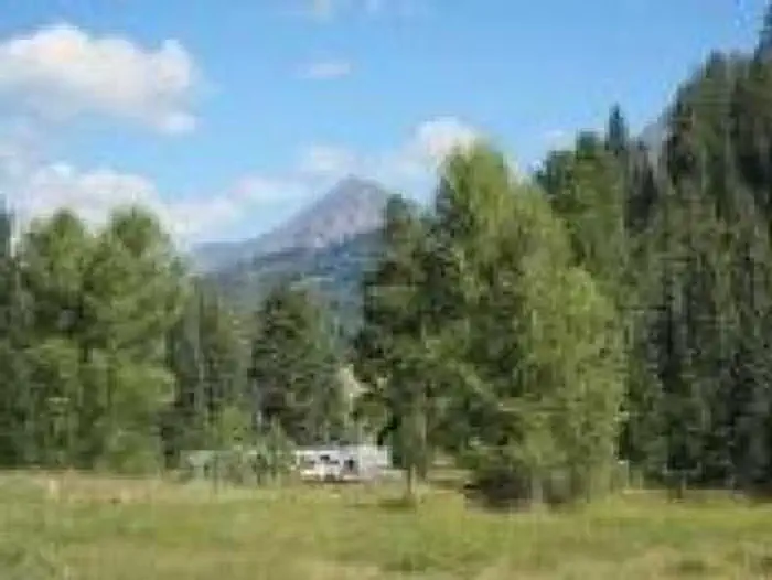
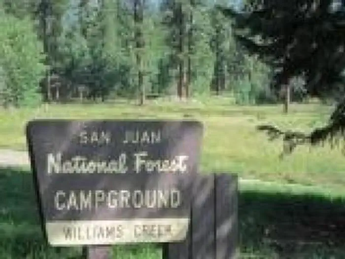
Overview This popular campground, 23 miles north of Pagosa Springs, Colorado, offers both shaded and sunny campsites with some located creek-side.
Sites6136 reservable
Elev.8,199ft
Comf.Jun-Sep4 months
Max rig45 ft8 pull-thru
Electricnonesites
From Grand Junction6h06real road time
The honest read
Synthesized from RIDB · Open-Meteo OSM · OSRM Updated 2026-05-27
At 8,199 ft, Williams Creek Campground has a 4-month comfortable window (Jun-Sep). Winter nights average around 11°F, so the shoulder seasons turn cold fast. 61 sites total: 36 reservable and 25 first-come, first-served. Of the sites, 8 pull-through, 19 walk-in, and the longest takes a 45-ft rig. Within about 4 miles: 1 peak, lake or river access.
What campers say
SYNTHESIZED · RICH SIGNAL
Facilities
01 / 06
Hosts keep the place immaculate and rake sites before arrival.
Repeat visitors single out the vault toilets as some of the cleanest they have seen at a national forest campground, with reliable water spigots throughout the loops. Hosts are credited by name in several reviews for raking sites, cleaning fire rings before turnover, and selling firewood on the grounds.
Access
02 / 06
Plan 45 minutes to an hour of rough gravel past Pagosa Springs.
The 23-mile approach up Piedra Road turns to dirt at Turkey Springs and runs washboarded and dusty through summer, with the worst sections closer to town. Most rigs handle it slowly, but big trailers and low-clearance cars should expect a beating.
Sites
03 / 06
Creek-side sites are the draw, but many pads run tight and unlevel.
Sites along the eastern edge sit on Williams Creek and book first, and Site 42 in Loop B gets called out for a long level pull-through with ridgeline mountain views. Interior roads are narrow with aspens crowding the turns, and rigs over about 30 feet report scouting before committing to a pad.
Vibe
04 / 06
Quiet ponderosa and aspen forest with steady ATV traffic in and out.
The 8,100-foot setting under ponderosa, aspen, and cedar reads as peaceful most of the day, and crowds stay light outside peak summer weekends. ATV and side-by-side users base here for Poison Park Road and East Fork to Silver Falls, so expect engine noise on the access road during the morning and late afternoon.
Water
05 / 06
Williams Creek Reservoir sits 1.5 miles up the road for paddling and trout.
The reservoir holds cutthroat, rainbow, and kokanee, with the creek itself often fishing better than the lake through summer. Kayakers and float-tube anglers use the small ramp on the north end, and the walk from creek-side sites to the water is short.
Trails & access
06 / 06
Trailheads into the Weminuche Wilderness start within a few miles.
Piedra Falls is the easy nearby payoff, while Williams Creek Trail #587 and Cimarrona Trail #586 push north into the Weminuche and connect to the Continental Divide Trail. Day hikers and horse packers both use the campground as a staging base.
Synthesized from public trip reports and forum discussion, summarized in our words and never quoted. This is durable sentiment, not a live feed.
The campground at a glance
01 · CHARACTER
Reads strongest on shade and cool nights. Softest on roomy sites.
Six axes, each scored relative to every other federal campground in the region: quiet (miles to a major road), cool (elevation), roomy (average site spacing), shade, RV-fit (longest rig), and how reservable it is. All six come from data, nothing hand-tuned.
When to go
02 · CLIMATE
avg highavg lowfrost-freedriest · Apr
Jun-Sep
Comfortable window: nights stay above 35°F, days below 90°F.
We synthesize public data layers: RIDB and Recreation.gov facility and site records, Open-Meteo climate normals, OpenStreetMap roads, trails, and water, OSRM drive times, and USGS elevation. We take no bookings, no ads, and no paid placements. Independence is the entire point.